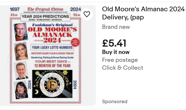
eBay advert screenshot for Old Moore’s Almanac 2024
This week I received my copy of Old Moore’s Almanac. This is probably the best known Almanac in the Uk. It follows the format of Alamancs which have been published since the medieval period as I discussed in an earlier post about the Kalendar of Shepherds of the 15th Century. Almanacs became the third most popular book published in London.
Old Moore’s, which claims ancestry back to 1697, begins with a large tranche of predictions both for the world and for celebrities, based on astrology. 2024, Frances Moore says, is the ‘Year of Hope’. He says, ‘we may have a good time, [but] a severe money problem from elsewhere may surface to worry us’. Hedging his bets or what?!
He predicts astonishing advances in technology, and thinks that Britain is in a good place to profit from these advances in healthcare, IT, and Robotics.
We need good, old-fashioned leadership to get through challenging times, with Pluto in Aquarius and Saturn through Pisces, we should be steered to ‘safe management.’
Wokery will lead us down a spiral to weakness. However, the Tories will remain disorganised with the country receptive to caring Socialism, with an upsurge in local power. The UK will become a more caring society.
Old Moore hints that Putin might be indicted. The US will have deep financial and social problems. The election might be close, but he also suggests Trump’s support might be on the wane.
There is a page for each month, noting the calendar events such as Epiphany, Burns Night, Australia Day, and other days filled with very random notable events chosen to represent that day through history- 2nd Jan Conquest of Granada 1462. 9th Jan Duchess of Cambridge b. 1982, 13th Jan Trump impeached 2021 etc. It also gives a forecast for the Month. January is likely to see constitutional change, Old Moore predicts which seems very unlikely.
Next are columns for Sun rise and set, high water at London Bridge, moon at London. And a weather column. (Early cold spell followed by normal rainy pattern), which isn’t wrong yet.
It has pages of predictions for celebrities such as King Charles III, which suggests ‘communication problems’ in the family. Who could have guessed that! Anton Du Beke, Adele. Zelenskyy, whose entry suggests success will be achieved only by diplomacy; otherwise the stubbornness predicted by the stars will lead to a long stalemate.
Then there are charts for each star sign. Towards the back are astrological help for winning on Horse Racing, Greyhound Racing, Football pools, Bingo, Lottery, Lucky Lotto, Euro Millions and pages for sowing and planting times for gardening by the moon, and a Guide for Anglers.
£5.41 good value, or is it just cheap? It was £3.50 in 2022.
I’ve relieved of the necessity to search for the Town Walls of Amsterdam without prior research by the fact that I am here to see my daughter who has recently broken her ankle, so she has an excuse for refusing to go on forced forced marches around the City.
I haven’t yet had a good look at a map, but the pattern of Canals circuling the centre is amazing and it seems possible there was no need for walls, when the centre is protected by so many rings of water.
I don’t know much about Amsterdam, but it reminds me of the surprising fact that Holland was a major power in the 17th/18th Century. I discovered this on a visit to Kerala in India where I realised that Portugal had a vast empire which was largely taken over by the Dutch in the 17th Century and then taken over by the British in the 18th Century.
It was one of the major pivots in world history. These three countries were small peripheral seafaring nations of no great importance in Europe until the Age of Discovery. Portugal set up trading systems (perhaps rather systems of exploitation) first down the coast of Africa and then to India and beyond. The Dutch then took over the trading stations and took control of the spice routes. Then the British took over.
Previously the spice routes from the East came through Egypt, Greece, Rome, Carthage and later the Ottoman and the Venetian Empires. This made the Mediterranean the richest place in Europe, both north and southern coasts.
The new ocean routes led to a major shift in power from the Mediterranean to the North Sea, leading to the current situation where the Mediterranean is no longer the centre of the world. Greece, Southern Italy, North Africa now under performing economies. A Roman would find this hard to believe.
Portugal, then Holland followed by Britain rose to the status of world power which would, itself, have been inconceivable before the 16th Century.
Holland was in the perfect geographic position astride the trade routes that lead to the heart of Europe. The entry point was the major river systems around the Rhine/Danube axis including the Rhine, the Scheldt, the Waal, and the Amstel. Antwerp, Rotterdam and Amsterdam developed from regional trading towns to global Cities. They spawned a self confident set of merchants who set the foundations of modern capitalism with foundations in spices and slaves.
Central to this was the Dutch East India Company. The first organisation in Europe where an investor only risked their investment rather than the shirt off their back in the event of bankruptcy. This let the shackles off investment, took money out of gold in the bank vaults and multiplied it around the economy.
But not only did it take away the risks of the consequences of investment the Dutch East India Company, set up in Amsterdam in 1602, was given quasi state power, with the ability to fight wars and impose laws on subject populations. This template was copied by the British East India Company which conquered and ran India, setting the seal for the British Empire and Capitalism.
360 degree Image of the Herb Garret (4th December 2000) at the Old Operating Theatre Museum. Click on the VR label to go full screen, and use the mouse to navigate.
Digital Heritage Is a subject I had a very early interest in. My, very minor claim to fame, is that I set up the Museum of London’s and the Victoria and Albert’s first computer systems. I then co-authored one of the earliest hyperlinked digital histories (on the history of London), and set up the first web sites for various museums and organisations such as the Old Operating Theatre Museum, Brunel Engine House, Garden History Museum, Royal Bethlem Museum etc..
But that was a long time ago so long that most of the Museums have changed their names! Despite the desire to do so, I have not had the time to keep up with developments.
So, I’m going to spend a little time investigating online heritage sites, and at the same time, maybe, look back at my part in the history of digital heritage.
Firstly, the principles of the study. Early on I came to the conclusion that the Internet should allow access to Museums for all those people who could not afford, or did not have the time, to visit in person. So, I’m looking for online/virtual visits that have something about them almost as good as a physical visit. Secondly, I’m looking for online exhibitions that provide an enjoyable experience that works in a similar way to a real exhibition. This means for me that the technology does not get in the way, and is not too complex to access and use. I also have an interested in digital guided walking tours.
I must admit that 40 years after I began to see the potential in digital I rarely see virtual visits or exhibitions that I want to spend time with. When I use websites for data and information, which I do all the time. I search, I find, I read but I don’t often linger for pleasure and. I rarely go back.
Yes we have Virtual Reality, Augmented Reality and the Metaverse, but they don’t really impact positively on my experience of heritage, history and museums. This might well be because I haven’t looked very hard, or spent much time on the subject in recent years, or because I don’t enjoy digital experiences that much, But, I’m going to have a good look around to see what is on offer, and I hope you will join me.
My starting point is the Old Operating Theatre Museum web site. I was in charge of the Museum for 30 years from the mid 80s onwards. In the early days of my management of the Museum I set up a very early web site designed to give those who could not visit a real idea of the Museum. This was achieved by the usual set of information pages but also with 360 degree annotated panoramic photos of the museum spaces linked together. This gave a simple and informative tour of the museum. which was easy to use, did not take long to see and did not depend on complicated technology on the part of the user. Later we added an online database of the collection to give access to the collection.
Thanks to the Wayback Machine – which is an amazing internet archive, no the internet archive, which archives old web sites, I have been able to retrieve a version of the site, dated to 2000AD so you can have a look at it. As you will see below it is very wordy but I think a really nice design by Highway 57 and Chris Sansom, who is also a composer, and now heading up an innovative jazz band called ‘Perfect Stranger’ .
Unfortunately, good though the Wayback Machine might be it does not have the technology to show the 360degree panoramas. So to get an idea of how they worked please have a look at the image at the top of the page, and imagine the addition of ‘hotspots’ which you could click to see further information or click through to the next panoramic view. Please note this is the second iteration of the site and so far I have been unable to find my original self-designed site.
The Old Operating Theatre Museum – www.thegarret.org.uk in 2000, retrieved from the Wayback Machine
So, I think the interactive tour of the museum gave a pretty good, simple and enjoyable tour of the Museum. I should say that the Old Operating Theatre Museum is one of the most amazing Museums. It is in the roof space of a Church and was a store for herbal medicines, and an operating theatre/emergency room for female surgical patients used before anaesthesia and antiseptic surgery.
Its now 23 years later. The website has been completely redesigned since I left, and it opens with a very good video that gives an excellent introduction to the museum. Click on the link to have a look at the video on the home page @ https://oldoperatingtheatre.com/
Inside the website is a huge amount of information, some very good videos, there is a ‘virtual tour’ which does not work on my browser for some reason, interactive games and a clickable image to explore the Old Operating Theatre itself. Its use of media is much, much better than in the 2000s, and the information is composed now into interesting stories rather than dry information. So a pretty good job of putting the Museum’s stories to the public in an engaging way. I would say however, that perhaps it was a little easier to find out the basic information about the Museum, the Operating Theatre, and the Herb Garret before than it now is. But you can ignore that as my vanity.
I have chosen one of the stories to include here and this is an object that I bought at an auction for the Museum. I remember the excitement well, and the great interest in the medicines that were included in the medical chest.
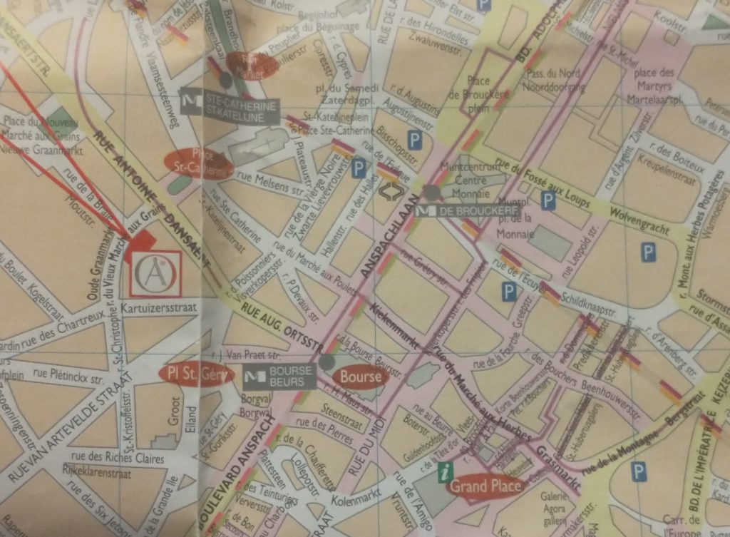
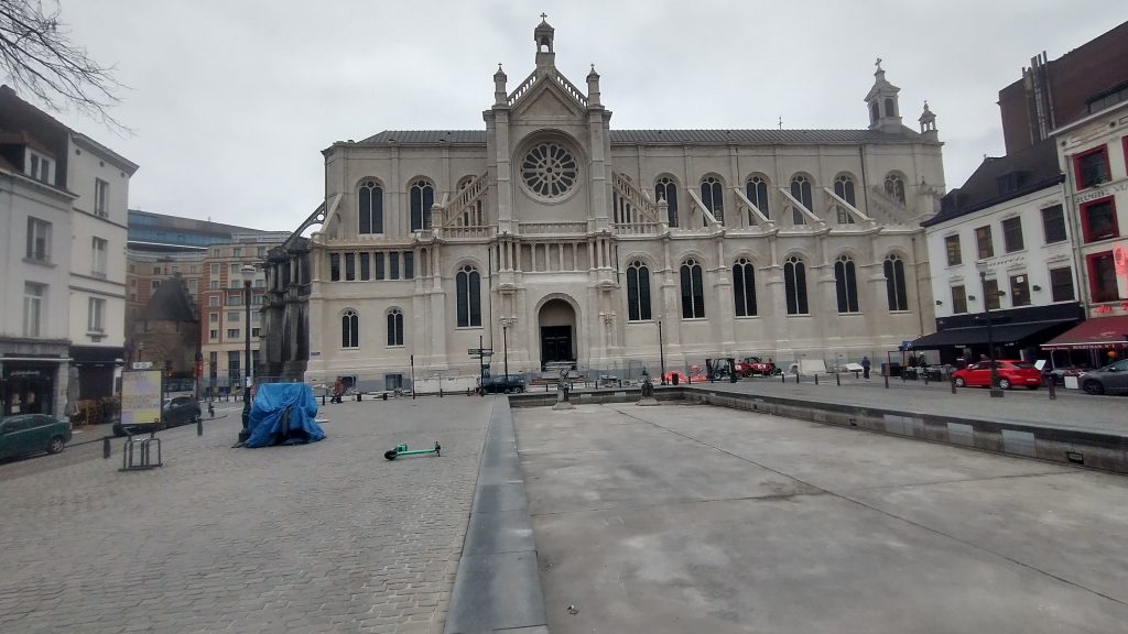
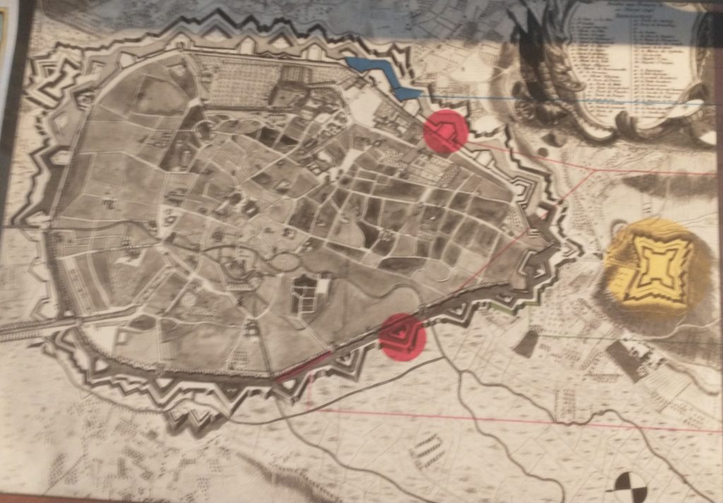
Modern map of central Brussels. The Bourse is a red circle near the centre.
The map of the centre of Brussels shows the area where I have identified topographical evidence of an early Wall circuit. The two red lines coming from the top left point to a red rectangle which is on the curved road called ‘Vieux Marché aux Grains’. This road follows the curved line of the NE section of the wall and was confirmed by the discovery of a surviving section of the Wall on it (see previous posts).
So, on my 4th and last day in Brussels I want to find the rest of this circuit. If you look at the map you can convince yourself there is a circular route – Rue des Riches Clares (Street of the Clare nuns); Rue des Teinturies (Street of Dyers); Kolenmarkt (Coal Market) and to the Grand Place. But I can find nothing that proves it and its a bit weird to have the Town Square (Grand Place) of the town outside the circuit. Maybe this is because the Bourse was the original centre of gravity I wondered? Whatever the case, the roads have the irregularity of medieval town centre streets.
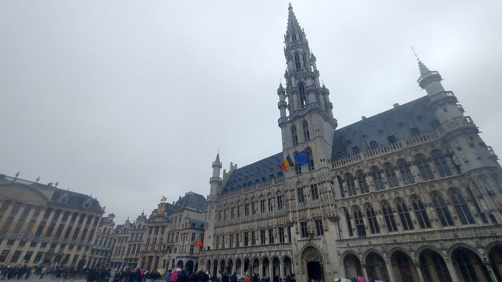
The Town Hall Grand Place, Brussels
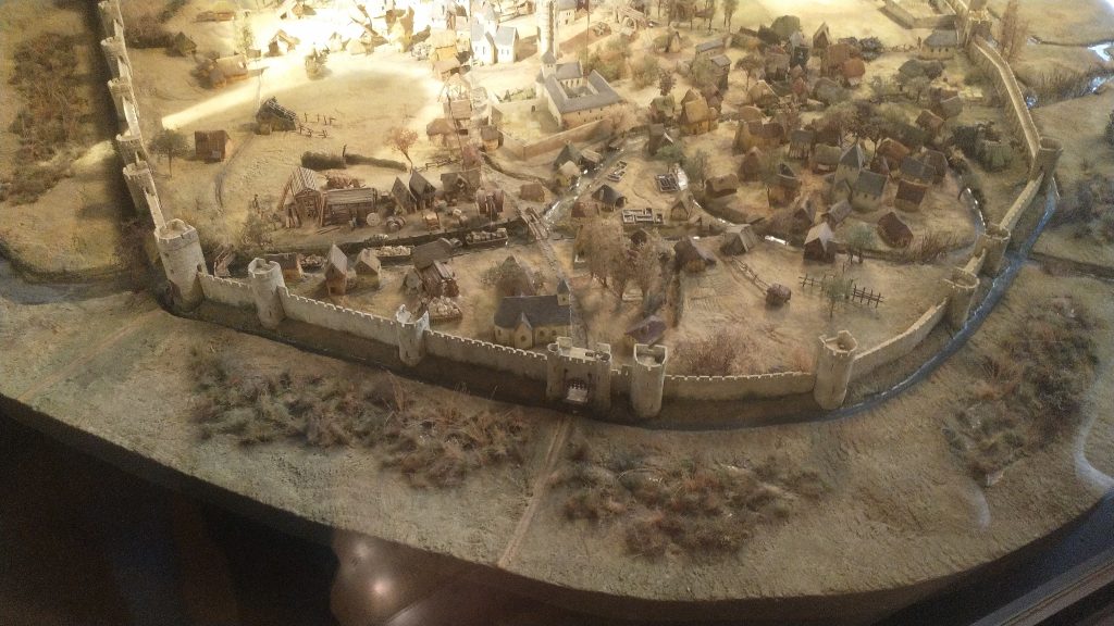
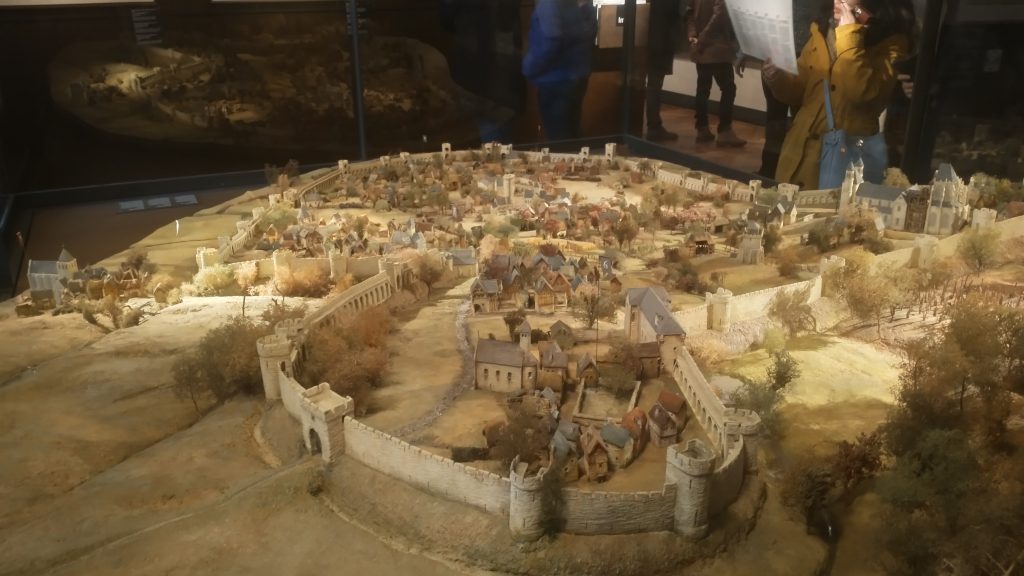
It started to rain so decided to see about a guided tour of the Town Hall, but the attendant suggested I’d be better off at the free ‘House of the King’ across the square which I discover with rising excitement is subtitled ‘The Brussels City Museum.’ Initially I’m disappointed as it is full of fragments of Gothic statues, but upstairs, I strike pay dirt with not only maps, engravings and photographs of the Old Wall Circuit but also a massive model.
Model of 13th Century Wall Circuit of Brussels. (looking South West)
It takes me a lot of time to work out what is what and which direction we are looking. But the section of the wall at the bottom of the photo above is the wall I identified on the Vieux Marché aux Grains. St Catherine’s is the Church seen just inside the Wall, just to the left of the Gate at the middle bottom of the photo. Other evidence makes it clear that the present day St Catherine’s was moved a little to the left (east).
So, a confirmation of sorts, but also a revelation, in that a river is flowing just behind the wall, and the wall circuit is much bigger than I suspected.
The River is the Senne, it was navigable to an extent taking 8 days to take cargoes to the River Schelde. The River is completely gone, and I think the other part of the wall I pencilled in was actually not the wall but roads following the route of the River.
The River Senne, originally the reason for the foundation of Brussels, became a stinking sewer and was filled in leaving no trace, except the roads that ran alongside it or replaced it.
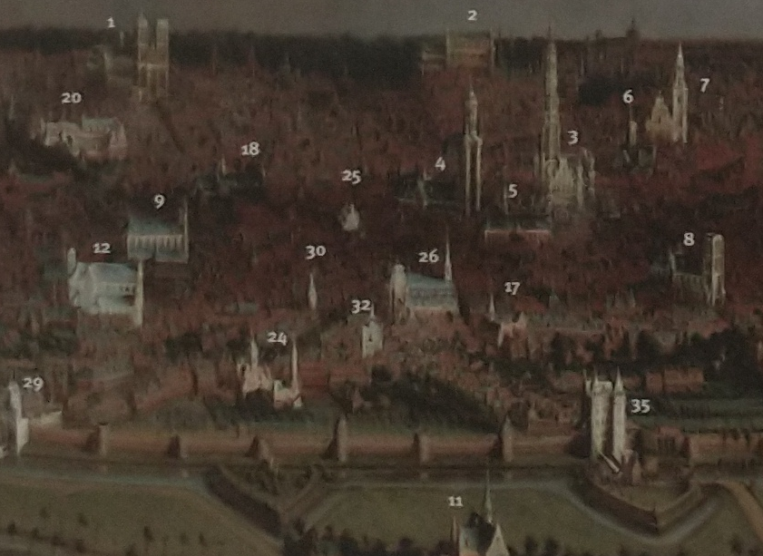
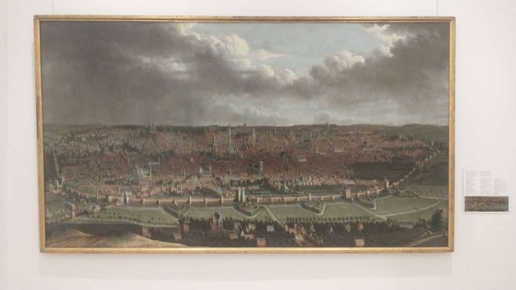
Detail labelled copy of panoramic painting of Brussels c1665 by Jean-Baptiste Bonnercroy. Looking South West
The River was augmented and then replaced by a Canal, which reduced the journey time to the Schelde to one day. The Canal came into the expanded City at no 29 (above_ which is the River gate of the 2nd Wall circuit, and, you might just be able to see a wide street going diagonally from 29 towards no 26, which is St Catherine’s Church. This street used to be the new canal, now a dry linear park and market place.
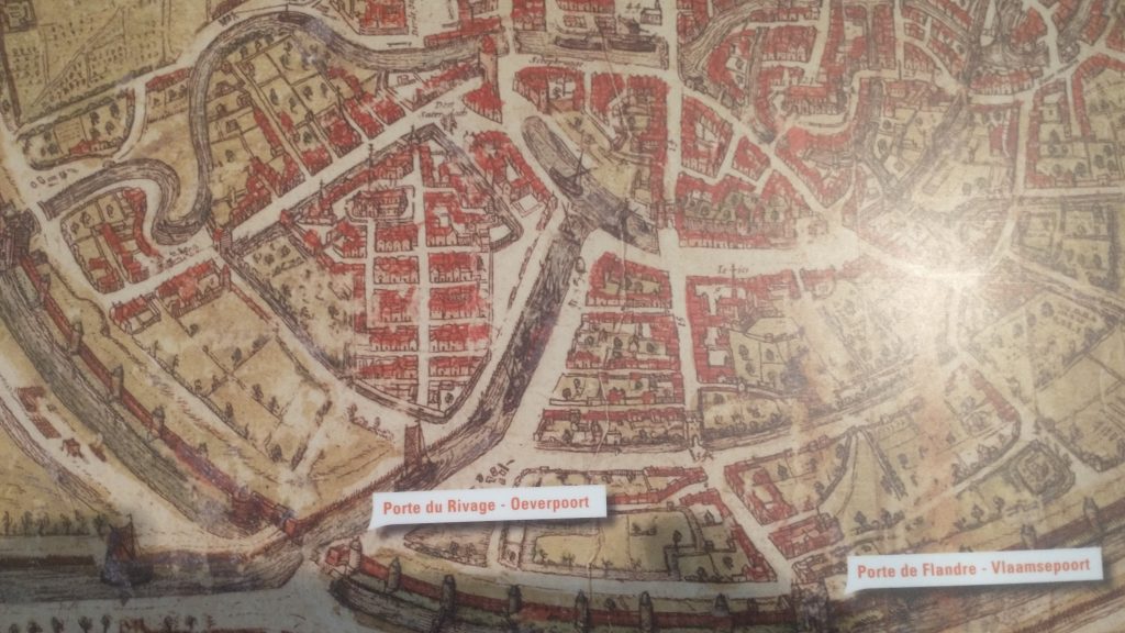
Detail of Braun & Hogenberg map of 1572, showing the canal entering at Porte De Rivage.
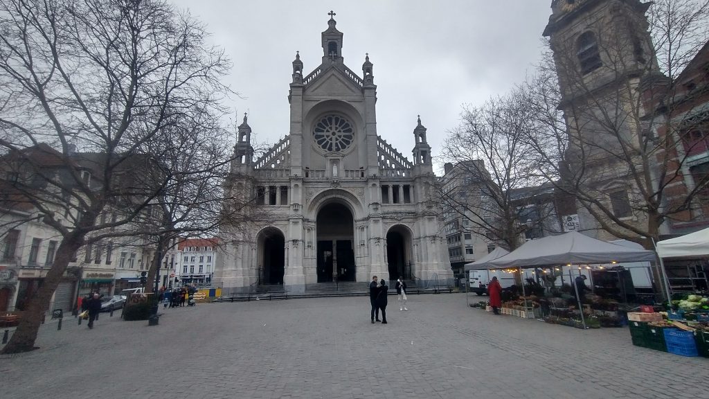
At the end of the canal was a T-Junction so that boats could turn around. When this was filled in and reclaimed St Catherine’s was moved and rebuilt in this space. The Wall was just south of the t-Junction and No 30 in the panorama is the Black Tower, part of the original 13th Century Wall Circuit.
St Catherine’s, built over the old t-junction of the canal. The photo is taken from what was once the canal.
But back to my search for the 13th Century Walk circuit. Look below at the whole model you will see how wrong I was about a small roundish early wall circuit.
Model of 13th Century Wall Circuit of Brussels.
This view of the town is the opposite direction to the previous one, so the wall in the far distance was the section I correctly identified. But I had absolutely no idea that the walled area was so large. The bulge in the wall at the front of the picture was on high ground and was original the site of the Duke of Brabant’s Castle, on Coundenberg Hill and founded in the 11th Century. My exploration was not particularly successful, as far as the 13th Century circuit was concerned, as I had no idea where most of the wall circuit was. I was thinking that there must have been a castle on top of the Hill, but didn’t think the wall circuit would be that big.
Brussels itself began as a small trading town on the River Senne and in the marshy valley of the River. It collected grain from the rich area to export to Antwerp and other urban centres.
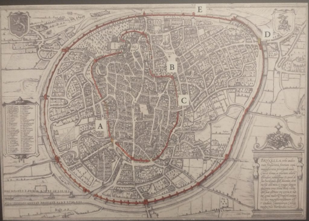
Braun and Hogenberg Plan of Brussels, 1572 showing both wall circuits. North east at the bottom of the plan
The map above shows the two wall circuits. The earliest built 1210 -1230 and the large circuit built in 1357 -1383. That later was extensively developed with the addition of demi-lunettes in 1578, and turned into full bastions in 1671 to cope with the increasing power of artillery. The letters on the plan refer to pictures of the wall that survive.
Panoramic painting of Brussels c1665 by Jean-Baptiste Bonnercroy. Looking South West
The second wall circuit can clearly be seen in the picture above, with Porte de Flandres in the centre, and demi-lunettes in front of the 14th Century Wall.
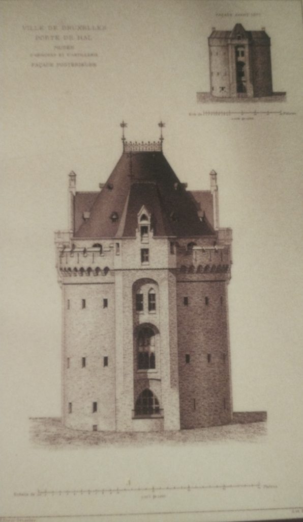
I finished the exploration by finally getting into the 14th Century Gate – Porte de Halle which was wall worth the two trips.
Porte de Halles
This image below will give a good idea of the final form of the defences before they were almost totally demolished and replaced by a ring road.
The late 17th Century Defences of Brussels.
So all in all Brussels is a very interesting City with great museums, amazing pubs/bars, fabulous remains of Art Nouveau dotted around, and an interesting history. As to my exploration, very enjoyable, a little disappointed I didn’t find the River, or identify more of the 13th Century Circuit. With another day I would have walked the entire 13th and 14th Century circuits. But I suspect the surgeon who did my hernia operation would have thought I overdid it as it was.
modern map of central Brussels. The Bourse is a red circle near the centre.
So my next task is to confirm the earlier wall circuit on the map.
To remind you I have tentatively identified the street called the’ Vieux Marché aux Grains’ as a section of an earlier wall circuit surrounding Brussels. On the map above the two red lines coming from the top left point to a red rectangle which is on the Vieux Marché. Walking along it you soon come to a beautiful church dedicated to St Catherine. It must be either just inside, just outside or on top of my walk circuit.
St Catherine’s, Brussels
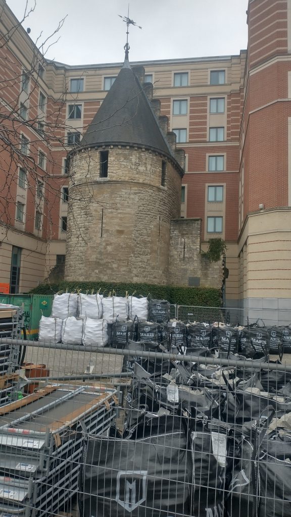
I walk into the church, photograph lots of saints and walk out and there just beyond it is the confirmation that I’m right. There is a beautiful interval Tower and, just to make it certain, it has sections of wall coming out from it. So this the earlier wall circuit. Looks medieval, a century or two earlier than the Porte de Halles.
The Black Tower, Brussels
So, I’m feeling pleased with myself. Two wall circuits confirmed, the outer one I know where the entire circuit is and that it has all been swept away and replaced by an urban ring road except a couple (?) of fragments.
The inner circuit I have only confirmed one section, I know one more bit of it exists or did exist but pretty sure not much else. I’m thinking from the street pattern that it is a small roundish circuit, but nothing is clear from the street pattern apart from this one street.
Feeling smug although I am aware this is a strange game I play with myself. I could just Google ‘Brussels Town Walls’ and I would have most of the answers instantly but the fun of the game is to find it out yourself through topographical clues.
I do it, I think, partly to honour my friend, David Bentley, who died of motor neurone disease a good few years ago but not before we had many stimulating discussions on topographical clues to urban history. Also, it really helps you understand the City, it will tell you why particular roads are important, and give the history of the growth of the town. Since I lost David it is often a solitary game as it needs a very tolerant person to put up with following leads to frequent dead ends and someone who can share the thrill of finding a small fragment of ‘wall’ in exactly the predicted place.
One more discovery before I end. There is a linear ‘park’ coming down from the Porte Flandres, it is lined with what remind me of canalside houses in Bruges, and this seems to be the original route of the canal that was built to link Brussels to the Scheldt. I was told that the canal was diverted when they built the new walk circuit so this seems to be the original course. It comes down to the side of St Catherine’s.
Filled in Canal leading to St Catherine’s. Fish restaurants to the right and you can just see the Black Tower to the left of the Church.
I have no idea how the boats turned around but the grain market was to the right and the fish restaurants suggest this is where fish were landed.
Tomorrow, you will find out if my smugness is confirmed after I decide it is time to check the facts and leave speculation behind.
Panoramic painting of Brussels c1665 by Jean-Baptiste Bonnercoy.
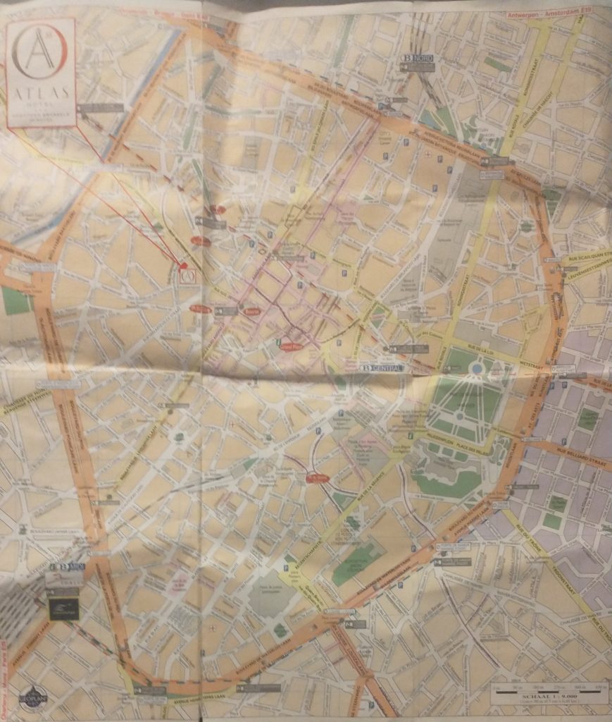
So I arrived at the hotel in Brussels. Got their free map and looked for likely Wall circuits.
Creased Map of Brussels
As you will see there is an extensive inner ring road or boulevard clearly marked in orange. This is, I thought probably the Renaissance wall alignment when the town had expanded and the old walls became useless in the face of cannons.
A closer look at the map confirms it was a wall circuit as at junctions there is a grey label saying ‘Porte de Flandres’ or similar.
So the next task is to find if there was an earlier wall circuit on the map. I’m basically looking for curved roads that were originally just inside the walls or just outside.
modern map of central Brussels. The Bourse is a red circle near the centre.
The two red lines coming from the top left point to a red rectangle which is my hotel and by chance is on a curved road which is my guess to be the early wall circuit. It is called the ‘Vieux Marché aux Grains’. I had a quick explore before retiring for the night. But found nothing conclusive and St Catherine’s Church is astride it.
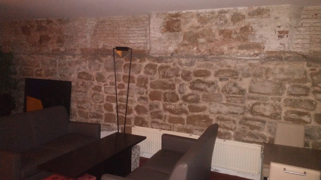
At breakfast, in the basement I failed to notice that 3 of the 4 walls were ancient stone, and there was a picture of a wall and bastion tower. These were pointed out by a staff member, and they suggested they were part of the wall.
Basement cafe of Hotel Atlas
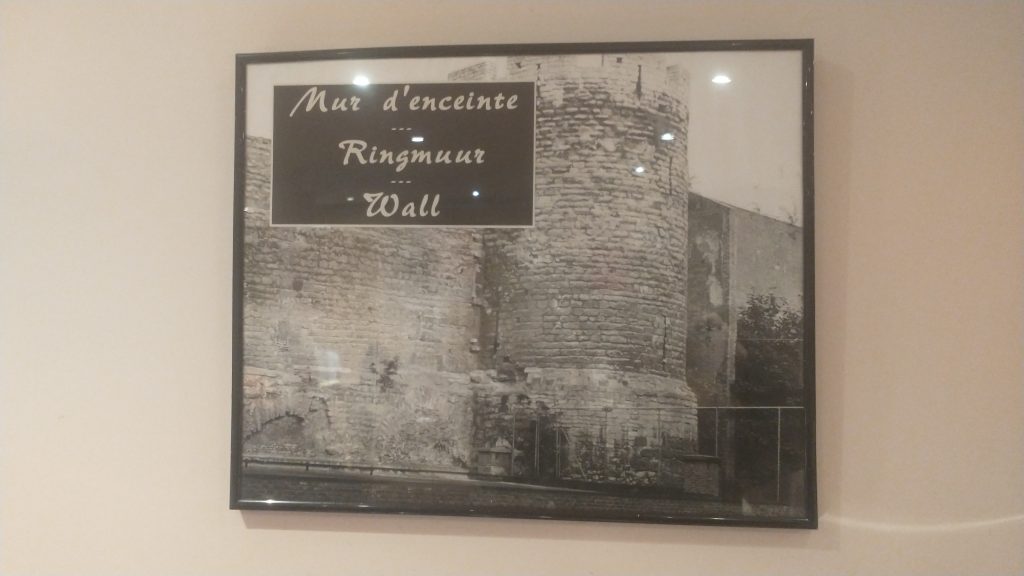
The walls in the basement formed three sides of a rectangle so I had my doubts whether it was ‘the wall’ but it could be a tower or a building built up against the wall. But the picture certainly confirmed my guess that this curved street marked the route of the early wall.
Picture of the wall
So next I walked up to the ‘Porte de Flandres’ in the north east of the town on what I am calling the Renaissance circuit. I wanted to see if any gate or wall survived (no) and to look at the canal which runs alongside the wall.
Then to visit Brussels amazing museums where in the Old Masters museum was found the view of the walls that you will find above. The view is from the north east and at the bottom you will see the canal that linked Brussels to the main trade routes with triangular ramparts in front designed to withstand cannon fire, with the canal and the wall behind. Right in the centre of the bottom is the Porte de Flandres. It looks 15th Century to me, give or take a century but the triangular ramparts look 17th Century.
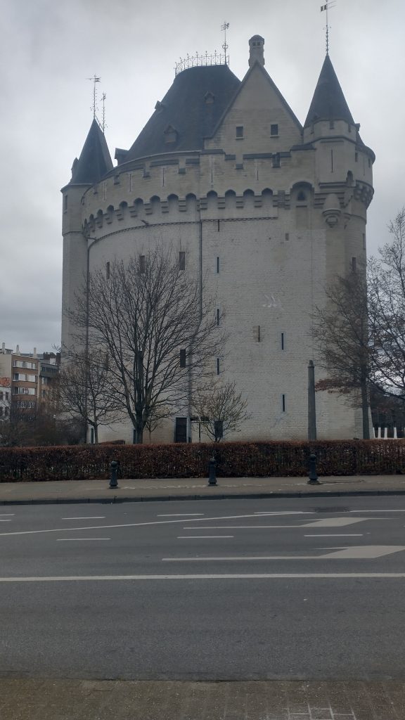
At the Museum were leaflets to a Porte de Halle museum, So I went from the Musee d’Arte et D’ Histoire, through the European Parliament to the old Wall circuit past several old gates which no longer exist and then saw the view below of the Porte de Halle.
Porte de Halle, Brussels
It looks like something from the Très Riches Heures du Duc de Berry which is early 15th Century. I couldn’t confirm because the gatekeeper of the Porte refused entry as, he said, last entry was at 4pm (1 arrived at 4.03pm) although the leaflet clearly says last entry is 45 mins prior to closing at 5pm.
So I went to confirm the existence of the earlier wall circuit. And I will post about that later.
I am working on a new season, and these are the walks for the first six months – but more to come.
The Archaeology Of London Walk Sunday 2nd April 2023 11:15 Exit 3 Bank Underground Station To book Jane Austen’s London Sat 2.30 pm 2nd April 2023 Green Park underground station, London (north exit, on the corner). To book Chaucer’s Medieval London Guided Walk Aldgate Tube Sunday 16 April 2023 11.30pm To book Chaucer’s London To Canterbury Virtual Pilgrimage Sunday 16th April 2023 7.30pm To book The Peasants Revolt Anniversary Guided Walk Aldgate Underground Sunday 11th June 2023 10.45am. To book The Peasants Revolt Anniversary Virtual Tour Sunday 11th June 2023 7.30pm To book
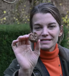
Detail of photo from the American Viscountess showing a medlar (link to the site below:)
Medlars were a very common and useful fruit particularly in the Medieval and Early Modern period. They are best harvested after the first frosts, although some say harvest in late October and store them because they can only be eaten when they are rotten and ‘bletted’. They also store well. They, therefore, provide a source of winter sweetness when there were few other fresh sources available.
They are from the Rosaceae family which includes apples, pears, rosehips and quinces. The English called them ‘open arses’ or ‘dog’s arses’ or ‘granny’s arses’ because of the way they looked until the more polite French name the Medlar caught on.
Shakespeare uses both words and uses their sexual connotations as they were thought also to look like female genitalia. A medlar was also a name for a prostitute. So in Romeo and Juliet this speech by Mercutio to Romeo and their mates contains some very bawdy thoughts:
If love be blind, love cannot hit the mark. Now will he sit under a medlar tree And wish his mistress were that kind of fruit As maids call medlars when they laugh alone. O, Romeo, that she were, O that she were An open-arse and thou a poppering pear!
RJ 2.1.33
I think you can also see how good Shakespeare was at making his allusions available to all classes. For the sophisticated he begins with the reference to the French medlar and in case the groundlings are missing out throws in the ‘open-arse’ so they know what he is alluding to.