Archaeology discoveries. The Image is a sketch of the ‘Facial Reconstruction, Impossible Factual/BBC’
Interesting Archaeology discoveries.
The following discoveries were reported in Salon IFA the newsletter of the Society of Antiquaries of London in Salon: Issue 526 7 February 2024, which you can see here:
Pliny the Elder’s Villa found near Vesuvius?
The 1st Century seafront villa, with views of the Bay of Naples and of Mount Vesuvius, has been excavated at the town of Bacoli, which was the port of Misenum. Pliny commanded the fleet as ‘Praefectus classis Misenensis’. Pliny tried to rescue his friends and family, ignoring warnings saying ‘Fortune favours the brave’, ‘Audentes Fortuna luvat’. It didn’t and he died, at Stabiae, by toxic fumes. Read more about the villa here:
Face Reconstructed for a Victim of Roman Crucifixion
A male skeleton found, 4 years ago, in a Roman cemetery in Fenstaton in Cambridgeshire was found with a 2-inch nail through his heel bone. BBC 4 has made a documentary about the recent reconstruction of the man’s face by, as Salon reports it:
‘US forensic artist Joe Mullins, of George Mason University, Virginia. He usually works with law enforcement agencies, reconstructing the faces of modern-day crime victims. ‘
To follow the details, read more here, or watch the BBC documentary, ‘The Cambridgeshire Crucifixion’, which can be viewed on BBC iPlayer.
Coltsfoot is a daisy-like plant which is flowering about now. Gerard’s Herbal of 1633 suggests that the ‘fumes of the dried leaves taken through a funnel’ is good for those with coughs and shortness of breath. He suggests that it is smoked like tobacco and it ‘mightly prevaileth.’
This idea, Mrs Grieves says in her herbal (1931), is endorsed by ‘Dioscorides, Galen, Pliny, and Boyle’. And Coltsfoot is ‘nature’s best herb for the lungs’. (This is historic information re herbs and NOT current medical advice, as Coltsfoot can be very dangerous!).
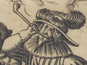
Detail from Lobspruch deß edlen hochberühmten Krauts Petum oder Taback Nuremberg, 1658 New York Public Library Public Domain
My grandson and parents found a 19th Century pipe bowl, much like the one above, by the Thames where there were many fragments of clay pipe. For more on 17th Century smoking, have a look here.
Blossom is also coming out in London a little early. (2022 we had a false spring when Cherry Blossom came out, and I think we are now just getting used to it, so I don’t think it is being noted so much in 2024). Blackthorn (I think) is coming out in profusion in my local park. Photos below by the Author of Haggerston Park in East London. Left February 2022, Right Feb 23.
One thing I am trying to improve in my Almanac of the Past, is to include more specific London content. This can be difficult on a daily basis. But I think I have, by chance, found a solution. I was trying to glue the toe flap on a perfectly good pair of trainers so that it did not flap, and I needed a heavy weight to press the two edges together. I found a random couple of heavy books for the purpose. 24 hours later, I lifted the books to discover the failure of my project. But, as I returned the books to their place in the book case, I found the heaviest was called ‘A London Year. 365 Days of City Life in Diaries, Journals, and Letters.’ Compiled by Travis Elborough and Nick Bennison, published in 2013, and the price on it of £5.99 makes me feel I must have bought it second hand. Have I opened it before now? Indeed, I had forgotten its existence, but Cometh the Hour, Cometh the Book! What a timely rediscovery.
Cholera in London. The news of the Cholera being in London has been received abroad. According to the feelings of the different nations towards England, France, who wish to court us has ordered a quarantine in her ports of three days; Holland, who feels aggrieved by our conduct at the conference, one of 40 days. The fog so thick in London that the illuminations for the Queen’s Birthday were not visible.
24th February 1832 Thomas Raikes, Diary 1832 (from ‘A London Year’ Compiled by Travis Elborough and Nick Bennison, 2013,
I think the Conference mentioned above was the London Conference of May 1832, which aimed to establish a Kingdom of Greece with a King, It was set up by Foreign Secretary Lord Palmerston without discussion with the Greeks and ended up giving them a Bavarian King. King Otto. Otto was forced from the throne in a revolution in 1862, and replaced by a Danish King, from whom Prince Philip, Duke of Edinburgh was descended.
I have a friend with whom I argue about the sanctity of the book. She believes they need to be treated like the priceless spear carriers of culture that they are. While I, read them in the bath; turn down corners to mark my place; underline interesting phrases, mark paragraphs and commit other forms of libricide. (is there such a word?)
In my defense I note that I used to work at the Freud Museum, where they studied the marginalia in Freud’s Library to gain insight into his thought processes and influences.
But I recently came across the clincher to my ongoing argument in Charles Nicholls’ marvelous book on Shakespeare’s life as a lodger (‘The Lodger’) in Silver St. just down the road from the Guildhall in the City of London.
He quotes Shakespeare’s Cymberline where Iachino finds a book by Imogen’s bed and says:
‘She hath been reading late: The Tale of Tereus. Here, the leaf’s turn’d down.
The Chinese New Year is a lunar festival that falls on the second new moon after the winter solstice. However, not always. The need to keep the lunar and the solar years in some sort of sync means they add in intercalary months from time to time, in which case the Chinese New year will fall on the third new moon after the winter solstice.
If you look at the chart you will see this is the year of the dragon, the wood dragon, representing both wood and earth, which are, to some extent, in conflict. To find out more and for predictions of the year, look here:
First written in January 2023 and revised in February 2024.
Full Moon Photos by Natalie Tobert – you can find out more about her work here:
The Goddess Book of Days’ has the the 7th as the Day of Selene and other Moon Goddesses. (February 6th as the Festival of Aphrodite)
Selene is one of the most beguiling of Goddesses as she is the epitome of the Moon (Romans knew her as Luna). She, who gives that silvery, ethereal light to dark days, who appears and disappears to a routine few of us really understand. She is therefore beautiful, beguiling, unknowable. She is the Goddess of Intuition. She brings the tides and the monthly periods, and so is a Goddess of power as well as fertility, pregnancy and so love, and mothers, and babies.
To my mind, far more powerful than Aphrodite, Selene seems much more independent. On the Parthenon Marbles at the British Museum she is shown with her brother Helios, the Sun God; with Hercules – the epitome of male strength, Demeter and Persephone, representing the earth and underworld (or life and death), Athene and her father, Zeus; Iris, the messenger Goddess; Hestia, the Goddess of the home, and Dione with her daughter ,Aphrodite, representing love. At one end, Helios brings up the sun with his Chariot and Horse and at the other, Selene’s horse sinks exhausted in Oceanus after a glorious night of moon shine. It’s a wonderful arrangement, which suggests the scheme was to show a balanced cosmos between female and male forces, framed by the Sun and the Moon.
Cartoon of Elgin Marble, showing Selene’s Horse at the right hand end
I did a longer piece on this pediment of the Parthenon Marbles here
Selene – Moon Goddess by Mike Petrucci -unsplash
I have used several of Natalie Tobert’s photos in my post which I pluck from Natalie’s face facebook feed which is a veritable visual feast. She worked, as an archaeologist at the Museum of London at the same time as me. She is an excellent potter, photographer and artist. Natalie was a Fellow of the Royal Society of Arts, and a member of Society of Designer Craftsmen. You can see more of her pictures here.
This is going to be transferred to April 20th in 2025.
First published in 2022, and revised February 2024.
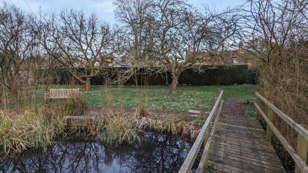
Snowdrops in late January 2024, Gilbert White’s House Selborne (Photo Kevin Flude)
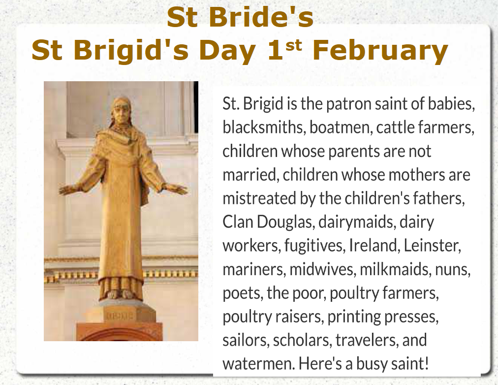
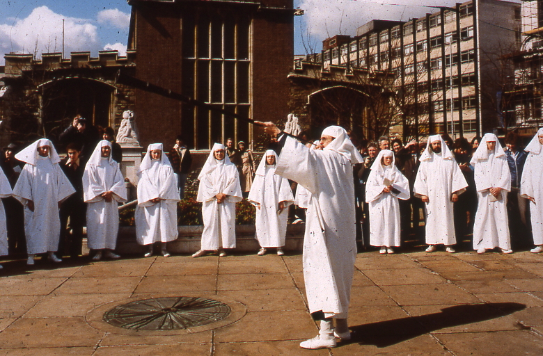
Today is Imbolc, one of the four Celtic Fire Festivals. It corresponds with St Bridget’s Day, which is a Christian festival for the Irish Saint, and is the eve of Candlemas. Bridget is the patron saint of all things to do with brides, marriage, fertility, and midwifery (amongst many other things, see above). And in Ireland, last year (2024) was the very first St Bridget’s/ Imbolc Day Bank Holiday!
St Bride’s Statue, St Bride’s Church. Fleet Street from K.Flude’s virtual tour on Imbolc
St Bridget, aka Briddy or Bride, converted the Irish to Christianity along with St Patrick in the 5th Century AD. She appears to have taken on the attributes of a Celtic fertility Goddess, called Bridget or Brigantia, so some doubt she was a real person.
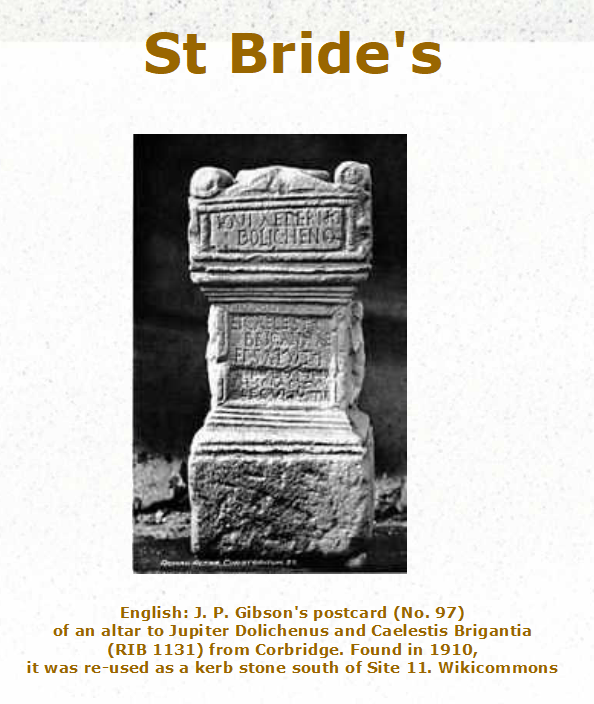
Brigantia
There are Roman altars dedicated to Brigantia The Brigantes tribe in the North were named after the Goddess. The Brigantes were on the front line against the invading Romans in the 1st Century AD, and led by Queen Cartimandua. Cartimandua tried to keep her independence by cooperating with the Romans, while, a few years later, Boudica took the opposite strategy. But both women appear to have had agency as leaders of their tribes and show a great contrast with Roman misogyny.
Altar to Brigantia from K Flude’s virtual tour on Imbolc
Last day of medieval Christmas and the Lords of Misrule.
This was the end of the Christmas period. John Stow, in the 16th Century describes the period between Halloween and Candlemas being the time that London was ruled by various Lords of Misrule and Boy Bishops (see my post here). In the piece below Stow goes on to talk about a terrible storm that took place on st February 1444.
Against the feast of Christmas every man’s house, as also the parish churches, were decked with holm, ivy, bays, and whatsoever the season of the year afforded to be green. The conduits and standards in the streets were likewise garnished; amongst the which I read, in the year 1444, that by tempest of thunder and lightning, on the 1st of February, at night, Powle’s steeple was fired, but with great labour quenched; and towards the morning of Candlemas day, at the Leaden hall in Cornhill, a standard of tree being set up in midst of the pavement, fast in the ground, nailed full of holm and ivy, for disport of Christmas to the people, was torn up, and cast down by the malignant spirit (as was thought), and the stones of the pavement all about were cast in the streets, and into divers houses, so that the people were sore aghast of the great tempests.’
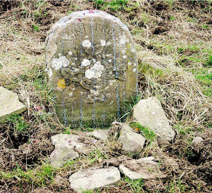
Wells dedicated to St Bridget
There are many wells dedicated to St Bride. They were often used in rituals and dances concerned with fertility and healthy babies. And perhaps, the most famous, was near Fleet Street. Henry VIII’s Palace of Bridewell, later an infamous prison, was named after the Well. St Bride’s Church has long been a candidate as an early Christian Church, and although the post World War Two excavations found nothing to suggest an early Church, they did find an early well near the site of the later altar of the Church, and by the remains of a Roman building, possibly a mausoleum. Therefore, it is possible that the Church was built on the site of an ancient, arguably holy, well.
St Bridget’s Well, Glastonbury
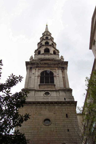
The steeple of St Brides is said to be the origin of the tiered Wedding Cake, which, in 1812, inspired a local baker to bake for his daughter’s wedding.
Steeple of St Brides Fleet Street
Imbolc and St Bridget’s Day are the time to celebrate the return of fertility to the earth as spring approaches. In my garden and my local park, the first snowdrops, violets, and daffodils are coming out, and below the bare earth, there is a frenzy of bulbs and seeds budding, and beginning to poke their shoots up above the earth, ready for the Spring. In the meadows, ewes are lactating, and the first lambs are being born.
Violets, bulbs, and my first Daffodil of the year. Hackney (2022), London by K Flude
I, occasionally, do walks about Imbolc and other Celtic festivals, in conjunction with the Myths and Legends of London, and at May Eve, the Solstices, Halloween and Christmas (when I have time). See the walks page of this blog
And let’s end with the Saint Brigid Hearth Keeper PrayerCourtesy of SaintBrigids.org
Brigid of the Mantle, encompass us, Lady of the Lambs, protect us, Keeper of the Hearth, kindle us. Beneath your mantle, gather us, And restore us to memory. Mothers of our mother, Foremothers strong. Guide our hands in yours, Remind us how to kindle the hearth. To keep it bright, to preserve the flame. Your hands upon ours, Our hands within yours, To kindle the light, Both day and night. The Mantle of Brigid about us, The Memory of Brigid within us, The Protection of Brigid keeping us From harm, from ignorance, from heartlessness. This day and night, From dawn till dark, From dark till dawn.
I have been waiting to post this for a long time, as it relates to Christmas. (Was it really a month ago?) By the way, I have added to some text to yesterday’s Brexit posts.
This evening is also Imbolc, the Celtic Festival to Brigantia and St. Bridget of Kildare. Candlemas tomorrow.
This is a letter from Mary Musgrove in Persuasion (Chapter 18). This is Jane Austen’s most mature and probably the best novel,. Here the moany Mary Musgrove writes a typically FOMO letter which illustrates how Christmas, for the well, off really continued to February 1st and Candlemas.
February 1st “My dear Anne,–I make no apology for my silence because I know how little people think of letters in such a place as Bath. You must be a great deal too happy to care for Uppercross, which, as you well know, affords little to write about. We have had a very dull Christmas; Mr. and Mrs. Musgrove have not had one dinner party all the holidays. I do not reckon the Hayters as anybody.
The holidays, however, are over at last: I believe no children ever had such long ones. I am sure I had not. The house was cleared yesterday, except of the little Harvilles; but you will be surprised to hear they have never gone home. Mrs. Harville must be an odd mother to part with them so long. I do not understand it. They are not at all nice children, in my opinion; but Mrs. Musgrove seems to like them quite as well, if not better, than her grandchildren.
What dreadful weather we have had! It may not be felt in Bath, with your nice pavements; but in the country it is of some consequence. I have not had a creature call on me since the second week in January, except Charles Hayter, who had been calling much oftener than was welcome.
Between ourselves, I think it a great pity Henrietta did not remain at Lyme as long as Louisa; it would have kept her a little out of his way. The carriage is gone to-day, to bring Louisa and the Harvilles to-morrow. We are not asked to dine with them, however, till the day after, Mrs. Musgrove is so afraid of her being fatigued by the journey, which is not very likely, considering the care that will be taken of her; and it would be much more convenient to me to dine there to-morrow.
I am glad you find Mr. Elliot so agreeable, and wish I could be acquainted with him too; but I have my usual luck: I am always out of the way when any thing desirable is going on; always the last of my family to be noticed. What an immense time Mrs. Clay has been staying with Elizabeth! Does she never mean to go away? But perhaps if she were to leave the room vacant, we might not be invited. Let me know what you think of this. I do not expect my children to be asked, you know. I can leave them at the Great House very well, for a month or six weeks.
I have this moment heard that the Crofts are going to Bath almost immediately; they think the Admiral gouty. Charles heard it quite by chance; they have not had the civility to give me any notice, or of offering to take anything. I do not think they improve at all as neighbours. We see nothing of them, and this is really an instance of gross inattention.
Charles joins me in love, and everything proper.
Yours affectionately,.”
It is my paragraphing rather than the original. The mystery of the book is how such a lovely, considerate, able daughter like Anne, can be from the same family as both her awful sisters, and her monstrous, egotistical father.
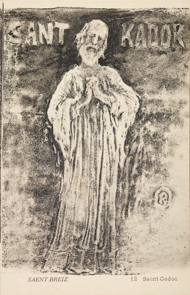
St Cadoc was born in 497 AD, a Saint, and Martyr, who founded a monastery at Llancarfan, near Cowbridge, Glamorgan, Wales. He also has associations with Scotland, Brittany, and England. His story is not written down until the 11th Century, but it is fascinating and, in its own way, a charming story. The gentle son of a savage, robber King, he was educated in Latin under an Irish priest, and refused to fight on his father’s orders. But lived to convert his parents eventually. He is known as Cattwg Ddoeth, “the Wise”, although his sayings are mired in the forgeries of Iolo Morganwg.
His story brings Cadoc into conflict with King Arthur. In Welsh literature, King Arthur is a brave but wilful King who demanded Cadoc give him compensation after the Saint sheltered a man who had killed three of Arthur’s men. The compensation was delivered as a herd of cows, but as soon as Arthur took charge of them they turned into ferns.
Cadoc was forced out of Britain by the pagan Anglo-Saxons, but eventually, he felt he had to return despite the grave danger he would return to. He wanted to obey his own maxim:
Would you find glory? Then march to the grave.
He therefore moved to the Saxon settlements to give spiritual succour to the native British Christians who had survived the massacres of the Saxons. He met his martyrdom at Weedon in Northamptonshire, where he was celebrating a service when it was interrupted by Saxon horsemen, and Cadoc was slain as he served the Eucharist.
The Catholic Church celebrates him in September, elsewhere on the 24th January.
For more, look at https://celticsaints.org or Wikipedia.
First published in January 2023, republished in January 2024
‘The man born under Aquarius shall be lonely and ireful; he shall have silver at 32 years; he shall win wherever he goeth, or he shall be sore sick. He shall have fear on the water, and afterwards have good fortune, and shall go into divers strange countries. He shall live to be 75 years after nature.’
‘The woman shall be delicious, and have many noises for her children; she shall be in great peril at 24 years and thereafter in felicity. She shall have damage by beasts with four feet and shall live 77 years after nature.
The Kalendar of Shepherds, 1604 (quoted in the Perpetual Almanac by Charles Kightly)
the Author sporting a Betsy Trotwood aphorism ‘Never be mean, never be false, never be cruel’
Resolutions & Predictions
The Kalendar of Shepherds predictions for those born in Aquarius, (see above) are so specific they cannot help but be wrong for most people. The art of the prophecy, surely, is to be vague, be general and to know human nature.
By the 21st of January, we should have an idea of whether we are going to keep to your resolutions or not. And perhaps we should now be tuning them or adapting them to fit our lives as actually lived, rather than on our pious hopes.
Last year, on January 21st, I had a chat with a taxi driver on the way to the railway station after my Uncle Brian’s Funeral. The driver told me that funerals make him wonder how his behaviour might influence the number of people who will, one day, make that special effort to turn up at his funeral. He was a young Asian guy, so he was thinking ahead quite some way.
I replied that ‘Funerals make me reflect on how much time I have spoiled by not being fully engaged in the moment’. All those conversations where my mind wandered, those radio programmes I only half heard as I tried to read a book at the same time, those train journeys, walks in the woods or along the canal while listening to headphones, those visits to relatives where I rushed back to get home as quickly as possible. Being present in the moment was, I said, perhaps, the key to improving the quality of life and interactions with others
We continued chatting through the short journey and as we arrived in the forecourt of the station he suggested we exchange a final bit of wisdom. As we had been talking about history, I turned to Charles Dickens and told him Betsy Trotwood’s words to David Copperfield:
“Never,” said my aunt, “be mean in anything; never be false; never be cruel. Avoid those three vices, Trot, and I can always be hopeful of you.”
I said that Betsy’s words stem from Charles Dickens’ belief that the key to progress in the world was to ignore the dogma of religion but to live by just one tenet: Treat people as you want to be treated by others.
In return, he told me of an Islamic teacher who responded to his enquiry as to how he could be sure of salvation given all the many (possibly conflicting) moral teachings and texts there were. The answer was, if he lived wisely and thoughtfully on his impact on others, he could be sure of salvation.
By this time I had missed my train, but the two of us had had a moment of connection, and there are plenty of trains from Guildford to Waterloo.
T-shirts
Philosophy for life as told to St Patrick by a Druid
I have a lot of t-shirts with quotations from history on them. I suspect I am one of the very few people who store his t-shirts in chronological order. Above is the first, and the last is
“You can’t always get what you want But if you try sometime you’ll find You get what you need”
Rolling Stones.
End note
Dickens philosophy was based on the broad understanding of Christianity, as expressed in these two quotations:
“Thou shalt love thy neighbour as thyself” (Matthew 22:37–39).
“Do to others as you would have them do to you” (Luke 6:31).
First written on 21st January 2023, revised January 2024.
I keep an archive of the walks I have done each year.
Ring in the New Year Virtual Walk
Old New Year Card
Monday 1st January 2024 7.00pm On this Virtual Walk we look at how London has celebrated the New Year over the past 2000 years.
The New Year has been a time of review, renewal and anticipation of the future from time immemorial. The Ancient Britons saw the Solstice as a symbol of a promise of renewal as the Sun was reborn. As the weather turns to bleak mid winter, a festival or reflection and renewal cheers everyone up. This idea of renewal was followed by the Romans, and presided over by a two headed God called Janus who looked both backwards and forwards. Dickens Christmas Carol was based on redemption and his second great Christmas Book ‘The Chimes’ on the renewal that the New Year encouraged.
We look at London’s past to see where and how the New Year was celebrated. We also explore the different New Years we use and their associated Calendars – the Pagan year, the Christian year, the Roman year, the Jewish year, the Financial year, the Academic year and we reveal how these began. We look at folk traditions, Medieval Christmas Festivals, Boy Bishops, Distaff Sunday and Plough Monday, and other Winter Festival and New Year London tradition and folklore.
At the end we use ancient methods to divine what is in store for us in 2024
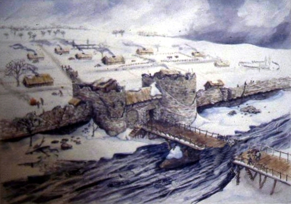
ROMAN LONDON – A LITERARY & ARCHAEOLOGICAL WALK
Reconstruction View of Roman Riverside Wall being built
Sunday 21st Jan & 3rd March 2023 11.30 am Monument Underground Station
Our Guides will be Publius Ovidius Naso and Marcus Valerius Martialis who will be helped by Kevin Flude, former Museum of London Archaeologist, Museum Curator and Lecturer.
We disembark at the Roman Waterfront by the Roman Bridge, and then explore the lives of the citizens as we walk up to the site of the Roman Town Hall, and discuss Roman politics. We proceed through the streets of Roman London, with its vivid and cosmopolitan street life via the Temple of Mithras to finish with Bread and Circus at the Roman Amphitheatre.
REVIEWS “Kevin, I just wanted to drop you a quick email to thank you ever so much for your archaeological tours of London! I am so thrilled to have stumbled upon your tours! I look forward to them more than you can imagine! They’re the best 2 hours of my week! 🙂 Best, Sue
Jane Austen’s London Sunday Jan 21st 2.30 pm Green Park underground station,
An exploration of Mayfair, the centre of the London section of Sense & Sensibility and where Jane came to visit her brother
“It is a truth universally acknowledged, that a Jane Austen devotee in possession of the good fortune of a couple of free hours today must be in want of this walk.”
People associate Jane Austen and her characters with a rural setting. But London is central to both Jane Austen’s real life and her literary life. So, this tour will explore Jane’s connections with London and give the background to Sense and Sensibility, a good part of which is based in this very area. We begin with the place Jane’s coach would arrive from Hampshire, and then walk the streets haunted by Willougby; past shops visited by the Palmers, the Ferrars; visit the location of Jane Austen’s brother’s bank and see the publisher of Jane’s Books. The area around Old Bond Street was the home of the Regency elite and many buildings and a surprising number of the shops remain as they were in Jane Austen’s day.
This is a London Walk Guided Walk lead by Kevin Flude
Sat 6pm 25th May 2024 Green Park Tube
Myths, Legends, Archaeology and the Origins of London
Druids at All Hallows, by the Tower
Sunday 4th February & Saturday 23 March 2024 11.30pm Tower Hill Underground
The walk tells the stories of our changing ideas about the origins of London during the Prehistoric, Roman and Saxon periods.
The walk is led by Kevin Flude, a former archaeologist at the Museum of London, who has an interest both in myths, legends and London’s Archaeology.
The walk will tell the story of the legendary origins of London which record that it was founded in the Bronze Age by an exiled Trojan and was called New Troy, which became corrupted to Trinovantum. This name was recorded in the words of Julius Caesar; and, then, according to Legend, the town was renamed after King Ludd and called Lud’s Dun. Antiquarians and Archaeologists have taken centuries to demolish this idea, and became convinced London was founded by the Romans. Recently, dramatic evidence of a Bronze Age presence in London was found.
When the Roman system broke down in 410 AD, historical records were almost non-existent, until the Venerable Bede recorded the building of St Pauls Cathedral in 604 AD. The two hundred year gap, has another rich selection of legends. which the paucity of archaeological remains struggles to debunk.
The walk will explore these stories and compare the myths and legends with Archaeological discoveries.
The route starts at Tower Hill, then down to the River at Billingsgate, London Bridge, and into the centre of Roman London
Tudor London – The City of Wolf Hall
Sunday 4th February 2024 2.15pm Barbican Underground Station
Tudor London – The City of Wolf Hall Virtual Tour Sunday 4th February 2024 7.30 pm To book
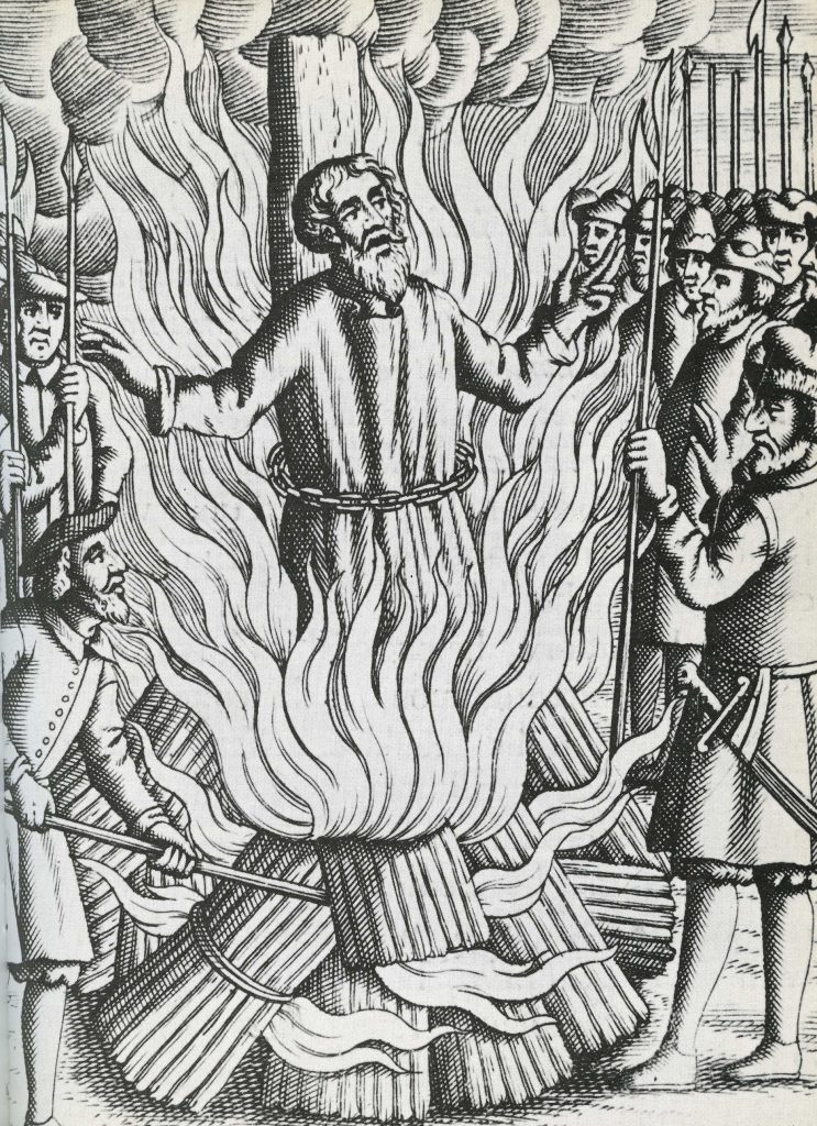
Thomas Bilney martyred in Smithfield.
The Walk creates a portrait of London in the early 16th Century, with particular emphasis on the life and times of Thomas Cromwell and Thomas More during the Anne Boleyn years.
More and Cromwell had much in common, both lawyers, commoners, who rose to be Lord Chancellor to Henry VIII, and ended their careers on the block at Tower Hill.
The walk starts with an exploration of Smithfield – site of the stake where heretics were burnt alive and of St Bartholomew’s Monastery – given to Richard Rich after his decisive role in the downfall of Thomas More. We continue to St Paul where Martin Luther’s books were burnt, and later, where Puritans preached against dancing round the Maypole.
We walk along the main markets streets of London, to Thomas More’s birthplace, and to the site of More’s and Cromwell’s townhouses before, if time allows, finishing at the site of the Scaffold where More and Cromwell met their ends, overlooking where Anne Boleyn was incarcerated in the Tower of London
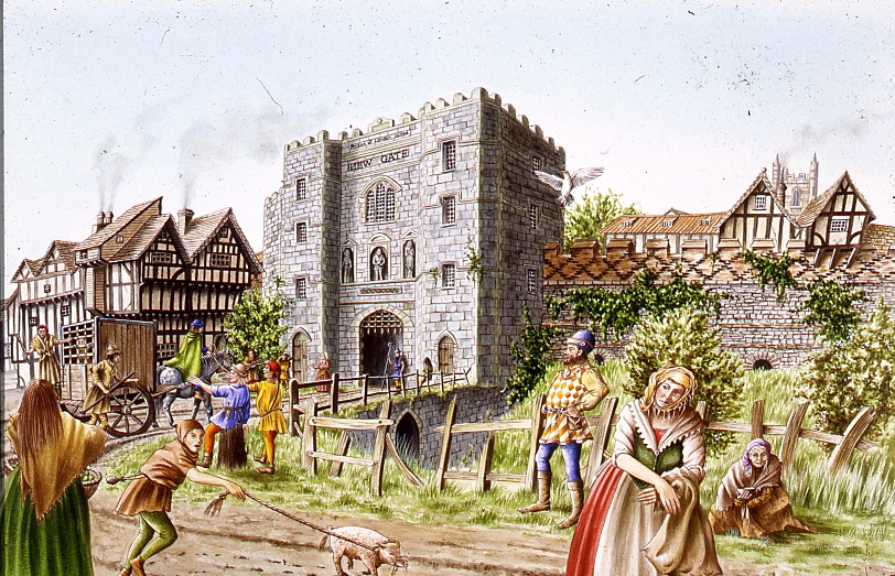
The Leap Year Pub Walk Thurs 6pm 29 February 2024 Tower Hill Underground
Sketched from a photo by simple-aign on pixaby
Thurs, 29 February 2024, 6pm Tower Hill Underground
We explore London, the Leap Year and 29th February through history A strange amazing day – and walk – that comes only once every four years. For the rest of the time it does not “exist.” A day – and walk – of temporal tune-up. A day – and walk – of unlocked potential. A day – and a walk – of unlocked London.
As the Sun, Moon and Seasons have different cycles and don’t fit into a set number of days, Londoners have had to cope with fixes to their Calendars to align the Cosmos with everyday life. As we walk through the streets of the ancient City of London, we explore how Londoners organised and celebrated their year throughout history
One of the most popular forms of publication in London was the Almanac. It was full of seasonal advice, of prophecy, traditional wisdom, and important events past and future. We will look at Almanacs and Diaries to find how Londoners spent their Leap Year.
We start with the Romans at the City Wall, near the Tower of London, and walk through history until we reach a historic pub to celebrate the New Year.
The Leap Year Almanac of the Past Pub Walk is led by Kevin Flude, a lecturer, curator and former archaeologist at the Museum of London. Join him to explore London’s History through its celebrations, festivals, calendars and almanacs.
This is a London Walks Guided Walk.
Roman London – A Literary & Archaeological Walk Sun 11.30 am 3rd March 2024 Monument Underground Station To book Jane Austen’s London Sun 2.30 pm 3rd March 2024 Green Park Underground station (Green Park Exit. Fountain in Green Park), To book Myths, Legends, Archaeology and the Origins of London Sunday 11.30am 23rd March 2024 Tower Hill Underground
London. 1066 and All That Walk
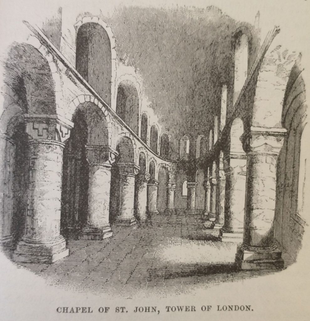
Old illustration Chapel of St Johns Tower of London
Sunday 2.30pm 23rd March 2024 Blackfriars Underground Station The Archaeological Walk that explores the City of London at the end of the Saxon period and at the beginning of the Norman.
The Norman Conquest of 1066 defines Britain in a way unmatched by any other event. And on this walk we explore the London that William conquered and how he changed England for all time.
London was England’s most important City, but not yet the capital. It was crucial to William in his attempt to conquer the realm. But his army could not fight their way across the heavily defended London Bridge after the defeat of the English King, Harold, at the Battle of Hastings.
The future of England was in the balance as he ravaged the country seeking a way across the river and to persuade the English that resistance was hopeless.
Once across the river, the English leaders sued for peace, and William was crowned at the newly built Westminster Abbey. The English hoped for a strong King who would rule with the people. But William began by building Castles to oppress the Citizens, and soon swept aside the English Aristocracy and establishment and replaced them with the Conquerors.
This was a death blow to Anglo-Saxon culture, but the City made an accommodation with the new regime and the first Lord Mayor of London was an Englishman.
So, on the walk we explore the Late Saxon City of London, and how it changed in the last 11th and 12th Centuries.
Walk is by Kevin Flude, former Archaeologist at the Museum of London Kevin
Chaucer’s Medieval London Guided Walk
Medieval Newgate
Sunday 7th April 2024 11.30pm & Saturday 6th July 2.30 Aldgate Underground
A Walk around Medieval London following in the footsteps of its resident medieval poet – Geoffrey Chaucer One of the spectators at the Peasants Revolt was Geoffrey Chaucer, born in the Vintry area of London, who rose to be a diplomat, a Courtier and London’s Customs Officer. He lived with his wife in the Chamber above the Gate in the City Wall at Aldgate. His poetry shows a rugged, joyous medieval England including many scenes reflecting life in London. His stories document the ending of the feudal system, growing dissatisfaction with the corruption in the Church, and shows the robust independence with which the English led their lives.
His work helped change the fashion from poetry in French or Latin to acceptance of the English language as suitable literary language. This was helped by the growth of literacy in London as its Merchants and Guildsmen became increasingly successful. In 1422, for example, the Brewers decided to keep their records in English ‘as there are many of our craft who have the knowledge of reading and writing in the English idiom.’
Chaucer and other poets such as Langland give a vivid portrait of Medieval London which was dynamic, successful but also torn by crisis such as the Lollard challenge to Catholic hegemony, and the Peasants who revolted against oppression as the ruling classes struggled to resist the increased independence of the working people following the Black Death.
A walk which explores London in the Middle Ages, We begin at Aldgate, and follow Chaucer from his home to his place of work at the Customs House, and then to St Thomas Chapel on London Bridge, and across the River to where the Canterbury Tales start – at the Tabard Inn.
This is a London Walks event by Kevin Flude
The Decline And Fall Of Roman London Walk
London in the 5th Century Reconstruction painting.
Sat 1.30pm 25th May 2024Exit 2 St Pauls Underground Station
An exploration of what happened at the end of the Roman Period, and how the City became deserted, and then, reborn as an English City
The first British Brexit? The Roman Britons kicked out the Romans in 407AD, and, soon, asked them to come back after a catastrophic collapse. Faced with plague, civil war, invasion, mass immigration, industrial decline, reversion to barter; the authorities struggled against anarchy and descent into a dark age.
But was that how it was? Wasn’t it a rather a transition into the Late Antique period in which life for most people went on much as before except paying taxes to local rulers rather than distant Romans?
The walk investigates why the Roman system in London broke down, and what really was the impact of the end of the Roman system in London? What is the evidence? and can we trust it? Or can we really do nothing much more than guess?
We tramp the streets of London in search of light to shine on the dark age of London.
This is a London Walks event by Kevin Flude, ex Museum of London Archaeology and Museum Curator.
Jane Austen’s London Walk
Saturday 25th May 6pm 2024 Green Park underground station (Green Park exit, by the fountain)
An exploration of Mayfair, the centre of the London section of Sense & Sensibility and where Jane came to visit her brother
“It is a truth universally acknowledged, that a Jane Austen devotee in possession of the good fortune of a couple of free hours today must be in want of this walk.”
People associate Jane Austen and her characters with a rural setting. But London is central to both Jane Austen’s real life and her literary life. So, this tour will explore Jane’s connections with London and give the background to Sense and Sensibility, a good part of which is based in this very area. We begin with the place Jane’s coach would arrive from Hampshire, and then walk the streets haunted by Willougby; past shops visited by the Palmers, the Ferrars; visit the location of Jane Austen’s brother’s bank and see the publisher of Jane’s Books. The area around Old Bond Street was the home of the Regency elite and many buildings and a surprising number of the shops remain as they were in Jane Austen’s day.
This is a London Walk Guided Walk lead by Kevin Flude
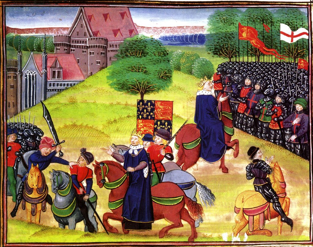
The Peasants Revolt Anniversary Guided Walk
Medieval Manuscript of Peasants Revolt at Smithfield
Aldgate Underground Thursday 6.30 13th June 2024
An Anniversary Walk tracking the progress of the Peasants as they take control of London in June of 1381
The Summer of Blood
The Peasants’ Revolt. The greatest popular rising in English history. This is the anniversary walk. The London Walk that heads back to 1381, back to the Peasants’ Revolt. You want a metaphor, think stations of the cross. This is the stations of the Peasants’ Revolt walk. We go over the ground, literally and metaphorically. Where it took place. Why it took place. Why it took place at these places. What happened. The walk is guided by the distinguished Museum of London Archaeologist His expertise means you’ll see the invisible. And understand the inscrutable.
On the anniversary of the Peasants Revolt we reconstruct the events that shook the medieval world. In June 1381, following the introduction of the iniquitous Poll Tax, England’s government nearly fell, shaken to the core by a revolt led by working men. This dramatic tour follows the events of the Revolt as the Peasants move through London in June 1381.
We met up with the Peasants at Aldgate, force our way into the City. We march on the Tower of London as the King makes concessions by ending serfdom, at Mile End. But the leaders take the mighty Tower of London and behead the leaders of Richard’s government. Attacks follow on the lawyers in the Temple, the Prior at St. John’s of Jerusalem, Flemish Londoners, and on Lambeth and Savoy Palaces.
The climax of the Revolt comes at Smithfield where a small Royal party confront the 30,000 peasants.
Chaucer’s Medieval London Guided Walk
Medieval Newgate
Sat 2.30 6th July 2024 Aldgate Underground
A Walk around Medieval London following in the footsteps of its resident medieval poet – Geoffrey Chaucer
One of the spectators at the Peasants Revolt was Geoffrey Chaucer, born in the Vintry area of London, who rose to be a diplomat, a Courtier and London’s Customs Officer. He lived with his wife in the Chamber above the Gate in the City Wall at Aldgate. His poetry shows a rugged, joyous medieval England including many scenes reflecting life in London. His stories document the ending of the feudal system, growing dissatisfaction with the corruption in the Church, and shows the robust independence with which the English led their lives.
His work helped change the fashion from poetry in French or Latin to acceptance of the English language as suitable literary language. This was helped by the growth of literacy in London as its Merchants and Guildsmen became increasingly successful. In 1422, for example, the Brewers decided to keep their records in English ‘as there are many of our craft who have the knowledge of reading and writing in the English idiom.’
Chaucer and other poets such as Langland give a vivid portrait of Medieval London which was dynamic, successful but also torn by crisis such as the Lollard challenge to Catholic hegemony, and the Peasants who revolted against oppression as the ruling classes struggled to resist the increased independence of the working people following the Black Death.
A walk which explores London in the Middle Ages, We begin at Aldgate, and follow Chaucer from his home to his place of work at the Customs House, and then to St Thomas Chapel on London Bridge, and across the River to where the Canterbury Tales start – at the Tabard Inn.
This is a London Walks event by Kevin Flude
Myths, Legends, Archaeology and the Origins of London
King Bran’s head buried at Tower Hill
Sat 6pm 6th July 2024 Tower Hill Underground
The walk tells the stories of our changing ideas about the origins of London during the Prehistoric, Roman and Saxon periods.
The walk is led by Kevin Flude, a former archaeologist at the Museum of London, who has an interest both in myths, legends and London’s Archaeology.
The walk will tell the story of the legendary origins of London which record that it was founded in the Bronze Age by an exiled Trojan and was called New Troy, which became corrupted to Trinovantum. This name was recorded in the words of Julius Caesar; and, then, according to Legend, the town was renamed after King Ludd and called Lud’s Dun. Antiquarians and Archaeologists have taken centuries to demolish this idea, and became convinced London was founded by the Romans. Recently, dramatic evidence of a Bronze Age presence in London was found.
When the Roman system broke down in 410 AD, historical records were almost non-existent, until the Venerable Bede recorded the building of St Pauls Cathedral in 604 AD. The two hundred year gap, has another rich selection of legends. which the paucity of archaeological remains struggles to debunk.
The walk will explore these stories and compare the myths and legends with Archaeological discoveries.
The route starts at Tower Hill, then down to the River at Billingsgate, London Bridge, and into the centre of Roman London.
Roman London – A Literary & Archaeological Walk
Reconstruction View of Roman Riverside Wall being built
Sat 11.30 am 21st August 2024 Monument Underground Station To book
This is a walking tour that features the amazing archaeological discoveries of Roman London, and looks at life in the provincial Roman capital of Londinium.
Our Guides will be Publius Ovidius Naso and Marcus Valerius Martialis who will be helped by Kevin Flude, former Museum of London Archaeologist, Museum Curator and Lecturer.
We disembark at the Roman Waterfront by the Roman Bridge, and then explore the lives of the citizens as we walk up to the site of the Roman Town Hall, and discuss Roman politics. We proceed through the streets of Roman London, with its vivid and cosmopolitan street life via the Temple of Mithras to finish with Bread and Circus at the Roman Amphitheatre.
Zinger Read: Talk about a high-quality one-two punch. This walk investigates the groundbreaking archaeological discoveries of Roman London. And then it reconstructs life in a provincial Roman capital using archaeological and literary sources. Discoveries – insights – like flashes of lightning in a cloud. We begin at the site of the Roman bridge. We might be decent young Roman citizens in togas, having this and that bit of explained to us as we make our way towards the Roman Town Hall. From there we head to the site of the excavation called ‘the Pompeii of the North.’ Followed by the Temple of Mithras. We finish with a walk along the Roman High Street in order to end at the site of the Roman Amphitheatre. So, yes, welcome to London as it was 2,000, 1,900, 1,800, 1,700 and 1,600 years ago. And, yes, the walk’s guided by a real expert, the distinguished emeritus Museum of London archaeologist Kevin Flude. That means you’ll see things other people don’t get to see, delve into London via fissures that aren’t visible, let alone accessible, to non-specialists.
REVIEWS “Kevin, I just wanted to drop you a quick email to thank you ever so much for your archaeological tours of London! I am so thrilled to have stumbled upon your tours! I look forward to them more than you can imagine! They’re the best 2 hours of my week! 🙂 Best, Sue
The Walk creates a portrait of London in the early 16th Century, with particular emphasis on the life and times of Thomas Cromwell and Thomas More during the Anne Boleyn years
More and Cromwell had much in common, both lawyers, commoners, who rose to be Lord Chancellor to Henry VIII, and ended their careers on the block at Tower Hill.
The walk starts with an exploration of Smithfield – site of the stake where heretics were burnt alive and of St Bartholomew’s Monastery – given to Richard Rich after his decisive role in the downfall of Thomas More. We continue to St Paul where Martin Luther’s books were burnt, and later, where Puritans preached against dancing round the Maypole.
We walk along the main markets streets of London, to Thomas More’s birthplace, and to the site of More’s and Cromwell’s townhouses before, if time allows, finishing at the site of the Scaffold where More and Cromwell met their ends, overlooking where Anne Boleyn was incarcerated in the Tower of London
Sunday 6pm 8th September 2024 Green Park underground station (Green Park exit, by the fountain) To Book:
An exploration of Mayfair, the centre of the London section of Sense & Sensibility and where Jane came to visit her brother
“It is a truth universally acknowledged, that a Jane Austen devotee in possession of the good fortune of a couple of free hours today must be in want of this walk.”
People associate Jane Austen and her characters with a rural setting. But London is central to both Jane Austen’s real life and her literary life. So, this tour will explore Jane’s connections with London and give the background to Sense and Sensibility, a good part of which is based in this very area. We begin with the place Jane’s coach would arrive from Hampshire, and then walk the streets haunted by Willougby; past shops visited by the Palmers, the Ferrars; visit the location of Jane Austen’s brother’s bank and see the publisher of Jane’s Books. The area around Old Bond Street was the home of the Regency elite and many buildings and a surprising number of the shops remain as they were in Jane Austen’s day.
This is a London Walk Guided Walk lead by Kevin Flude
Chaucer’s Medieval London Walk Sat 11.30 5th October 24 Aldgate Underground
London Before And After The Roman Invasion 3pm Saturday 5th October 2024 Tower Hill Underground
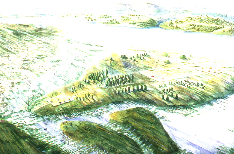
View of London from the SE as it might have looked before the Roman Invasion
Tower Hill Underground 3pm Saturday 5th October 2024
The walk looks into the evidence for a prehistoric London and tells the story of the coming of the Romans in AD43
The walk is led by Kevin Flude, a former archaeologist at the Museum of London.
The walk investigates the City of London before and after the the Roman Conquest. What is the evidence for settlement before the Romans set up town of Londinium? Why did the Romans establish the town on this spot? Who were the early Roman Londoners and what made their choice of site so successful?
The fledgling Town was then burnt down by Queen Boudiccan and her Icenian rebels. We look at the evidence for the Revolt and London’s recovery to became the capital of Britain.
This is a London Walks Guided Walk. Look at their web site for a list of other of their amazing walks.
REVIEWS (from London Walks website) “Kevin, I just wanted to drop you a quick email to thank you ever so much for your archaeological tours of London! I am so thrilled to have stumbled upon your tours! I look forward to them more than you can imagine! They’re the best 2 hours of my week! 🙂 Best, Sue
Myths, Legends & Halloween Virtual Walk Thu 8.00pm 31st October 2024
The walk tells the story of London’s myths and legends and the Celtic origins of Halloween. The virtual walk is led by Kevin Flude, a former archaeologist at the Museum of London, who has an interest both in the archaeological evidence as well as the myths and legends of London’s origin.
The virtual walk will tell the story of a selection of London’s Myths and Legends, beginning with the tale of London’s legendary origins in the Bronze Age by an exiled Trojan called Brutus. Stories of Bladud, Bellinus, Bran and Arthur will be interspersed with how they fit in with archaeological discoveries.
As we explore the City we also look at the origins of Halloween celebrations and how they may have been celebrated in early London.
The virtual route starts at Tower Hill, then down to the River Thames at Billingsgate, to London Bridge and Southwark Cathedral, to the Roman Forum at the top of Cornhill, into the valley of the River Walbrook, passed the Temple of Mithras, along Cheapside to the Roman Amphitheatre, and finishing up in the shadow of St Pauls.
This is a London Walks Guided Walk. Look at their web site for a list of other of their amazing walks.
REVIEWS (from London Walks website) “Kevin, I just wanted to drop you a quick email to thank you ever so much for your archaeological tours of London! I am so thrilled to have stumbled upon your tours! I have wanted to be an archaeologist since 1978 at the ripe old age of 8 years,… I was told for years that I could not be an archaeologist [for any number of reasons, which I now realise are completely ridiculous!], so I ended up on a different course of study. And now at the age of 50, it is my one great regret in life. So, I am thoroughly enjoying living vicariously through you, the digs you’ve been on, and the history you bring to life for us! British archaeology would have been my specific area of study had I pursued it. ?? Thank you SO MUCH for these! I look forward to them more than you can imagine, and honestly, I’ll be sad if you get them down to 1.5 hours! They’re the best 2 hours of my week! 🙂 Best, Sue
Roman London – Literary & Archaeology Walk Sat 11.30 am,9th November 2024
London: 1066 and All That Walk Sat 2.30pm 9th Nov 24
Old illustration Chapel of St Johns Tower of London
Sat 2.30pm 9th November 2024 Blackfriars Underground Station The Archaeological Walk that explores the City of London at the end of the Saxon period and at the beginning of the Norman.
The Norman Conquest of 1066 defines Britain in a way unmatched by any other event. And on this walk we explore the London that William conquered and how he changed England for all time.
London was England’s most important City, but not yet the capital. It was crucial to William in his attempt to conquer the realm. But his army could not fight their way across the heavily defended London Bridge after the defeat of the English King, Harold, at the Battle of Hastings.
The future of England was in the balance as he ravaged the country seeking a way across the river and to persuade the English that resistance was hopeless.
Once across the river, the English leaders sued for peace, and William was crowned at the newly built Westminster Abbey. The English hoped for a strong King who would rule with the people. But William began by building Castles to oppress the Citizens, and soon swept aside the English Aristocracy and establishment and replaced them with the Conquerors.
This was a death blow to Anglo-Saxon culture, but the City made an accommodation with the new regime and the first Lord Mayor of London was an Englishman.
So, on the walk we explore the Late Saxon City of London, and how it changed in the last 11th and 12th Centuries.
Walk is by Kevin Flude, former Archaeologist at the Museum of London Kevin
London Before London – Prehistoric London Virtual Walk
Sat 7.30pm 9th November 2024
View of London from the SE as it might have looked before the Roman Invasion
An exploration of London before the foundation of Londinium
It was long thought that London was founded by a Trojan Exile in the Late Bronze Age. But historical analysis and archaeological excavation gradually demoted the idea to a myth.
On this tour we explore what was in the London area before the Romans. We begin at Heathrow and tour Greater London for evidence from the Paleolithic to the invasion of the Emperor Claudius.
We concentrate on the period since the introduction of farming, and bring together evidence for the prehistoric Kingdoms that controlled the area on the eve of the Invasion. We look for henges, barrows, hill forts, hut circles and look at genetic evidence for identity of prehistoric Londoners. The tour will end in the City.
This is a London Walks event by Kevin Flude, ex Museum of London Archaeology and Museum Curator
The Decline And Fall Of Roman London Walk Sat 11.30am 23rd November 24 Jane Austen’s London Sat 3.00 pm 23rd November
Christmas With Jane Austen Virtual London Tour Mon 9 Dec 24 7.30pm
We look at how Jane Austen spent Christmas and at Georgian Christmas traditions and amusements.
“It is a truth universally acknowledged, that a Jane Austen devotee in possession of the good fortune of a couple of free hours must be in want of this virtual walk.”
This is a special walk, which looks at the traditions of Christmas during the Regency period and how Jane Austen might have celebrated it. It will give some background to Jane Austen’s life and her knowledge of London. We used her novels and her letters to find out what she might have done at Christmas, but also at how Christmas was kept in this period, and the range of ‘Curiosities, Amusements, Exhibitions, Public Establishments, and Remarkable Objects in and near London available to enjoy.
This is a London Walks Guided Walk by Kevin Flude, Museum Curator and Lecturer.
Reviews: ‘Thanks, again, Kevin. These talks are magnificent!’ “1 am glad to see there are a few more virtual presentations scheduled, they are wonderful!
Dickens London. Life, Work and Christmas Virtual Tour Mon 16 Dec 24 7.30pm
Trotty Veck 1889 Dickens The Chimes by Kyd (Joseph Clayton Clarke)
A Virtual Tour of Dickens London with a dash of Dickensian Christmas
The Virtual Tour weaves an exploration of Victorian London with Dickens London Life and writing. On the tour we have a look at London at Christmas and the contribution Dickens made to it by his Christmas Books
Dickens writing always has a moral element as exemplified by his Christmas Books. ‘Christmas Carol’ was based on redemption and his second great Christmas Book ‘The Chimes’ on the renewal that the New Year encouraged.
We start in Southwark, visit sites associated with the Christmas Books and others and end at Staple Inn with the Christmas Book ‘The Haunted Man’.
The London Winter Solstice Virtual Tour Sat 7:30pm 21 Dec 24
We explore London’s History through its celebrations, festivals, calendars, and almanacs of the Winter Solstice
Winter Solstice festivals have been a time of review, renewal and anticipation of the future from time immemorial. The Ancient Britons saw the Solstice as a symbol of a promise of renewal as the world entered bleak mid winter. The Roman season was presided over by Janus, a two headed God who looked both backwards and forwards, and Dickens based his second great Christmas Book on the renewal that the New Year encouraged.
We look at London’s past to see where and how the Solstice might be celebrated. We also explore the different Calendars – the Pagan year, the Christian year, the Roman year, the Jewish year, the Financial year, the Academic year and we reveal how these began. We look at folk traditions, Medieval Christmas Festivals, Boy Bishops, Distaff Sunday and Plough Monday, and other London winter traditions and folklore.
At the end we use ancient methods to divine what is in store for us in 2023.