I keep an archive of the walks I have done each year.
Ring in the New Year Virtual Walk
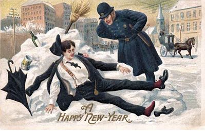
Monday 1st January 2024 7.00pm
On this Virtual Walk we look at how London has celebrated the New Year over the past 2000 years.
The New Year has been a time of review, renewal and anticipation
of the future from time immemorial. The Ancient Britons saw the Solstice as a symbol of a promise of renewal as the Sun was reborn. As the weather turns to bleak mid winter, a festival or reflection and renewal cheers everyone up. This idea of renewal was followed by the Romans, and presided over by a two headed God called Janus who looked both backwards and forwards. Dickens Christmas Carol was based on redemption and his second great Christmas Book ‘The Chimes’ on the renewal that the New Year encouraged.
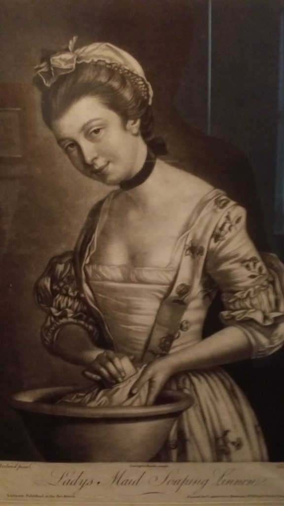
We look at London’s past to see where and how the New Year was celebrated. We also explore the different New Years we use and their associated Calendars – the Pagan year, the Christian year, the Roman year, the Jewish year, the Financial year, the Academic year and we reveal how these began. We look at folk traditions, Medieval Christmas Festivals, Boy Bishops, Distaff Sunday and Plough Monday, and other Winter Festival and New Year London tradition and folklore.
At the end we use ancient methods to divine what is in store for us in 2024
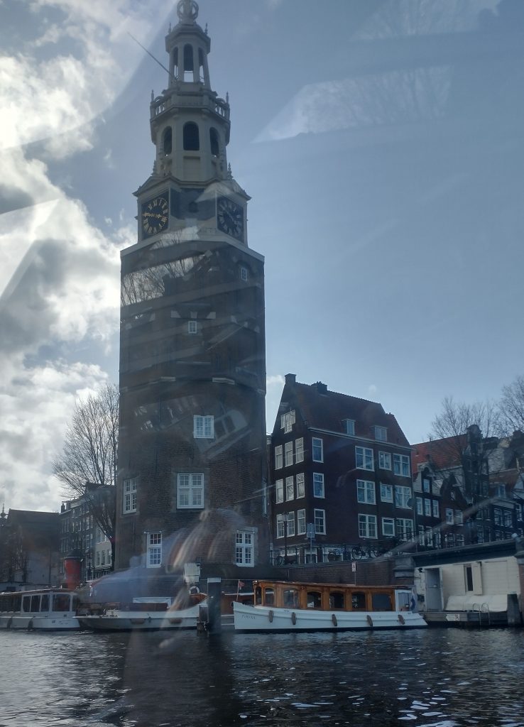
ROMAN LONDON – A LITERARY & ARCHAEOLOGICAL WALK
Sunday 21st Jan & 3rd March 2023 11.30 am Monument Underground Station
Our Guides will be Publius Ovidius Naso and Marcus Valerius Martialis who will be helped by Kevin Flude, former Museum of London Archaeologist, Museum Curator and Lecturer.
To book
We disembark at the Roman Waterfront by the Roman Bridge, and then explore the lives of the citizens as we walk up to the site of the Roman Town Hall, and discuss Roman politics. We proceed through the streets of Roman London, with its vivid and cosmopolitan street life via the Temple of Mithras to finish with Bread and Circus at the Roman Amphitheatre.
REVIEWS
“Kevin, I just wanted to drop you a quick email to thank you ever so much for your archaeological tours of London! I am so thrilled to have stumbled upon your tours! I look forward to them more than you can imagine! They’re the best 2 hours of my week! 🙂 Best, Sue
Jane Austen’s London Sunday Jan 21st 2.30 pm Green Park underground station,
An exploration of Mayfair, the centre of the London section of Sense & Sensibility and where Jane came to visit her brother
“It is a truth universally acknowledged, that a Jane Austen devotee in possession of the good fortune of a couple of free hours today must be in want of this walk.”
People associate Jane Austen and her characters with a rural setting. But London is central to both Jane Austen’s real life and her literary life. So, this tour will explore Jane’s connections with London and give the background to Sense and Sensibility, a good part of which is based in this very area. We begin with the place Jane’s coach would arrive from Hampshire, and then walk the streets haunted by Willougby; past shops visited by the Palmers, the Ferrars; visit the location of Jane Austen’s brother’s bank and see the publisher of Jane’s Books. The area around Old Bond Street was the home of the Regency elite and many buildings and a surprising number of the shops remain as they were in Jane Austen’s day.
This is a London Walk Guided Walk lead by Kevin Flude
Sat 6pm 25th May 2024 Green Park Tube
Myths, Legends, Archaeology and the Origins of London
Sunday 4th February & Saturday 23 March 2024 11.30pm Tower Hill Underground
The walk tells the stories of our changing ideas about the origins of London during the Prehistoric, Roman and Saxon periods.
The walk is led by Kevin Flude, a former archaeologist at the Museum of London, who has an interest both in myths, legends and London’s Archaeology.
The walk will tell the story of the legendary origins of London which record that it was founded in the Bronze Age by an exiled Trojan and was called New Troy, which became corrupted to Trinovantum. This name was recorded in the words of Julius Caesar; and, then, according to Legend, the town was renamed after King Ludd and called Lud’s Dun. Antiquarians and Archaeologists have taken centuries to demolish this idea, and became convinced London was founded by the Romans. Recently, dramatic evidence of a Bronze Age presence in London was found.
When the Roman system broke down in 410 AD, historical records were almost non-existent, until the Venerable Bede recorded the building of St Pauls Cathedral in 604 AD. The two hundred year gap, has another rich selection of legends. which the paucity of archaeological remains struggles to debunk.
The walk will explore these stories and compare the myths and legends with Archaeological discoveries.
The route starts at Tower Hill, then down to the River at Billingsgate, London Bridge, and into the centre of Roman London
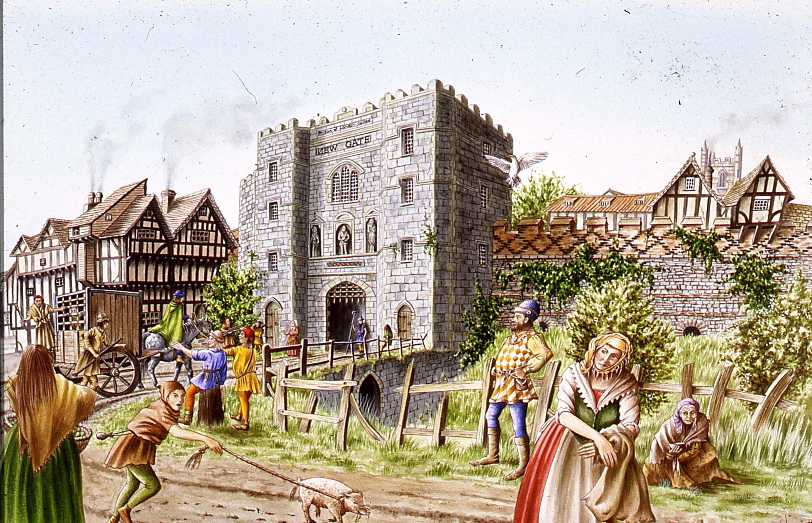
Tudor London – The City of Wolf Hall
Sunday 4th February 2024 2.15pm Barbican Underground Station
Tudor London – The City of Wolf Hall Virtual Tour Sunday 4th February 2024 7.30 pm To book
The Walk creates a portrait of London in the early 16th Century, with particular emphasis on the life and times of Thomas Cromwell and Thomas More during the Anne Boleyn years.
More and Cromwell had much in common, both lawyers, commoners, who rose to be Lord Chancellor to Henry VIII, and ended their careers on the block at Tower Hill.
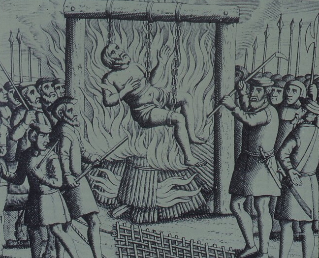
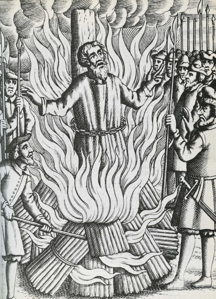
The walk starts with an exploration of Smithfield – site of the stake where heretics were burnt alive and of St Bartholomew’s Monastery – given to Richard Rich after his decisive role in the downfall of Thomas More. We continue to St Paul where Martin Luther’s books were burnt, and later, where Puritans preached against dancing round the Maypole.
We walk along the main markets streets of London, to Thomas More’s birthplace, and to the site of More’s and Cromwell’s townhouses before, if time allows, finishing at the site of the Scaffold where More and Cromwell met their ends, overlooking where Anne Boleyn was incarcerated in the Tower of London
The Leap Year Pub Walk Thurs 6pm 29 February 2024 Tower Hill Underground

Thurs, 29 February 2024, 6pm Tower Hill Underground
We explore London, the Leap Year and 29th February through history
A strange amazing day – and walk – that comes only once every four years. For the rest of the time it does not “exist.” A day – and walk – of temporal tune-up. A day – and walk – of unlocked potential. A day – and a walk – of unlocked London.
As the Sun, Moon and Seasons have different cycles and don’t fit into a set number of days, Londoners have had to cope with fixes to their Calendars to align the Cosmos with everyday life. As we walk through the streets of the ancient City of London, we explore how Londoners organised and celebrated their year throughout history
One of the most popular forms of publication in London was the Almanac. It was full of seasonal advice, of prophecy, traditional wisdom, and important events past and future. We will look at Almanacs and Diaries to find how Londoners spent their Leap Year.
We start with the Romans at the City Wall, near the Tower of London, and walk through history until we reach a historic pub to celebrate the New Year.
The Leap Year Almanac of the Past Pub Walk is led by Kevin Flude, a lecturer, curator and former archaeologist at the Museum of London. Join him to explore London’s History through its celebrations, festivals, calendars and almanacs.
This is a London Walks Guided Walk.
Roman London – A Literary & Archaeological Walk Sun 11.30 am 3rd March 2024 Monument Underground Station To book
Jane Austen’s London Sun 2.30 pm 3rd March 2024 Green Park Underground station (Green Park Exit. Fountain in Green Park), To book
Myths, Legends, Archaeology and the Origins of London Sunday 11.30am 23rd March 2024 Tower Hill Underground
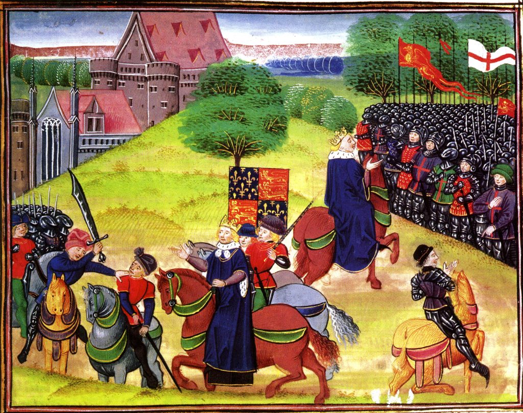
London. 1066 and All That Walk
Sunday 2.30pm 23rd March 2024 Blackfriars Underground Station
The Archaeological Walk that explores the City of London at the end of the Saxon period and at the beginning of the Norman.
The Norman Conquest of 1066 defines Britain in a way unmatched by any other event. And on this walk we explore the London that William conquered and how he changed England for all time.
London was England’s most important City, but not yet the capital. It was crucial to William in his attempt to conquer the realm. But his army could not fight their way across the heavily defended London Bridge after the defeat of the English King, Harold, at the Battle of Hastings.
The future of England was in the balance as he ravaged the country seeking a way across the river and to persuade the English that resistance was hopeless.
Once across the river, the English leaders sued for peace, and William was crowned at the newly built Westminster Abbey. The English hoped for a strong King who would rule with the people. But William began by building Castles to oppress the Citizens, and soon swept aside the English Aristocracy and establishment and replaced them with the Conquerors.
This was a death blow to Anglo-Saxon culture, but the City made an accommodation with the new regime and the first Lord Mayor of London was an Englishman.
So, on the walk we explore the Late Saxon City of London, and how it changed in the last 11th and 12th Centuries.
Walk is by Kevin Flude, former Archaeologist at the Museum of London
Kevin
Chaucer’s Medieval London Guided Walk
Sunday 7th April 2024 11.30pm & Saturday 6th July 2.30 Aldgate Underground
A Walk around Medieval London following in the footsteps of its resident medieval poet – Geoffrey Chaucer
One of the spectators at the Peasants Revolt was Geoffrey Chaucer, born in the Vintry area of London, who rose to be a diplomat, a Courtier and London’s Customs Officer. He lived with his wife in the Chamber above the Gate in the City Wall at Aldgate. His poetry shows a rugged, joyous medieval England including many scenes reflecting life in London. His stories document the ending of the feudal system, growing dissatisfaction with the corruption in the Church, and shows the robust independence with which the English led their lives.
His work helped change the fashion from poetry in French or Latin to acceptance of the English language as suitable literary language. This was helped by the growth of literacy in London as its Merchants and Guildsmen became increasingly successful. In 1422, for example, the Brewers decided to keep their records in English ‘as there are many of our craft who have the knowledge of reading and writing in the English idiom.’
Chaucer and other poets such as Langland give a vivid portrait of Medieval London which was dynamic, successful but also torn by crisis such as the Lollard challenge to Catholic hegemony, and the Peasants who revolted against oppression as the ruling classes struggled to resist the increased independence of the working people following the Black Death.
A walk which explores London in the Middle Ages, We begin at Aldgate, and follow Chaucer from his home to his place of work at the Customs House, and then to St Thomas Chapel on London Bridge, and across the River to where the Canterbury Tales start – at the Tabard Inn.
This is a London Walks event by Kevin Flude
The Decline And Fall Of Roman London Walk

Sat 1.30pm 25th May 2024Exit 2 St Pauls Underground Station
An exploration of what happened at the end of the Roman Period, and how the City became deserted, and then, reborn as an English City
The first British Brexit? The Roman Britons kicked out the Romans in 407AD, and, soon, asked them to come back after a catastrophic collapse. Faced with plague, civil war, invasion, mass immigration, industrial decline, reversion to barter; the authorities struggled against anarchy and descent into a dark age.
But was that how it was? Wasn’t it a rather a transition into the Late Antique period in which life for most people went on much as before except paying taxes to local rulers rather than distant Romans?
The walk investigates why the Roman system in London broke down, and what really was the impact of the end of the Roman system in London? What is the evidence? and can we trust it? Or can we really do nothing much more than guess?
We tramp the streets of London in search of light to shine on the dark age of London.
This is a London Walks event by Kevin Flude, ex Museum of London Archaeology and Museum Curator.
Jane Austen’s London Walk
Saturday 25th May 6pm 2024 Green Park underground station (Green Park exit, by the fountain)
An exploration of Mayfair, the centre of the London section of Sense & Sensibility and where Jane came to visit her brother
“It is a truth universally acknowledged, that a Jane Austen devotee in possession of the good fortune of a couple of free hours today must be in want of this walk.”
People associate Jane Austen and her characters with a rural setting. But London is central to both Jane Austen’s real life and her literary life. So, this tour will explore Jane’s connections with London and give the background to Sense and Sensibility, a good part of which is based in this very area. We begin with the place Jane’s coach would arrive from Hampshire, and then walk the streets haunted by Willougby; past shops visited by the Palmers, the Ferrars; visit the location of Jane Austen’s brother’s bank and see the publisher of Jane’s Books. The area around Old Bond Street was the home of the Regency elite and many buildings and a surprising number of the shops remain as they were in Jane Austen’s day.
This is a London Walk Guided Walk lead by Kevin Flude
The Peasants Revolt Anniversary Guided Walk
Aldgate Underground Thursday 6.30 13th June 2024
An Anniversary Walk tracking the progress of the Peasants as they take control of London in June of 1381
The Summer of Blood
The Peasants’ Revolt. The greatest popular rising in English history. This is the anniversary walk. The London Walk that heads back to 1381, back to the Peasants’ Revolt. You want a metaphor, think stations of the cross. This is the stations of the Peasants’ Revolt walk. We go over the ground, literally and metaphorically. Where it took place. Why it took place. Why it took place at these places. What happened. The walk is guided by the distinguished Museum of London Archaeologist His expertise means you’ll see the invisible. And understand the inscrutable.
On the anniversary of the Peasants Revolt we reconstruct the events that shook the medieval world. In June 1381, following the introduction of the iniquitous Poll Tax, England’s government nearly fell, shaken to the core by a revolt led by working men. This dramatic tour follows the events of the Revolt as the Peasants move through London in June 1381.
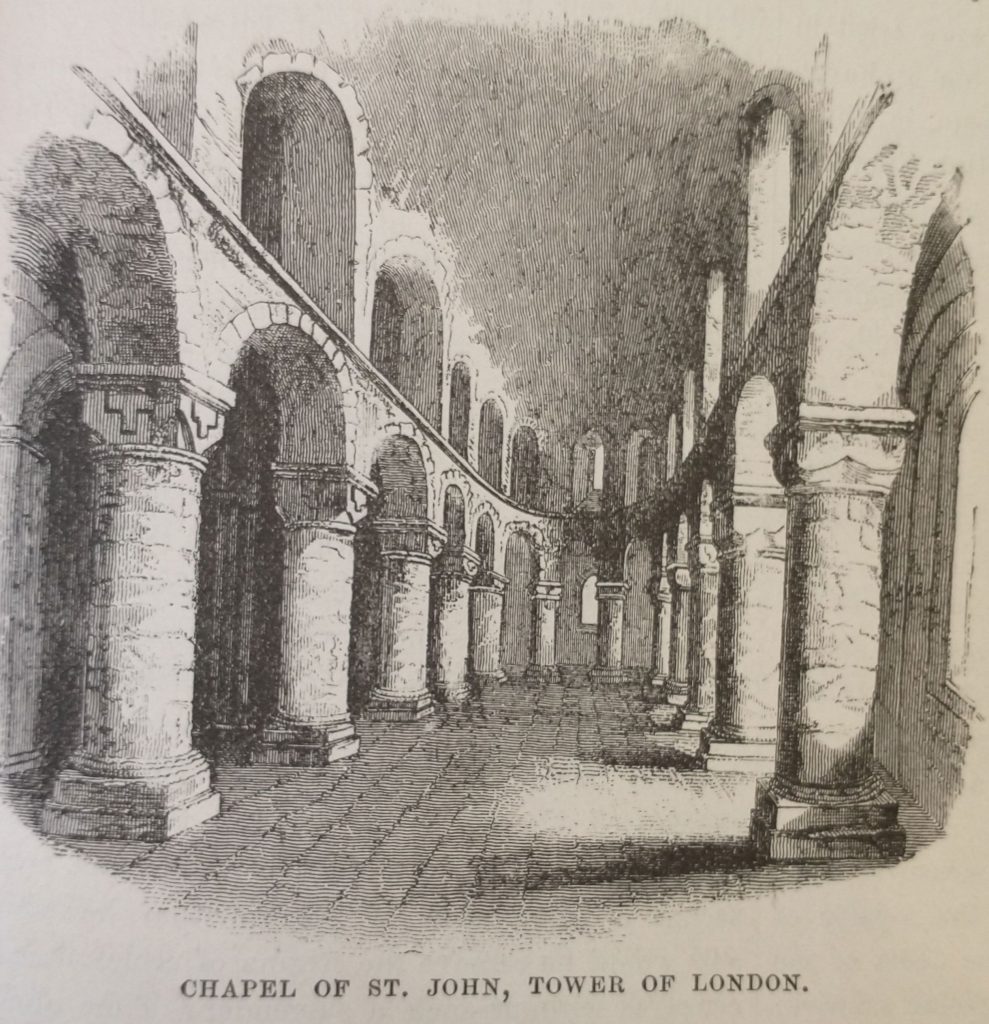
We met up with the Peasants at Aldgate, force our way into the City. We march on the Tower of London as the King makes concessions by ending serfdom, at Mile End. But the leaders take the mighty Tower of London and behead the leaders of Richard’s government. Attacks follow on the lawyers in the Temple, the Prior at St. John’s of Jerusalem, Flemish Londoners, and on Lambeth and Savoy Palaces.
The climax of the Revolt comes at Smithfield where a small Royal party confront the 30,000 peasants.
Chaucer’s Medieval London Guided Walk
Sat 2.30 6th July 2024 Aldgate Underground
A Walk around Medieval London following in the footsteps of its resident medieval poet – Geoffrey Chaucer
One of the spectators at the Peasants Revolt was Geoffrey Chaucer, born in the Vintry area of London, who rose to be a diplomat, a Courtier and London’s Customs Officer. He lived with his wife in the Chamber above the Gate in the City Wall at Aldgate. His poetry shows a rugged, joyous medieval England including many scenes reflecting life in London. His stories document the ending of the feudal system, growing dissatisfaction with the corruption in the Church, and shows the robust independence with which the English led their lives.
His work helped change the fashion from poetry in French or Latin to acceptance of the English language as suitable literary language. This was helped by the growth of literacy in London as its Merchants and Guildsmen became increasingly successful. In 1422, for example, the Brewers decided to keep their records in English ‘as there are many of our craft who have the knowledge of reading and writing in the English idiom.’
Chaucer and other poets such as Langland give a vivid portrait of Medieval London which was dynamic, successful but also torn by crisis such as the Lollard challenge to Catholic hegemony, and the Peasants who revolted against oppression as the ruling classes struggled to resist the increased independence of the working people following the Black Death.
A walk which explores London in the Middle Ages, We begin at Aldgate, and follow Chaucer from his home to his place of work at the Customs House, and then to St Thomas Chapel on London Bridge, and across the River to where the Canterbury Tales start – at the Tabard Inn.
This is a London Walks event by Kevin Flude
Myths, Legends, Archaeology and the Origins of London
Sat 6pm 6th July 2024 Tower Hill Underground
The walk tells the stories of our changing ideas about the origins of London during the Prehistoric, Roman and Saxon periods.
The walk is led by Kevin Flude, a former archaeologist at the Museum of London, who has an interest both in myths, legends and London’s Archaeology.
The walk will tell the story of the legendary origins of London which record that it was founded in the Bronze Age by an exiled Trojan and was called New Troy, which became corrupted to Trinovantum. This name was recorded in the words of Julius Caesar; and, then, according to Legend, the town was renamed after King Ludd and called Lud’s Dun. Antiquarians and Archaeologists have taken centuries to demolish this idea, and became convinced London was founded by the Romans. Recently, dramatic evidence of a Bronze Age presence in London was found.
When the Roman system broke down in 410 AD, historical records were almost non-existent, until the Venerable Bede recorded the building of St Pauls Cathedral in 604 AD. The two hundred year gap, has another rich selection of legends. which the paucity of archaeological remains struggles to debunk.
The walk will explore these stories and compare the myths and legends with Archaeological discoveries.
The route starts at Tower Hill, then down to the River at Billingsgate, London Bridge, and into the centre of Roman London.
Roman London – A Literary & Archaeological Walk
Sat 11.30 am 21st August 2024 Monument Underground Station To book
This is a walking tour that features the amazing archaeological discoveries of Roman London, and looks at life in the provincial Roman capital of Londinium.
Our Guides will be Publius Ovidius Naso and Marcus Valerius Martialis who will be helped by Kevin Flude, former Museum of London Archaeologist, Museum Curator and Lecturer.
We disembark at the Roman Waterfront by the Roman Bridge, and then explore the lives of the citizens as we walk up to the site of the Roman Town Hall, and discuss Roman politics. We proceed through the streets of Roman London, with its vivid and cosmopolitan street life via the Temple of Mithras to finish with Bread and Circus at the Roman Amphitheatre.
Zinger Read: Talk about a high-quality one-two punch. This walk investigates the groundbreaking archaeological discoveries of Roman London. And then it reconstructs life in a provincial Roman capital using archaeological and literary sources. Discoveries – insights – like flashes of lightning in a cloud. We begin at the site of the Roman bridge. We might be decent young Roman citizens in togas, having this and that bit of
explained to us as we make our way towards the Roman Town Hall. From there we head to the site of the excavation called ‘the Pompeii of the North.’ Followed by the Temple of Mithras. We finish with a walk along the Roman High Street in order to end at the site of the Roman Amphitheatre. So, yes, welcome to London as it was 2,000, 1,900, 1,800, 1,700 and 1,600 years ago. And, yes, the walk’s guided by a real expert, the distinguished emeritus Museum of London archaeologist Kevin Flude. That means you’ll see things other people don’t get to see, delve into London via fissures that aren’t visible, let alone accessible, to non-specialists.
REVIEWS
“Kevin, I just wanted to drop you a quick email to thank you ever so much for your archaeological tours of London! I am so thrilled to have stumbled upon your tours! I look forward to them more than you can imagine! They’re the best 2 hours of my week! 🙂 Best, Sue
To Book:
Tudor London – The City of Wolf Hall
Sunday 1.30pm 8th September 2024 Barbican Underground Station
To Book:
The Walk creates a portrait of London in the early 16th Century, with particular emphasis on the life and times of Thomas Cromwell and Thomas More during the Anne Boleyn years
More and Cromwell had much in common, both lawyers, commoners, who rose to be Lord Chancellor to Henry VIII, and ended their careers on the block at Tower Hill.
The walk starts with an exploration of Smithfield – site of the stake where heretics were burnt alive and of St Bartholomew’s Monastery – given to Richard Rich after his decisive role in the downfall of Thomas More. We continue to St Paul where Martin Luther’s books were burnt, and later, where Puritans preached against dancing round the Maypole.
We walk along the main markets streets of London, to Thomas More’s birthplace, and to the site of More’s and Cromwell’s townhouses before, if time allows, finishing at the site of the Scaffold where More and Cromwell met their ends, overlooking where Anne Boleyn was incarcerated in the Tower of London
To Book:
Jane Austen’s London
Sunday 6pm 8th September 2024 Green Park underground station (Green Park exit, by the fountain)
To Book:
An exploration of Mayfair, the centre of the London section of Sense & Sensibility and where Jane came to visit her brother
“It is a truth universally acknowledged, that a Jane Austen devotee in possession of the good fortune of a couple of free hours today must be in want of this walk.”
People associate Jane Austen and her characters with a rural setting. But London is central to both Jane Austen’s real life and her literary life. So, this tour will explore Jane’s connections with London and give the background to Sense and Sensibility, a good part of which is based in this very area. We begin with the place Jane’s coach would arrive from Hampshire, and then walk the streets haunted by Willougby; past shops visited by the Palmers, the Ferrars; visit the location of Jane Austen’s brother’s bank and see the publisher of Jane’s Books. The area around Old Bond Street was the home of the Regency elite and many buildings and a surprising number of the shops remain as they were in Jane Austen’s day.
This is a London Walk Guided Walk lead by Kevin Flude
Chaucer’s Medieval London Walk Sat 11.30 5th October 24 Aldgate Underground
London Before And After The Roman Invasion 3pm Saturday 5th October 2024 Tower Hill Underground

Tower Hill Underground 3pm Saturday 5th October 2024
The walk looks into the evidence for a prehistoric London and tells the story of the coming of the Romans in AD43
The walk is led by Kevin Flude, a former archaeologist at the Museum of London.
The walk investigates the City of London before and after the the Roman Conquest. What is the evidence for settlement before the Romans set up town of Londinium? Why did the Romans establish the town on this spot? Who were the early Roman Londoners and what made their choice of site so successful?
The fledgling Town was then burnt down by Queen Boudiccan and her Icenian rebels. We look at the evidence for the Revolt and London’s recovery to became the capital of Britain.
This is a London Walks Guided Walk. Look at their web site for a list of other of their amazing walks.
REVIEWS (from London Walks website)
“Kevin, I just wanted to drop you a quick email to thank you ever so much for your archaeological tours of London! I am so thrilled to have stumbled upon your tours! I look forward to them more than you can imagine! They’re the best 2 hours of my week! 🙂 Best, Sue
Myths, Legends & Halloween Virtual Walk Thu 8.00pm 31st October 2024
The walk tells the story of London’s myths and legends and the Celtic origins of Halloween.
The virtual walk is led by Kevin Flude, a former archaeologist at the Museum of London, who has an interest both in the archaeological evidence as well as the myths and legends of London’s origin.
The virtual walk will tell the story of a selection of London’s Myths and Legends, beginning with the tale of London’s legendary origins in the Bronze Age by an exiled Trojan called Brutus. Stories of Bladud, Bellinus, Bran and Arthur will be interspersed with how they fit in with archaeological discoveries.
As we explore the City we also look at the origins of Halloween celebrations and how they may have been celebrated in early London.
The virtual route starts at Tower Hill, then down to the River Thames at Billingsgate, to London Bridge and Southwark Cathedral, to the Roman Forum at the top of Cornhill, into the valley of the River Walbrook, passed the Temple of Mithras, along Cheapside to the Roman Amphitheatre, and finishing up in the shadow of St Pauls.
This is a London Walks Guided Walk. Look at their web site for a list of other of their amazing walks.
REVIEWS (from London Walks website)
“Kevin, I just wanted to drop you a quick email to thank you ever so much for your archaeological tours of London! I am so thrilled to have stumbled upon your tours! I have wanted to be an archaeologist since 1978 at the ripe old age of 8 years,… I was told for years that I could not be an archaeologist [for any number of reasons, which I now realise are completely ridiculous!], so I ended up on a different course of study. And now at the age of 50, it is my one great regret in life. So, I am thoroughly enjoying living vicariously through you, the digs you’ve been on, and the history you bring to life for us! British archaeology would have been my specific area of study had I pursued it. ?? Thank you SO MUCH for these! I look forward to them more than you can imagine, and honestly, I’ll be sad if you get them down to 1.5 hours! They’re the best 2 hours of my week! 🙂 Best, Sue
Roman London – Literary & Archaeology Walk Sat 11.30 am,9th November 2024
London: 1066 and All That Walk Sat 2.30pm 9th Nov 24
Sat 2.30pm 9th November 2024 Blackfriars Underground Station
The Archaeological Walk that explores the City of London at the end of the Saxon period and at the beginning of the Norman.
The Norman Conquest of 1066 defines Britain in a way unmatched by any other event. And on this walk we explore the London that William conquered and how he changed England for all time.
London was England’s most important City, but not yet the capital. It was crucial to William in his attempt to conquer the realm. But his army could not fight their way across the heavily defended London Bridge after the defeat of the English King, Harold, at the Battle of Hastings.
The future of England was in the balance as he ravaged the country seeking a way across the river and to persuade the English that resistance was hopeless.
Once across the river, the English leaders sued for peace, and William was crowned at the newly built Westminster Abbey. The English hoped for a strong King who would rule with the people. But William began by building Castles to oppress the Citizens, and soon swept aside the English Aristocracy and establishment and replaced them with the Conquerors.
This was a death blow to Anglo-Saxon culture, but the City made an accommodation with the new regime and the first Lord Mayor of London was an Englishman.
So, on the walk we explore the Late Saxon City of London, and how it changed in the last 11th and 12th Centuries.
Walk is by Kevin Flude, former Archaeologist at the Museum of London
Kevin
London Before London – Prehistoric London Virtual Walk
Sat 7.30pm 9th November 2024
An exploration of London before the foundation of Londinium
It was long thought that London was founded by a Trojan Exile in the Late Bronze Age. But historical analysis and archaeological excavation gradually demoted the idea to a myth.
On this tour we explore what was in the London area before the Romans. We begin at Heathrow and tour Greater London for evidence from the Paleolithic to the invasion of the Emperor Claudius.
We concentrate on the period since the introduction of farming, and bring together evidence for the prehistoric Kingdoms that controlled the area on the eve of the Invasion. We look for henges, barrows, hill forts, hut circles and look at genetic evidence for identity of prehistoric Londoners. The tour will end in the City.
This is a London Walks event by Kevin Flude, ex Museum of London Archaeology and Museum Curator
The Decline And Fall Of Roman London Walk Sat 11.30am 23rd November 24
Jane Austen’s London Sat 3.00 pm 23rd November
Christmas With Jane Austen Virtual London Tour Mon 9 Dec 24 7.30pm

We look at how Jane Austen spent Christmas and at Georgian Christmas traditions and amusements.
“It is a truth universally acknowledged, that a Jane Austen devotee in possession of the good fortune of a couple of free hours must be in want of this virtual walk.”
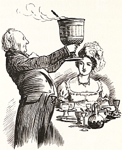
This is a special walk, which looks at the traditions of Christmas during the Regency period and how Jane Austen might have celebrated it. It will give some background to Jane Austen’s life and her knowledge of London. We used her novels and her letters to find out what she might have done at Christmas, but also at how Christmas was kept in this period, and the range of ‘Curiosities, Amusements, Exhibitions, Public Establishments, and Remarkable Objects in and near London available to enjoy.
This is a London Walks Guided Walk by Kevin Flude, Museum Curator and Lecturer.
Reviews: ‘Thanks, again, Kevin. These talks are magnificent!’
“1 am glad to see there are a few more virtual presentations scheduled, they are wonderful!
Dickens London. Life, Work and Christmas Virtual Tour Mon 16 Dec 24 7.30pm

A Virtual Tour of Dickens London with a dash of Dickensian Christmas
The Virtual Tour weaves an exploration of Victorian London with Dickens London Life and writing. On the tour we have a look at London at Christmas and the contribution Dickens made to it by his Christmas Books
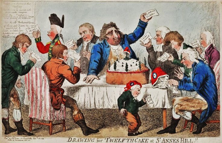
Dickens writing always has a moral element as exemplified by his Christmas Books. ‘Christmas Carol’ was based on redemption and his second great Christmas Book ‘The Chimes’ on the renewal that the New Year encouraged.
We start in Southwark, visit sites associated with the Christmas Books and others and end at Staple Inn with the Christmas Book ‘The Haunted Man’.
The London Winter Solstice Virtual Tour Sat 7:30pm 21 Dec 24

We explore London’s History through its celebrations, festivals, calendars, and almanacs of the Winter Solstice
Winter Solstice festivals have been a time of review, renewal and anticipation of the future from time immemorial. The Ancient Britons saw the Solstice as a symbol of a promise of renewal as the world entered bleak mid winter. The Roman season was presided over by Janus, a two headed God who looked both backwards and forwards, and Dickens based his second great Christmas Book on the renewal that the New Year encouraged.
We look at London’s past to see where and how the Solstice might be celebrated. We also explore the different Calendars – the Pagan year, the Christian year, the Roman year, the Jewish year, the Financial year, the Academic year and we reveal how these began. We look at folk traditions, Medieval Christmas Festivals, Boy Bishops, Distaff Sunday and Plough Monday, and other London winter traditions and folklore.
At the end we use ancient methods to divine what is in store for us in 2023.