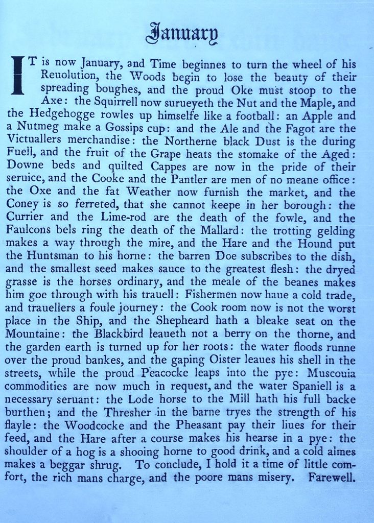
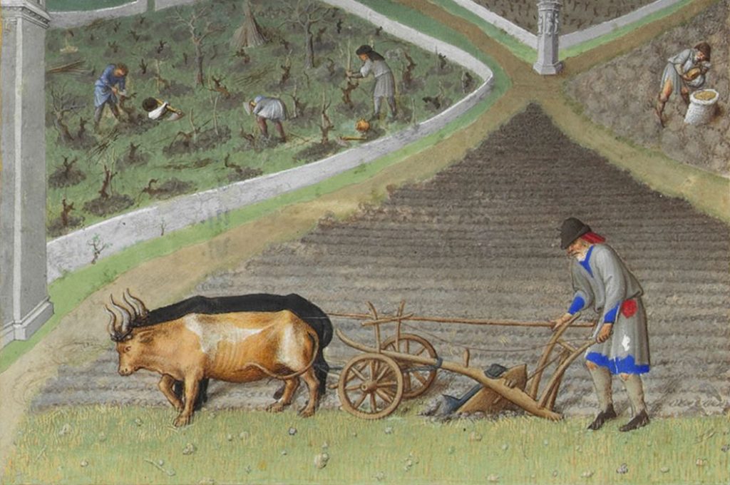
January from Nicholas Breton’s ‘Fantasticks 1626 from the Kalendar of Shepherds (digitised by Internet Archive)
The Kalendar of Shepherds was printed in 1493 in Paris and provided ‘Devices for the 12 Months.’ I use a modern (1908) reconstruction of it using wood cuts from the original French and adding various text from English 16th and 17th Century sources. The text of the month (as shown above) is provided from a 17th Century source. It gives an interesting view of the countryside in January. To see the full Kalendar, look here:
Nicholas Breton, the writer of the text above, concludes that January:
‘is a time of little comfort, the rich man’s charge, and the poore man’s misery.’
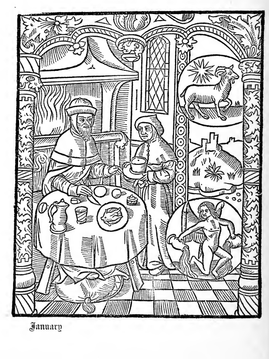
The rich man is burdened by having to help out all the poor people who depending upon him to get through the shortages of winter. The image for January shows that January is best spent indoors by a roaring fire, eating pies.
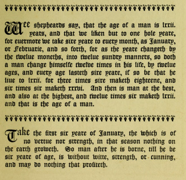
The Kalendar introduces a ‘conceit’ which is that the year mirrors our lives, and we can forecast what will happen in our lives by looking at the months.
Kalendar of Shepherds, January text
So our lives, which are of 72 years, can be divided into 12 ages of man, each of 6 years. So, January represents the first 6 years of a person’s life. And as you can see, that during these first 6 years, the child is ‘without witte, strength, or cunning, and may do nothing that profiteth‘. As the year changes every month, so, ‘a man change himself twelve times in his life’. At three times 6 (18 or March) a child becomes a man, and 6 times 6 (36 or June) man is at his best and highest. And at 12 times 6 (72 or December) man is at the end of his allotted span.
Shakespeare numbered the Ages of Man as seven, in the great speech of Jacques in ‘As You Like it’ I dealt with this and other Ages of the World in my post:
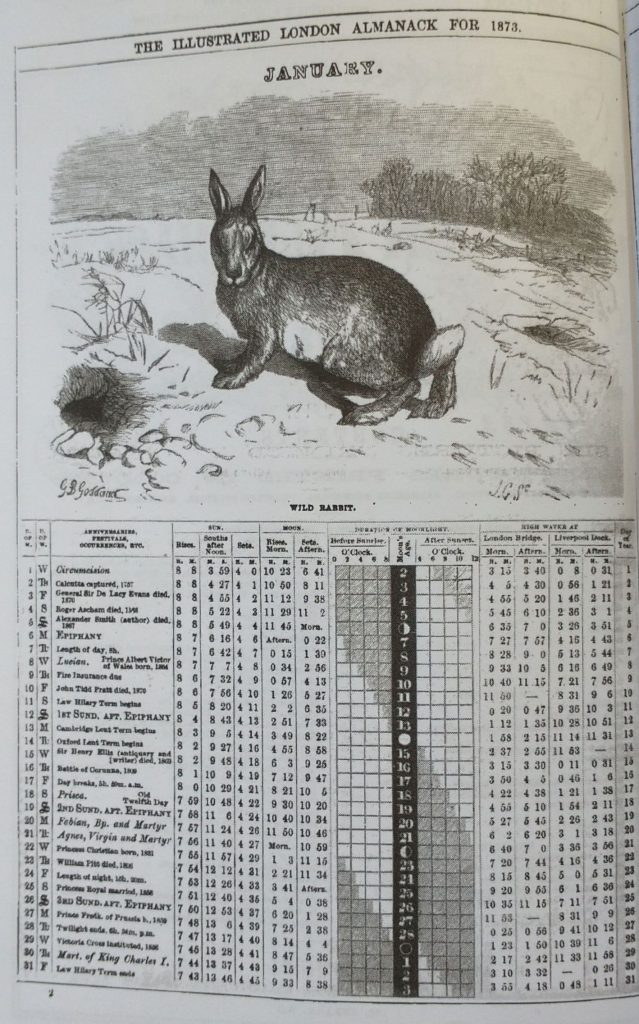
Bereton tells us that, in January, the ‘coney is so ferreted that she cannot keep in her borough’. To put that is modern speech, ‘the rabbit is so hunted with the aid of ferrets that she cannot keep in her burrow’. The London Illustrated Almanac of 1873 chose the Rabbit as its wild animal of the month.
January from London Illustrated Almanac of 1873
To have luck for a month, you are supposed to say ‘Rabbit, Rabbit’. No less a person than FD Roosevelt used to say this. No one knows why. Rabbit’s feet are lucky too. I remember some of my friends had them in our Surrey village in the early 60s. Some of Dad’s nieghbours kept ferrets, and I remember dead Rabbits hanging from walls. The history.com website gives an idea, possibly exaggerated view, of the merits of the feet which depended upon how they were collected:
“A 1908 British account reports rabbits’ feet imported from America being advertised as ‘the left hind foot of a rabbit killed in a country churchyard at midnight, during the dark of the moon, on Friday the 13th of the month, by a cross-eyed, left-handed, red-headed bow-legged Negro riding a white horse,’
As to why, no one really knows. But Pliny the Elder in 71AD reported that cutting off the foot of a live hare could cure gout. There are European traditions of rabbit and other animal’s feet amulets curing all sorts of ailments. There are associations with witches, who could shape-shift into a rabbit. So a rabbit’s foot would be witchy and therefore powerful. In March, I reported on the Hare, and their, similar, associations with witches:
For lovers of Music, Chas and Dave’s hit song ‘Rabbit’ has a chorus of ‘Rabbit, Rabbit’.According to the Cockney’s singers (they do love a Knee’s Up) it comes from the Cockney Rhyming Slang expression: Rabbit and Pork. This means ‘Talk’ because it rhymes with ‘Talk’. To hear the song, its gestation and Royal connections, click here.
Now, I must stop rabbiting on. Time to get things done.
First, published in 2023, revised in January 2024, 2025
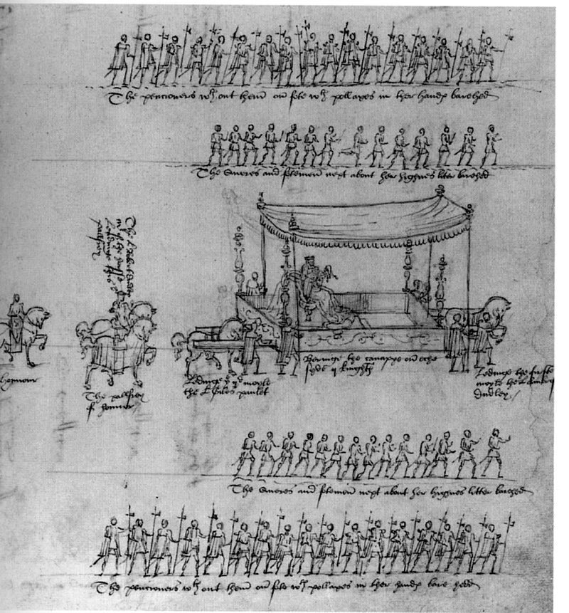
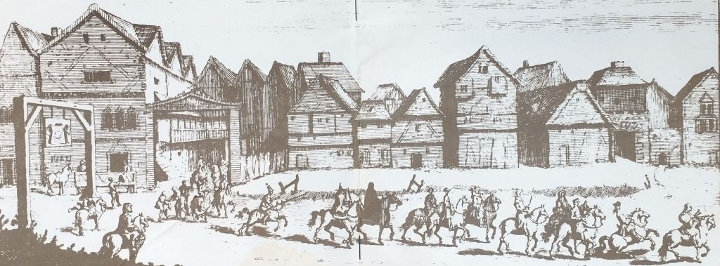
Queen Elizabeth 1 Coronation. Litter at her royal entry, accompanied by footmen and Gentlemen Pensioners. Unidentified engraver. (Wikipedia)
Queen Elizabeth 1 Accession
Queen Elizabeth 1 ascended the throne on 17 Nov 1558. Her accession was greeted with an outbreak of joy by the Protestant population. But the supporters of her dead sister Mary 1 did not want a Protestant monarch. On hearing the news of the death, Elizabeth rushed to occupy the Tower of London. She even risked shooting London Bridge, such was her haste. (see my post of the accession of Queen Elizabeth I)
She consulted lawyers about the legal position. Elizabeth, and her sister Mary, were declared bastards by two Succession Acts passed during Henry VIII’s ‘troubled’ married life. The Third Succession Act of 1543/44, following Henry’s marriage to Katherine Parr, restored Mary and Elizabeth to the Royal line. But it did not restore their legitimacy. Rather than tackle the complex legislation, Sir Nicholas Bacon, the Lord Keeper of the Great Seal, advised:
“the English laws have long since pronounced, that the Crown once worn quite taketh away all Defects whatsoever“. (Wikipedia)
Which, when you think about it, basically legitimises any successful ‘coup’! And, from a legal perspective, she was still, arguably, illegitimate.
Queen Elizabeth 1 Coronation
Her courtiers immediately began work on the Coronation, scheduled for January 15th 1559. In terms of Coronations, this was rushed. The precise date was, in fact, chosen by the Royal Astrologer. John Dee, a famous mathematician and credulous astrologer, found a date that the celestial bodies deemed propitious. But it needed to be sooner rather than later because Elizabeth’s position was so insecure.
Queen Elizabeth 1 Coronation Procession
The Coronation began with a procession from the Whitehall Palace in Westminster. Then back to the Tower of London for the Vigil. Followed by a Royal Procession through the City of London to Westminster Abbey for the Coronation service. After the Coronation, there was the traditional Coronation Banquet at Westminster Hall.
The Vigil Procession was on the Thames where she was escorted to the Tower by ‘ships, galleys, brigantines‘ sumptuously decorated. The Royal Entry consisted of 5 Pageants and 11 Triumphal Arches.
The first pageant showed the Queen’s descent from Henry VII and his marriage to Elizabeth of York. This marriage effectively ended the Wars of the Roses by linking the House of York and the House of Lancaster. The pageant also emphasised her ‘Englishness’ as opposed to the Spanish affiliations of Mary. The second pageant demonstrated that the Queen would rule by the four virtues of True Religion, Love of Subjects, Wisdom and Justice. At the same time she was shown trampling on Superstition, Ignorance and other vices.
The Procession at Cheapside
The third pageant, at the upper end of Cheapside near the Guildhall, provided the opportunity for the City to give Elizabeth a handsome present. This was a crimson purse with 1000 marks of gold, showing the closeness of the City and the Crown. The fourth pageant, contrasted a decaying country during the time of Mary with a thriving one under Elizabeth. It featured the figure of Truth, who was carrying a Bible written in English and entitled ‘the Word of Truth’. The Bible was lowered on a silken thread to the Queen. The Queen kissed it and laid it on her breast to the cheers of the crowd. She promised to read it diligently. The final pageant was Elizabeth portrayed as Deborah, the Old Testament prophet. Deborah rescued Israel and ruled for 40 years. So she was an ideal role model for Elizabeth. (For more details, look here.)
‘All the houses in Cheapside were dressed with banners and streamers, and the richest carpets, stuffs and cloth of gold tapestried the streets’.
British History.ac.uk Vol 1 pp315 -332
Queen Elizabeth 1 Coronation in Westminster Abbey
The Coronation was traditional – in Latin and presided by a Catholic Bishop, but there were significant innovations. Important passages were read both in Latin and in English. The Queen added to the Coronation Oath the promise that she would rule according to the:
‘true profession of the Gospel established in this Kingdom.’
This showed the path Queen Elizabeth was going to take. She would introduce innovation gradually into tradition, but emphasizing that the fundamentals had indeed changed. This was going to be a Protestant reign.
Can I remind you that I wrote a best-selling book on the Kings and Queens of Britain? It has sold over 130,000 copies, has been reprinted several times and in several editions and is available here.
Two posts today because it is also Plough Monday., the date to go back to work.
Bob Cratchet was back to work by Boxing Day. Some of us are back to work on 27th or 28th December. But increasing numbers holiday until the first weekend in January. It’s beginning to look medieval. Medieval society had even longer off. Distaff day was the day that women traditionally went back to work and Plough Monday was the men’s turn. Plough Monday was not just a normal day of work though. Particularly in the North, it was celebrated with a procession of ‘plough boys’. They used a decorated plough and team, known as ‘Fool Plough’. Mumming, sword dancing and foolery propelled people back to work.
Here is a lovely recipe for a ‘Norfolk Plough Pudding‘ brought to my attention by Sue Walker. The author is Karen Burn Jones who talks about her Grandmother’s plough pudding recipe. This is a great winter warmer being made of sausage meat and bacon. Norfolk also had traditions for Plough Monday. It was the day when the plough was blessed and the plough boys (Plough Jacks, Plough Bullocks or Plough Stots) performed “Molly Dances” . They did this partly to make up their income they had lost when the ground was too icy to plough.
The Christmas/Mid Winter break went on for some until Candlemas in early February. In Jane Austen’s day the school boys had a 6 week holiday at Christmas. This much distressed Mary Musgrove in ‘Persuasion’, Chapter 18. She complains bitterly of children being left with her during the long winter holiday. But as the letter was written on 1st February, I will leave the joy of that great FOMO letter until then.
The Wolf Moon and Mars
Not only is this Plough Monday but it is the first full moon of the year. At 5,27pm on January 13th the Wolf Moon rises and just below it to the left, at 7.30 UTC you will see the Red Planet Mars.
Wolf Moon is a nickname and a recent introduction to mainstream culture. It was borrowed from Native Americans as wolves howl at the moon at this time of the year. So can the wonder of the moon counter the reality of wintery bleakness following the joys of Christmas and the hopes of the New Year?
Full moon Socialising
In Jane Austen’s time, winter socialising depended upon the moon. Generally, people would schedule balls and dinner parties on nights when the moon was bright. This would make the journey, on days before street lighting, safer. This is one reason why Almanacs were so ubiquitous, as they listed the rising and setting of the Moon.
Page from 2022’s Old Moore’s Almanac showing the ‘Moon in London’
First Published 2023, revised 2024 and Wolf Moon added in 2025
My true love sent to me 6 Geese a Laying; 5 Golden Rings; 4 Calling Birds; 3 French Hens; 2 Turtle Doves and a Partridge in a Pear Tree
The Lord of Misrule, Masters of the Revels, and Boy Bishops
The Roman festival of Saturnalia, held between 17th and 23rd of December, included reversing rules so that slaves, ruled and masters served. In the medieval period, the disorder of Christmas was continued with the election of Lords of Misrule, Masters of the Revels, and Boy Bishops.
John Stow’s, Survey of London
He was London’s first great historian, wrote of the Lord of Misrule in London. In this section, Stow begins the role of the Lords of Misrule at Halloween and continues it until Candlemas, in erly February. See my post here for more details on Candlemas. This is what Stow says:
Now for sports and pastimes yearly used.
First, in the feast of Christmas, there was in the king’s house, wheresoever he was lodged, a lord of misrule, or master of merry disports, and the like had ye in the house of every nobleman of honour or good worship, were he spiritual or temporal. Amongst the which the mayor of London, and either of the sheriffs, had their several lords of misrule, ever contending, without quarrel or offence, who should make the rarest pastimes to delight the beholders.
These lords beginning their rule on Alhollon eve, continued the same till the morrow after the Feast of the Purification, commonly called Candlemas day. In all which space there were fine and subtle disguisings, masks, and mummeries, with playing at cards for counters, nails, and points, in every house, more for pastime than for gain.
Against the feast of Christmas every man’s house, as also the parish churches, were decked with holm, ivy, bays, and whatsoever the season of the year afforded to be green. The conduits and standards in the streets were likewise garnished; (…) , at the Leaden hall in Cornhill, a standard of tree being set up in midst of the pavement, fast in the ground, nailed full of holm and ivy, for disport of Christmas to the people…
Holm is an evergreen oak called Quercus ilex. John Stow talks about the Tree in Leadenhall Street being destroyed in the great wind of 1444 which you can read about here. You might also like to see the following posts, which include information about John Stow and London’s customs, and churches.
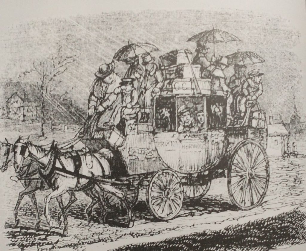
As the Sun enters the House of Capricorn remember the poor Coachman travelling all day everyday in all weathers. Washington Irving in his ‘Old Christmas’ (Originally ‘The Sketch Book of Geoffrey Crayon’ pub. 1819) describes him with a broad red face, a broad body widened by drinking beer; swathed with any numbers of layers of coats trying to keep the cold out. He has many worries on his mind as he has a coach full not only of people who need looking after but also a lot of parcels and commissions that need to be carried out in the many stops along the way. He is delivering parcels, turkeys, geese, presents, children, you name it he is responsible for its safe delivery.
Feel sorry for the people crowded inside the carriage but even sorrier for those sitting on the roof. They have umbrellas in a vain attempt to keep dry, but the umbrella tines will be poking you in your ear, and the run off from the canopy of the umbrella might trickle down your neck. There might be 6 people inside and up to 10 on the roof. 3d for travelling inside and half of that for the roof. voach
Inside, you are next to a large man who is not very salubrious looking, nor too worried about pressing his thighs against you.
John Keats blamed his consumption on his journey on the roof of a stage-coach travelling from London to Hampstead on a cold wet day in February.
Stage coaches became regular sights on the road during the 17th Century and were quite dangerous as the roads were in such a poor condition. It was suggested that passengers made their wills before travelling! From the late 17th and with Parliament increasingly used to set up not-for-profit toll road, the roads got better, and ‘Flyers’ and mail coaches could get up to the tremendous speed of 10 miles an hour, and averaging 7. This happened because improved roads meant improved suspensions, and wheels, and more and faster horses could be harnessed.
This revolutionized travel. It used to take 5 days in around 1700 to get to Manchester from London, by the mid 18th Century the time taken was reduced to 24 hours, and there were many more scheduled coaches, The mail coaches had priority, the coach had a blunderbuss and two pistols to deter highway men, and the guard had a post-horn with which to warn other vehicles to give clear passage, to alert tollgate keepers to open gates, and to announce arrival at a stop. Extra horses would be harnessed to help get up steep hills which, in some cases, like Broadway in the Cotswolds, might mean an additional 10 horses. Passengers might be asked not only to get off the coach to lighten the load but also to push if the going got boggy. On mail coaches, the passengers were not allowed to get off when the horses were changed, and only 4 were allowed inside the coach.
London was ringed by Coaching Inns, which were coach terminals and hotels. The most famous ones, remaining, are in Southwark on the approach road to London Bridge. The Tabard where the Chaucer’s Canterbury Tales started, The White Hart where Dickens’ Sam Wheeler is the Bootboy, and the George, which although not quite so literary is at least still half intact.
Pilgrims leaving the Tabard Inn for the Canterbury PilgrimageGeorge Inn,Southwark (photo Kevin Flude)
Capricorn
‘The man born under Capricorn shall be iracundious and a fornicator; a liar, and always labouring.
....The woman shall be honest and fearful, and have children of three men, she will do many pilgrimages in her youth and after have great wit.’
From Kalendar of Shepheards 1604 quoted in ‘The Perpetual Almanac of Folklore by Charles Kightly’.
iracundious is first mentioned in a work published by Caxton in the 15th Century and pretty much obselete by the 17th Century. It means easily angered or irritable.
This post failed to publish on the 7th November, so here it is:
As we are between Halloween, and Halloween Old Style the chances of bewitchment are high what with all those spirits being out and about on this – the most uncanny of all times. So, you might want to look at ‘Doctor Lilly’s Last Legacy’ of 1683 which gives a cure for those who have been bewitched at Halloween.
Take two horseshoes, beat them red-hot and nail one on the threshold of the door, but Quench the other in the Urine of the party bewitched: then set the urine over the fire in a pot or Pipkin and put the horseshoe into it. Make the urine boil with a little salt put onto it, and three horseshoe nails until it is almost all consumed: what is not boiled away cast into the fire. Keep then your horseshoes and nails in a clean paper or cloth and use the same manner three times. It will be the more effectual if is done at the change or full of the Moon.
Doctor Lilly’s Last Legacy, Online at the Wellcome Collection, although you will need a login to view it. I found it first in my favourite source, Perpetual Almanac of the Year by Charles Kightly.
Doctor Lilly’s Last legacy ‘Being the poor man’s physician, the sick man’s friend, and the country-man’s doctor’.
Items like this make me wonder about the gullibility of the human being, but I guess we are surrounded by examples of the lack of sense of a large proportion of our species. Perhaps I should rephrase this, I think most people make sensible decisions about their day-to-day life, but many do not have the critical thinking skills to evaluate the bigger issues.
For more on keeping witches away, witches’ marks etc. have a look at this post of mine.
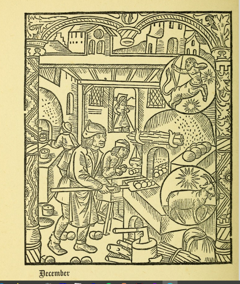
I am finishing my post on September, and using the Kalendar of Shepherds. As you may have noticed, I often use the Kalendar of Shepherds to provide an insight into how the seasons were seen in the past. Mostly, I use it for the posts at the beginning of each month. I have created this page as a placeholder to put information on the Kalendar for anyone who is eager to explore it more or to make use of it. Each month I will link to it, so I do not have to repeat the basic information about the Kalendar. Much of this text was contained in the December post, and I have used this month as my example. Tomorrow, you will get the September version.
About the Kalendar of Shepherds.
The Kalendar was printed in 1493 in Paris and provided ‘Devices for the 12 Months.’ The version I’m using is a modern (1908) reconstruction of it. It uses wood cuts from the original 15th Century version and adds various texts from 16th and 17th Century sources. (Couplets by Tusser ‘Five Hundred Parts of Good Husbandrie 1599. Text descriptions of the month from Nicholas Breton’s ‘Fantasticks of 1626.) This provides an interesting view of what was going on in the countryside every month.
The Kalendar of Shepherds has an illustration for each month (December above) which shows typical activities for the time of year, and has inserts to identify the astrological signs of the month. So, in December they are baking and collecting firewood. The star signs are Sagittarius (November 22 – December 21) and Capricorn(December 22 – January 19).
The text below gives a vivid description of December weather and then elaborates on the last six years of a man’s life, with hair going white, body ‘crooked and feeble’. The conceit here is that there are twelve months of the year, and a man’s lot of ‘Six score years and ten’ is allocated six years to each month. So December is not just about the 12th months of the Year but also the last six years of a person’s allotted span. The piece allows the option of living beyond 72, ‘and if he lives any more, it is by his good guiding and dieting in his youth.’ Good advice, as we now know. But living to 100 is open to but few.
Kalendar of Shepherds
The longer description of December (shown below) is by Breton (1626) and gives a detailed look at the excesses of Christmas, who is on holiday, and who working particularly hard. But it concludes it is a costly month.
Philip Mould Galley,Bond Street.The home of painter Mary Beale
The painter Mary Beale was born on March 26th 1633 in Barrow.
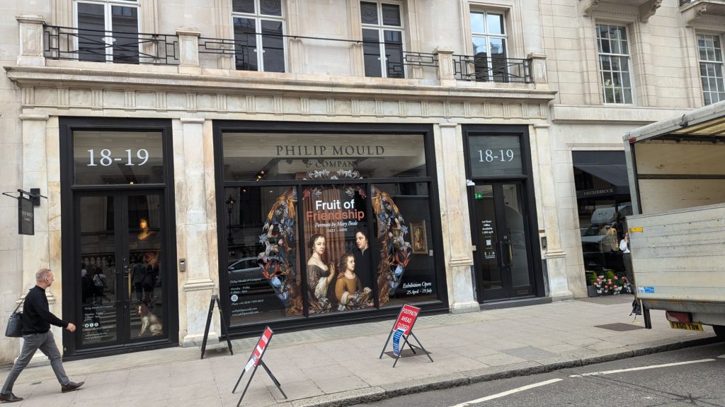
Last year, I was asked to do two Jane Austen’s London walks. The walk explores Mayfair, where her brother, Henry lived and had his Bank, and where Austen placed the central drama of Sense and Sensibility. I decided to use the time between the walks to look for a shopping mall which dates back to Jane Austen’s time, but I got diverted as I saw a sign for a free exhibition on Mary Beale in Pall Mall.
Mary Beale is that rare beast; a professional female artist of the 17th Century (1633-1699). So, I double-checked the ‘free entry’ notice because this was a posh West End private art gallery and the name Philip Mould was familiar. I went in and realised that this was something special. I returned to the entrance to ask the very friendly staff whether I could take photographs. ‘Yes, of course, they said.’ much to my surprise.
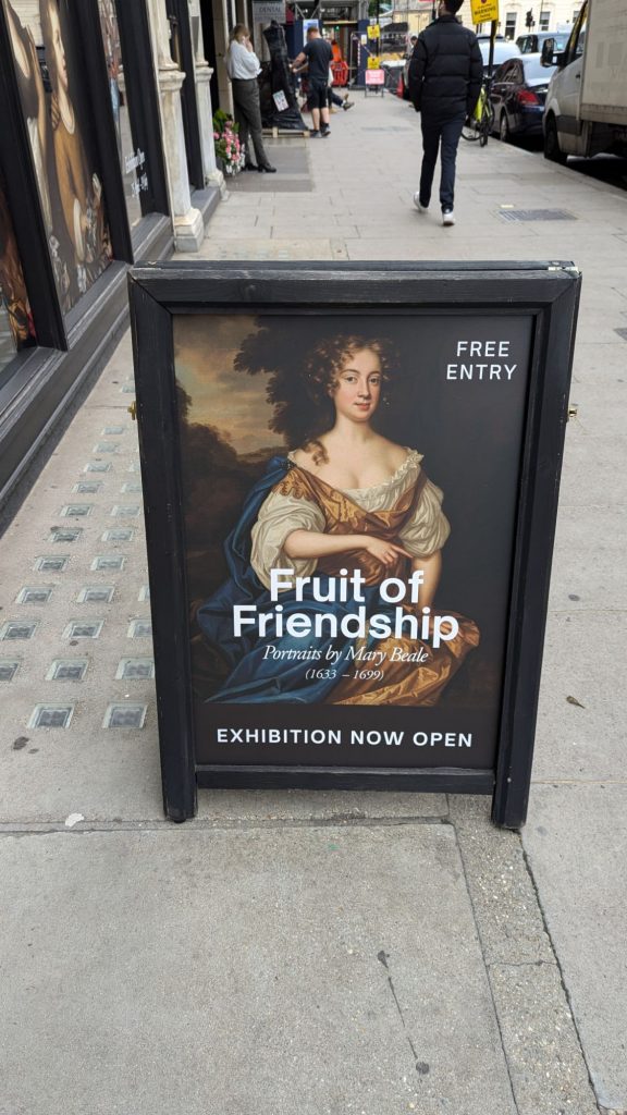
Mary Beale Exhibition sign.
Downstairs, the art of Mary Beale was beautifully displayed, and the exhibition had a very interesting story to tell, which was well-told, using excellent labels and a film narrated by Philip Mould. He was, as I thought, the co-presenter of ‘Fake or Fortune’ (with Fiona Bruce, newsreader and anchor of the BBC’s Antiques Roadshow). This is a BBC art programme which is in its 12th Series. The conceit of the show is that they investigate dubious paintings to find out whether they are genuine or not.
The film revealed that Philip Mould opened his Art Gallery here over a decade ago, but research has recently discovered that this is the very address where Mary Beale had her studio.
Scene shot of Philip Mould in the Mary Beale Exhibition in his short film shot in his Art Gallery.
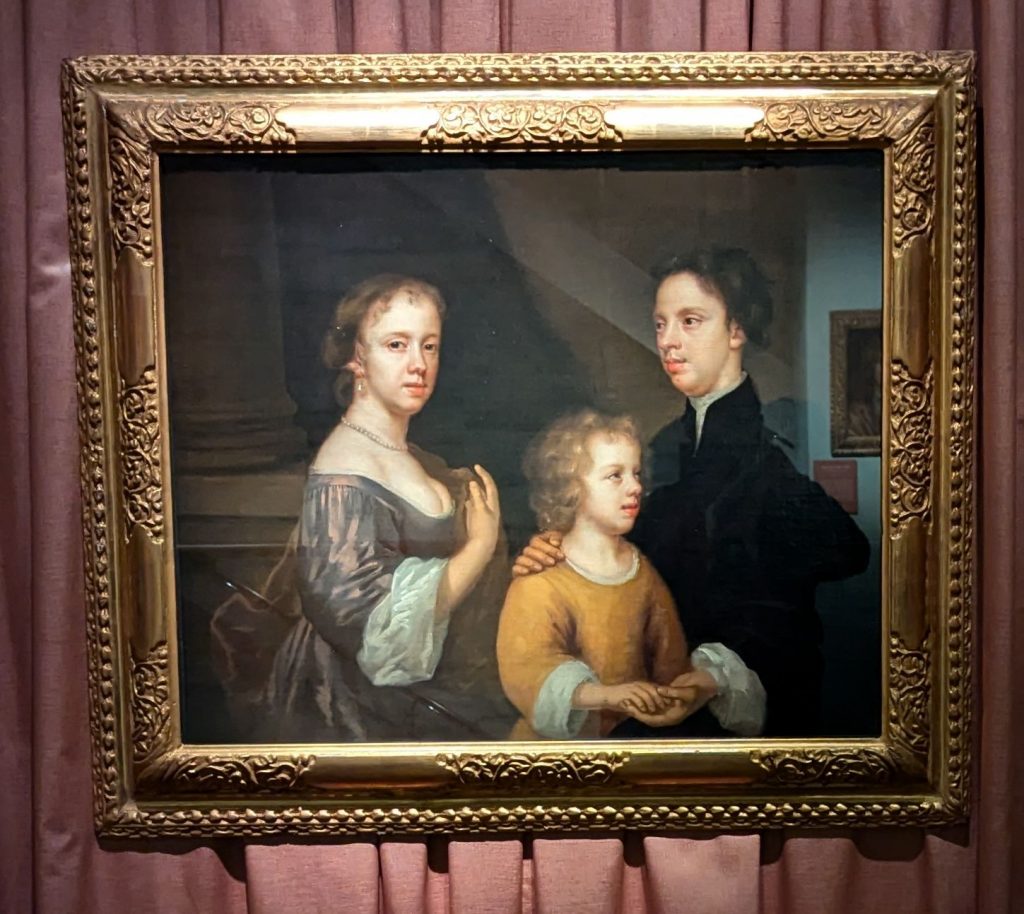
Her career is not only remarkable in itself, but it was recorded in great detail by her husband. She was the bread winner. He was her partner, and in effect the studio manager. In correspondence, he describes her as his ‘dearest heart’.
Self-Portrait of Mary, with her husband and son
It was a family business and their children also worked as painting assistants, doing draperies and other background details. Her paintings gave them an income of around £200 a year, which is not riches but, by comparison, a labourer got about £30 a year.
She was associated with Sir Peter Lely, the Court painter who succeeded Van Dyke. Mary Beale made copies of many of his paintings. She also painted many pictures of her family.
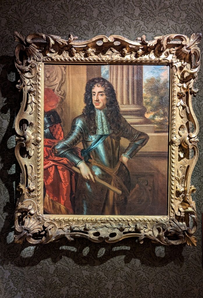
Mary Beale’s painting after Sir Peter Lely’s portrait of Charles II
There are several excellent short films about Mary Beale on the Gallery’s web site, which is well worth a visit. The exhibition ends on the 19th July, but there is also, for you to see, Tate Britain’s exhibition ‘Now you see us’ which is the story of British female artists from the 1520’s to 1920.
On continued this walk to the Royal Academy when I encountered the painting ‘Flaming June’ by Lord Leighton – I removed the content to its own page which you can see here
I have just come back from my very first Leap Year Walk, which I gave tonight for London Walks. It was one of a series of my walks, which are about the year through London’s History. So far, I have done, a New Year Walk, an Imbolc Walk (1 February, St Brigid’s Day), a Spring Equinox Walk, a May Day Walk, a Summer Solstice Walk, an Autumn Equinox Walk, a Halloween Walk, and a Winter Solstice Walk. All, at their core, have the subject of the year, how it is arranged, and celebrated in different cultures and different times in London.
I hoped to get this post done, today, but on arrival at home my burglar alarm was ringing, so had to get an emergency electrician out to pacify my neighbours, and tracking down the fault meant turning my house upside down. I rushed it out, with many bad proof reading errors and ommissions, And have now, on the dawn of a new month, and a new Season, updated it. Probably, knowing me, it still has a far few errors! Now, I am rushing to look after my Grandson!
So, the reason there is a leap year, is that the Sun and the Moon have different cycles, which cannot be easily aligned. And secondly, the solar year is not a fixed number, it is not 365 days, but 365 days and a bit.
Originally though, probably, most cultures lived their lives with time keeping controlled by time markers from their everyday environment, days and nights, the waning and waxing of the moon, the seasons, and the changes in the rising and setting of the Sun. Budding nature would have provided other markers as to when to sow, to harvest, to prune, to slaughter, to worship and marry.
The months were given by the cycle of the Moon, which also gave us tides and menstrual cycles. The months were given names, which were often associated with the weather. The trouble was that the Solar year did not align with the Moon, soon the months would get out of kilter with the seasons. So over time, the society would find it was winter in June, or summer in December. (which is OK if you live in Australia).
Society dealt with this in a number of ways. It could be ignored, why shouldn’t it be cold in June, why should June always be in Summer? Another way was to add in extra days, or months, every so often to make sure June remained in the Summer. This is what Egypt, the early Romans and the Celts did. They kept their months aligned to the actual movements of the Moon, and aligned their Solar Year with it by the addition of extra days or a month or two. or a combination of both.
I reported on this in my post on the Terminalia for February 23rd. As I wrote:
Terminus was an old ancient God who was the God of the boundary, the border, the edge, the liminal God. February was the last month of the original Roman year, but the rulers of Rome added an intercalary month every so often, called Mercedonius in an attempt to keep the Solar year in tune with the seasons. And when the intercalary month was added, the last five days of February were given to Mercedonius and the resulting leap year was either 377 or 378 days long.. So, in those years, the 23rd of February was the Terminus of the year. (For more on Terminalia look at my post for February 23rd on Terminalia-god-of-the-boundary)
Now, as the Roman Republic became more sophisticated, the intercalary months were added at the direction of the Pontiffs, supposedly every two and sometimes every three years. But the Pontiffs were often swayed by political advantage, and by the time of Julius Caesar the seasons had got wildly out of sync with the calendar year. The Dictator, therefore, instituted ‘the Year of Confusion’ which was over 400 days long and brought in the Julian Calendar which realigned the calendar back in line with the seasons.
Caesar spent time with Egyptian Astronomers, trying to understand their solution to the problem. They identified that the year was not 365 days long but 356.25 days, so JC ‘fixed’the issue with a leap day every four years. Based on the almost correct calculation of a solar year being 365.25 days. The new calendar was inaugurated on the Kalends of Januarius 709 AUC, or as we would call it I January 45 BC. It became, in time, something the Romans were very proud of – rationalising, measuring, time itself. Romans counted their dates from the time their City was founded by Romulus in what we call 753 BC or 753 BCE. So, 45 BCE in our reckoning is 709 ab urbe condita (AUC ‘from the founding of the City) as the Romans saw it.
I prefer not to use BCE because it seems ‘dishonest’ to me. The idea of AD BC was made up based on a guess as to when Jesus was born. Changing BC to BCE may rid the date of an explicit Christian identification but masks the fact that there is no such thing as the ‘Common Era. What the Common Era is, is the idea made up in the Late Roman period guessing when Jesus was born/ So I think call a spade a spade, even if it’s a broken meaningless spade that is not fit for purpose, either replace it with something rational, or real or call it what it is.
The interesting thing is that Caesar put the leap year in on the 24th February. Why? Because February, being the month of death, was the end of the year. March 25th was originally the beginning of the Roman year (Caesar moved it to January 1st). Why March 25th? Because it was the Spring Equinox. If you look at my post for March 25th you will find out it is the date of the creation of Humanity, the Birthday of Adam, the conception of Jesus, and until 1752, the day the year number changed in Britain.
The other strange thing about the new leap day was that it was not called February 25th. It was not given a number. Rather, February 24th was two days long. This continued in Britain until the date February 29th started appearing in calendars in the 15th Century, although the legendary Lawyer, Edward Coke (1552 – 1634), refers to the two days of February 24th, but the two day 24th was completely replaced by February 29th in the 16th Century.
One slight complication to the story of February 29th was that February 29th did exist before the Julian reforms. When February was not interrupted by the intercalary month, as described above, it was 29 days long. Julius Caesar made the months alternate 30 and 31 except for February which was 29 days long. When the Senate gave Julius the honour of having the 7th Month named after him, things were OK, but then Augustus wanted the same thing. The Senate duly gave him the next month, which became known as August, but it only had 30 days. This could not be allowed! So they made it up to 31 and stole the 29th from February and made February only 28 days long. This change also meant that there were now three 31 days months in a row, so they reduced September from 31 to 30, boosted October to 31, reduced November to 30 and boosted December to 31,
Hence, we can no longer remember Caesar rational allotment of days in the month, and we need to hum to ourselves:
Thirty days have September April, June, and November February has twenty-eight alone. All the rest have thirty-one. Excepting leap year – that’s the time When February’s days are twenty-nine.
But Caesar had not solved the problem of the shifting year, he had just minimised it. By the Council of Nicea in the early 4th Century (and not yet called AD!) the small error had changed the date of the Spring Equinox, from March 25th to March 21st. So, when Constantine convened the Council to bang the heads together of the Church leaders to unify their religion, particularly in regard to the date of Easter, and whether Jesus was equal to God. They fudged the complex issue of the date of Christ’s death, and used March 21st as the foundation of their calculation on the moon-based festival of Easter (more of which at Easter!)
It wasn’t until the 16th Century that Pope Gregory, solved the problem of the inaccuracy of Caesar’s solution, by introducting the Gregorian Calendar, for which see my post here.
Coltsfoot is a daisy-like plant which is flowering about now. Gerard’s Herbal of 1633 suggests that the ‘fumes of the dried leaves taken through a funnel’ is good for those with coughs and shortness of breath. He suggests that it is smoked like tobacco and it ‘mightly prevaileth.’
This idea, Mrs Grieves says in her herbal (1931), is endorsed by ‘Dioscorides, Galen, Pliny, and Boyle’. And Coltsfoot is ‘nature’s best herb for the lungs’. (This is historic information re herbs and NOT current medical advice, as Coltsfoot can be very dangerous!).
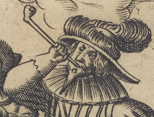
Detail from Lobspruch deß edlen hochberühmten Krauts Petum oder Taback Nuremberg, 1658 New York Public Library Public Domain
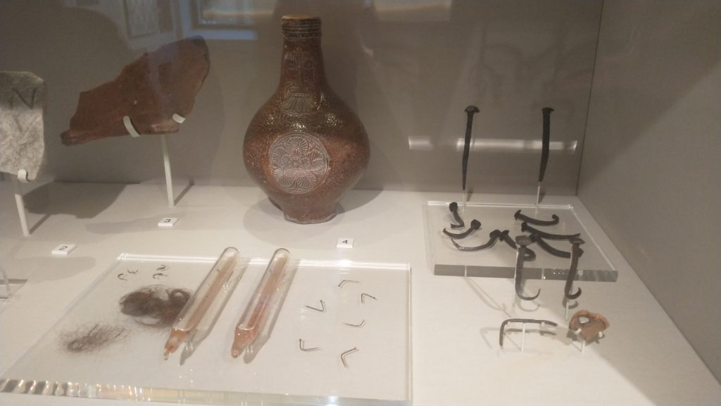
My grandson and parents found a 19th Century pipe bowl, much like the one above, by the Thames where there were many fragments of clay pipe. For more on 17th Century smoking, have a look here.
Blossom is also coming out in London a little early. (2022 we had a false spring when Cherry Blossom came out, and I think we are now just getting used to it, so I don’t think it is being noted so much in 2024). Blackthorn (I think) is coming out in profusion in my local park. Photos below by the Author of Haggerston Park in East London. Left February 2022, Right Feb 23.
One thing I am trying to improve in my Almanac of the Past, is to include more specific London content. This can be difficult on a daily basis. But I think I have, by chance, found a solution. I was trying to glue the toe flap on a perfectly good pair of trainers so that it did not flap, and I needed a heavy weight to press the two edges together. I found a random couple of heavy books for the purpose. 24 hours later, I lifted the books to discover the failure of my project. But, as I returned the books to their place in the book case, I found the heaviest was called ‘A London Year. 365 Days of City Life in Diaries, Journals, and Letters.’ Compiled by Travis Elborough and Nick Bennison, published in 2013, and the price on it of £5.99 makes me feel I must have bought it second hand. Have I opened it before now? Indeed, I had forgotten its existence, but Cometh the Hour, Cometh the Book! What a timely rediscovery.
Cholera in London. The news of the Cholera being in London has been received abroad. According to the feelings of the different nations towards England, France, who wish to court us has ordered a quarantine in her ports of three days; Holland, who feels aggrieved by our conduct at the conference, one of 40 days. The fog so thick in London that the illuminations for the Queen’s Birthday were not visible.
24th February 1832 Thomas Raikes, Diary 1832 (from ‘A London Year’ Compiled by Travis Elborough and Nick Bennison, 2013,
I think the Conference mentioned above was the London Conference of May 1832, which aimed to establish a Kingdom of Greece with a King, It was set up by Foreign Secretary Lord Palmerston without discussion with the Greeks and ended up giving them a Bavarian King. King Otto. Otto was forced from the throne in a revolution in 1862, and replaced by a Danish King, from whom Prince Philip, Duke of Edinburgh was descended.