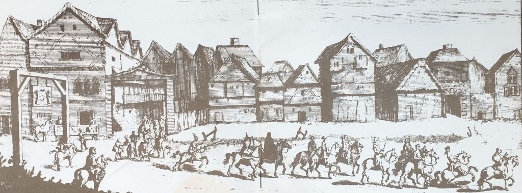
January 30th is the anniversary execution of King Charles I. Today, he was beheaded as a murderer and traitor. Or as a Royalist would see it, it is the anniversary of the Martyrdom of Charles I.
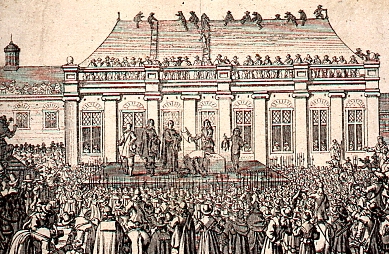
Thousands came to see the execution, amongst them Samuel Pepys. They crowded around the scaffold outside a window of Inigo Jones’s magnificent Banqueting Hall, in Whitehall, London. Charles was brought to the Banqueting House and must have looked up at the magnificent Peter Paul Reubens’ ceiling. Charles had ordered it the depiction of the Apotheosis of his father, James I. It was the symbol of the Divine Right of the King to rule. I
I doubt he saw the irony. It is more likely he thought on going to heaven in glory as a Martyr to his religion. He walked outside, through the window, into the cold January air. Two of his bloodstained shirts still exist probably to stop him shivering. He would want to to be seen as going fearless to his death not shivering with fear. Then, he made a short speech exonerating himself. He spoke without stammering for the first time in his public life. All the Rooftops around were lined with spectators. Black cloth framed the scaffold. As the executioner axe fell, there was a dull grown from the crowd (most could not see the axe falling).
This was on January 30th, 1648. But, if you look at a history book, it will tell you it was in 1649. This was before our conversation to the Gregorian calendar. Then the year number changed not as we do on January 1st but on March 25th. This was the day the Archangel Gabriel revealed to the Virgin Mary that she was pregnant. For more on the importance of March 25th look at my Almanac entry here:
On the same day, twelve years later, in 1660 Oliver Cromwell and his chief henchmen were dug up from their splendid Westminster Abbey tombs. Their bodies were abused by official command. Cromwell’s head was stuck on the top of Westminster Hall. There it remained until it was blown off in the Great Fire of 1703 (or 1672, or 1684). It was picked up and taken to Cambridge, Sidney Sussex College, which Cromwell attended. It was buried somewhere which is said to be known only to the Head Porter. (According to someone who came on my Oliver Cromwell Walk at the weekend.) Whether it is his head or not is disputed. The ins and outs of that tale are told in detail here.
The Royalist, John Evelyn, said in his diary:
This day (oh the stupendous, and inscrutable Judgements of God) were the Carkasses of that arch-rebel Cromwel1, Bradshaw, the Judge who condemned his Majestie and Ireton, sonn in law to the usurper, dragged out of their superb Tombs (in Westminster among the Kings) to Tybourne, and hanged on the Gallows there from 9 in the morning till 6 at night, and then buried under that fatal and ignominious Monument in a deep pit. Thousands of people (who had seen them in all their pride and pompous insults) being spectators .
Samuel Pepys records by contrast:
…do trouble me that a man of so great courage as he was should have that dishonour, though otherwise he might deserve it enough…
Pepys served the Parliamentary side before the restoration of Charles II, when he adroitly, swapped over to the Royalist side.
Today, I am doing a Guided Walk and a Virtual Tour on Charles I and the Civil War. Look here for details.
On This Day
1969 Get Back to Where you Once Belonged – This is also the anniversary of the rooftop concert in Saville Row where the Beatles played ‘Get Back’.
YouTube Clip with scenes from the Roof Top Concert
First published in 2023, revised on January 29th 2024, and 2025
Sorry to send an additional post but coming up are a couple of fascinating Virtual Tours which I would like to remind you of!
Tonight is an exploration of early 19th Century London. It is based on the 1809 Picture of London Guide book. An original copy was given to me by someone grateful to have attended one of my lectures at the Old Operating Theatre Museum. It is a tour of what Jane Austen could have visited on her walks around London. There are Austen associations, but mainly we are looking at London in 1809.
Jane Austen’s ‘A Picture of London in 1809’ Virtual Walk Mon 7.30 27th Jan25 To book
Yesterday, I was asked to give a Cromwell’s London walk as a 75th Birthday present. I haven’t done one for at least 25 years. But I really enjoyed the research. So added a guided walk and a virtual tour to my programme. This is the first time I have done this VT and it is a cracking story.
The Civil War, Restoration and the Great Fire of London Virtual Tour 7:30pm Thurs 30th Jan25To book
Finally, April is the month we go on pilgrimages, as Chaucer said (in Old English). So, in addition to my Chaucer Walks, I have added a Virtual tour so we can go all the way to Canterbury.
Chaucer’s London To Canterbury Virtual Pilgrimage 7.30pm Friday 18th April 25 To book
I may add one or two more before the Sun comes back
Many plants can be used for hedges, but hawthorn is the most common. It can be planted as bare-root from Autumn to Spring, so January is as good a time as any. It can also be grown from the seeds from its red berries. But this takes 18 months to achieve. Interspersed along the hedge should be trees—either trees for timber, or crab-apples or pear-stocks. Trees were also useful as markers. Before modern surveys, property would be delineated by ancient trees. Hedges could be removed. Trees were more difficult to eradicate.
Hawthorn hedges are an oasis for insects, mammals and migrating birds (who eat the berries). It is a lovely plant for May. In fact, it is often called May, or the May Flower or May Tree and also whitethorn. The berries are called ‘haws’ hence hawthorn. For more on this, look at https://whisperingearth.co.uk.
Hawthorns & Folklore
Hawthorn produces white flowers in Spring. So, it is one of the great pagan fertility plants, its flowers forming the garlands on May Eve. One of the chemicals in the plant is the same as one given out in decay of flesh. It is, therefore, associated with death in folklore, and not to be brought into the house.
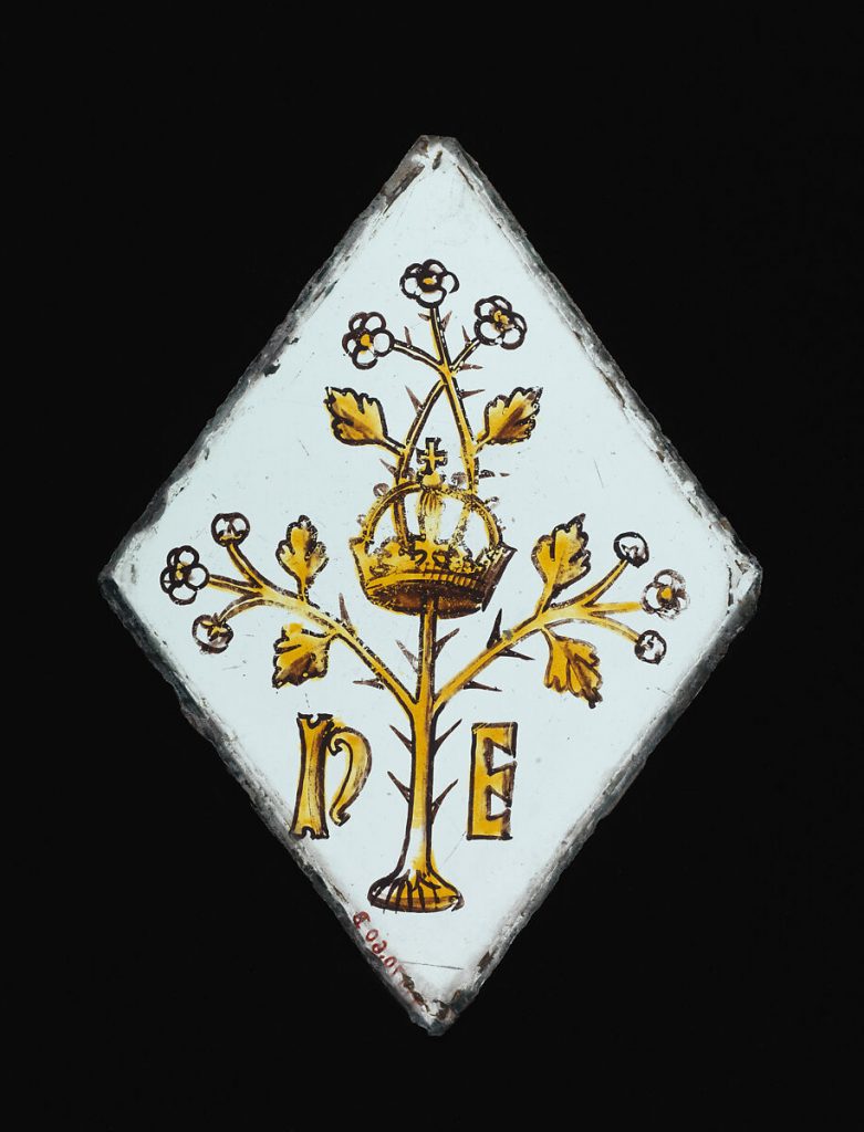
It was also said to be the thorn in the Crown of Thorns, so sacred. A crown from the helmet of the dead King Richard III was found on a hawthorn bush at the Battle of Bosworth Field. The victorious Henry VII adopted it for a symbol. . For more on the plant, https://www.woodlandtrust.org.uk
A ‘Quarry’ of Stained Glass showing the Crown, a hawthorn Bush and initials representing Henry VII and his, Queen, Elizabeth of York. Possibly from Surrey. Early 16th Century and from the Metropolitan Museum of Art (Public Domain).
The virtues of Hawthorn
John Worlidge, wrote in 1697
‘And first, the White-thorn is esteemed the best for fencing; it is raised either of Seeds or Plants; by Plants is the speediest way, but by Seeds where the place will admit of delay, is less charge, and as successful, though it require longer time, they being till the Spring come twelvemonth ere they spring out of the Earth; but when they have past two or three years, they flourish to admiration.’
Hawthorn is an excellent wood for burning, better than oak. It has the hottest fire so that its charcoal could melt pig-iron without the need of a blast. It is also good for making small objects such as boxes, combs, and tool-handles. It takes a fine polish, so also used for veneers and cabinets. For advice on the best wood to burn read my post.
Hawthorn has many medicinal benefits according to herbalists. Mrs Grieve’s Herbal suggests it was used as a cardiac tonic, to cure sore throats and as a diuretic. But don’t try any of these ancient remedies without medical advice!
What to plant in late January
This is the time, according to Moon Gardeners, to plant and sow plants that develop below ground. So rhubarb and garlic, fruit trees, bushes, bare-root plants and hedging plants.
First Published in January 2023, revised in January 2024
On This Day
1785 – ‘Boys play on the Plestor at marbles & peg-top. Thrushes sing in the Coppices. Thrushes & blackbirds are much reduced.’ From Gilbert White’s Garden Kalendar in Gilbert White’s Year. the Plestor is the village green. peg-top is a spinning top game. For more on Gilbert White, the inspirer of Darwin, see my post.
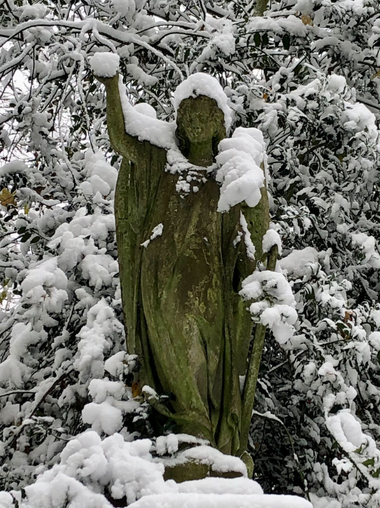
Winter at Abney Park Cemetery photo by Harriet Salisbury
Or so says the Shepherd’s Almanac for 1676. Until the 12th Night we were predicting that the weather on each of the 12 days will match the month of the same number. But having past Twelfth Night we have to find turn to other methods of weather lore.
Weather lore seems convinced of the undesirability of a warm January
‘January warm, the Lord have mercy’.
‘January commits the fault and May bears the blame.’
‘If Birds begin to Whistle in January, frosts to come’
‘When gnats swarm in January, the peasant become a beggar’
Most of the sayings about January quoted in Richard Inwards ‘Weather Lore’ first published in 1893, have this as their main focus. And the contrary (cold January good growing season) also generally holds:
‘When oak trees bend with snow in January, good crops may be expected.’
‘A cold January, a feverish February, a dusty March, a weeping April , and a windy May presage a good year and gay.’
The Weather according to Animals
So much for long range forecasts. Let’s see how Weather Lore helps us use animals to determine whether it will rain today.
‘If animals crowd together, rain will follow.’
‘When dogs eat grass it will be rainy‘
‘When a cat sneezes, it is a sign of rain‘
‘If young horses do rub their backs against the ground, if is a sign of great drops of rain to follow.’
The only weather lore repeated in my family was ‘Cows sitting down means it will rain.’ (And of course ‘red sky at night, shepherd’s delight’ etc).
Meteorology Office on weather lore.
A survey by the Met Office in 2017 found that a surprisingly large number of people (75%) use ‘folklore’ to predict weather and 55% think they are useful methods of predictions. Here is a quote from their post.
Red sky at night, shepherd’s delight – used by 70% of UK adults – CORRECT
It can be too cold to snow – used by 49% – PROBABLY NOT IN THE UK
Cows lie down when it is about to rain – used by 44% – NOT CORRECT
Pine cones open up when good weather is coming – used by 26% CORRECT
If it rains on St Swithin’s day, it will rain on each of the next 40 days – used by 22% Not Correct. In factt since records began in 1861, there has never been a record of 40 dry or 40 wet days following St Swithin’s Day
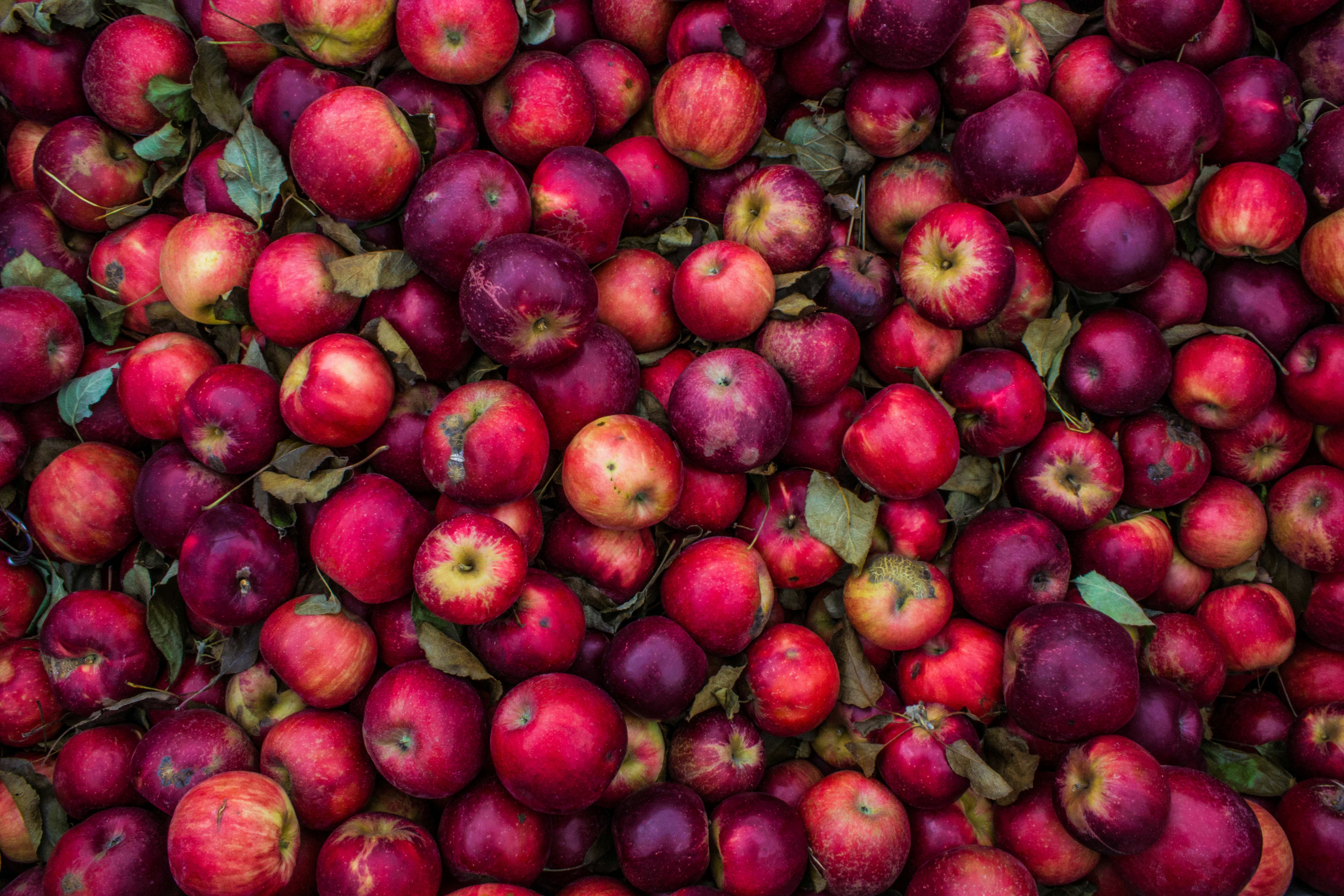
Gervase Markham was born in 1568, in Nottinghamshire, and was a prolific writer. Today, prompted by the Perpetual Almanac by Charles Kightly, I am looking through Markham’s eyes at Apples. Apples were an important source of joy as well as nutrition through a cold winter, as fresh produce became unavailable.
Markham wrote detailed books for use by the householders, the Husbands and the Housewives. And with the coming of frost, the survival of food in your food store might depend upon reading Markham’s books. When the frosts hit, as they are now doing in the UK, you had to look after your store of apples. They were an important sweet food source over the winter.
For the women, he wrote the English Housewife, published in 1615. Here is his recipe for Apple Tart.
For the Housewife How to Make Apple-tart
Take apples and peel them and slice them thin from the core into a pan with white wine, good store of sugar, cinnamon and rosewater, and so boil it all shall it be thick. Then cool it and strain it, and beat it very well together with a spoon, and then put it into your coffin or crust and bake it. It carrieth with the colour red.
Gervais Markham, the English Housewife 1683 version (quoted by Charles Kightly).
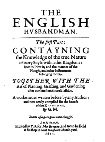
For the men, he wrote the English Husbandsman, published in 1613 and ‘Printed by T. S. for Iohn Browne, and are to be sould at his shop in Saint Dunstanes Church-yard.’ This is the St Dunstan’s in Fleet Street, I think (near Sweeney Todds, the Barbers.) The book is available on Project Gutenberg (Gervase Markham the English Husbandman. Project Gutenberg).
So to the frost – Markham ends his extensive piece on the best way to store apples as follows:
To keepe Fruit in frost. If the frost be very extreame, and you feare the indangering your fruit, it is good to couer them somewhat thicke with fine hay, or else to lay them couered all ouer either in Barley-chaffe, or dry Salte: as for the laying them in chests of Iuniper, or Cipresse, it is but a toy, and not worth the practise: if you hang Apples in nettes within the ayre of the fire it will kéepe them long, but they will be dry and withered, and will loose their best rellish.
I remember my Grandmother would store her excess apples from the tree, wrapped in paper and stored in cupboards in the pantry or outbuilding. They were often wrinkled but always delicious, and I think were Russets, which remain my favourite apple.
At the bottom of the piece, I include the rest of Markham’s advice for storing apples. To summarise it: Don’t store them near the ground. Place them on shelves ordered by variety based on which variety lasts longest. So at the back will be the long-lived species such as Russets and Pippins, to eat as spring approaches. The front the ones you need to eat now such as the ‘Costard, Pome-water, Quéene-Apple‘ varieties.
Marocco, Pocahontas and the Rhino – performing at the Bell Savage
Markham wrote many books, including one on the famous performing horse Marocco. He starred in shows at the Bell Savage, just outside Ludgate in the City of London. The horse would whinny in triumph with the naming of an English King. But snort with derision with the naming of a Pope. He could also count and add up. He was rumoured to have been burnt at the stake as a witch in Edinburgh. But this does not appear to be true. Also, appearing at the Bell Savage in the 17th Century was a Rhinoceros, other prodigies and Pocahontas.
How to Keep Apples extended version
For a more modern text on what to do with excess apples from your tree, have a look here. However, do read on to get an insight into life and the varieties of Apples that were eaten in the 17th Century.
The place where you shall lay your fruit must neither be too open, nor too close, yet rather close then open, it must by no meanes be low vpon the ground, nor in any place of moistnesse: for moisture bréedes fustinesse, and such naughty smells easily enter into the fruit, and taint the rellish thereof, yet if you haue no other place but some low cellar to lay your fruit in, then you shall raise shelues round about, the nearest not within two foote of the ground, and lay your Apples thereupon, hauing them first lyned, either with swéet Rye-straw, Wheate-straw, or dry ferne: as these vndermost roomes are not the best, so are the vppermost, if they be vnséeld, the worst of all other, because both the sunne, winde, and weather, peircing through the tiles, doth annoy and hurt the fruit: the best roome then is a well séeld chamber, whose windowes may be shut and made close at pleasure, euer obseruing with straw to defend the fruit from any moist stone wall, or dusty mudde wall, both which are dangerous annoyances.
The seperating of Fruit. Now for the seperating of your fruit, you shall lay those nearest hand, which are first to be spent, as those which will last but till Alhallontide, as the Cisling, Wibourne, and such like, by themselues: those which will last till Christmas, as the Costard, Pome-water, Quéene-Apple, and such like: those which will last till Candlemas, as the Pome-de-roy, Goose-Apple, and such like, and those which will last all the yéere, as the Pippin, Duzin, Russetting, Peare-maine, and such like, euery one in his seuerall place, & in such order that you may passe from bed to bed to clense or cast forth those which be rotten or putrefied at your pleasure, which with all diligence you must doe, because those which are tainted will soone poyson the other, and therefore it is necessary as soone as you sée any of them tainted, not onely to cull them out, but also to looke vpon all the rest, and deuide them into thrée parts, laying the soundest by themselues, those which are least tainted by themselues, and those which are most tainted by themselues, and so to vse them all to your best benefit.
Turning your Fruit
Now for the turning of your longest lasting fruit, you shall know that about the latter end of December is the best time to beginne, if you haue both got and kept them in such sort as is before sayd, and not mixt fruit of more earely ripening amongst them: the second time you shall turne them, shall be about the end of February, and so consequently once euery month, till Penticost, for as the yéere time increaseth in heate so fruit growes more apt to rot: after Whitsontide you shall turne them once euery fortnight, alwayes in your turning making your heapes thinner and thinner; but if the weather be frosty then stirre not your fruit at all, neither when the thaw is, for then the fruit being moist may by no meanes be touched: also in wet weather fruit will be a little dankish, so that then it must be forborne also, and therefore when any such moistnesse hapneth, it is good to open your windowes and let the ayre dry your fruit before it be turned: you may open your windowe any time of the yéere in open weather, as long as the sunne is vpon the skye, but not after, except in March onely, at what time the ayre and winde is so sharpe that it tainteth and riuelleth all sorts of fruits whatsoeuer.
Monday 1st January 2025 7.00 pm On this Virtual Walk we look at how London has celebrated the New Year over the past 2000 years.
The New Year has been a time of review, renewal, and anticipation of the future from time immemorial. The Ancient Britons saw the Solstice as a symbol of a promise of renewal as the Sun was reborn. As the weather turns to bleak mid winter, a festival or reflection and renewal cheers everyone up. This idea of renewal was followed by the Romans, and presided over by a two headed God called Janus who looked both backwards and forwards. Dickens Christmas Carol was based on redemption and his second great Christmas Book ‘The Chimes’ on the renewal that the New Year encouraged.
We look at London’s past to see where and how the New Year was celebrated. We also explore the different New Years we use and their associated Calendars – the Pagan year, the Christian year, the Roman year, the Jewish year, the Financial year, the Academic year and we reveal how these began. We look at folk traditions, Medieval Christmas Festivals, Boy Bishops, Distaff Sunday and Plough Monday, and other Winter Festival and New Year London traditions and folklore.
At the end, we use ancient methods to divine what is in store for us in 2023.
The virtual walk finds interesting and historic places in the City of London to link to our stories of Past New Year’s Days. We begin, virtually, at the Barbican Underground and continue to the Museum of London, the Roman Fort; Noble Street, Goldsmiths Hall, Foster Lane, St Pauls, Doctors Commons, St. Nicholas Colechurch and on towards the River Thames.
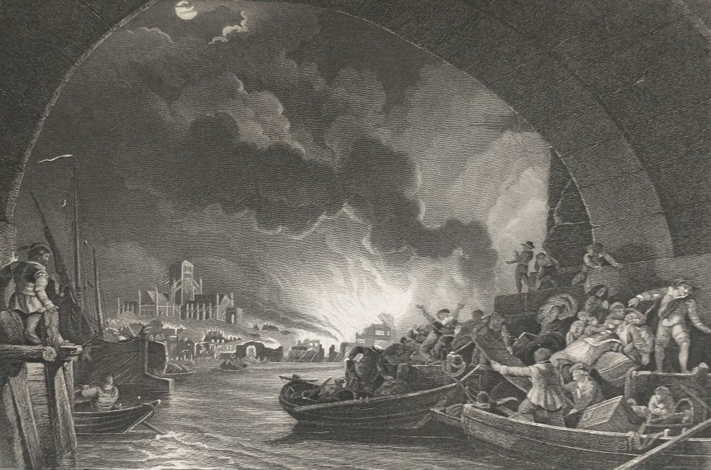
The Civil War, Restoration and the Great Fire of London Virtual Tour
The Great Fire of London looking towards StPauls Cathedral from an old print
7:30pm Fri 30th January 2025
January 30th is the Anniversary of the execution of Charles I and to commemorate it we explore the events and the aftermath of the Civil War in London.
Along with the Norman Conquest of 1066 and winning the World Cup in 1966 the Great Fire in 1666 are the only dates the British can remember!
And we remember the Great Fire because it destroyed one of the great medieval Cities in an epic conflagration that shocked the world.
But it wasn’t just the Great Fire that made the 17th Century an epic period in English History. There was a Civil War, beheading of the King, a Republic, a peaceful Restoration of the Monarch, the last great plague outbreak in the UK, the Glorious Revolution and the Great Wind.
The Virtual Walk puts the Great Fire in the context of the time – Civil War, anti-catholicism, plague, and the commercial development of London. The walk brings to life 17th Century London. It starts with the events that lead up to the Civil War concentrating on Westminster and ends with a vivid recreation of the drama of the Fire as experienced by eye-witnesses. Route includes: Westminster, Fish Street Hill, Pudding Lane, Monument, Royal Exchange, Guildhall, Cheapside, St Pauls, Amen Corner, Newgate Street, Smithfield.
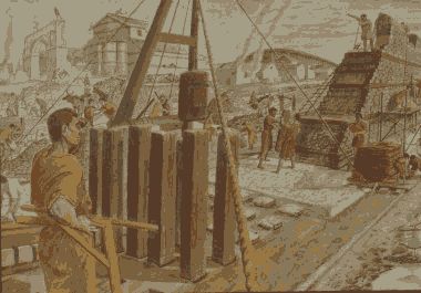
Roman London – Literary & Archaeology Walk
11.30 am Sun 9th Feb 2025 Monument Underground Station
also on 11.30am Sun 27th Apr 25 but starting from Moorgate
London Roman Riverside Wall o
This is a walking tour features the amazing archaeological discoveries of Roman London, and looks at life in the provincial Roman capital of Londinium.
This is a walking tour that features the amazing archaeological discoveries of Roman London, and looks at life in the provincial Roman capital of Londinium.
Our Guides will be Publius Ovidius Naso and Marcus Valerius Martialis who will be helped by Kevin Flude, former Museum of London Archaeologist, Museum Curator and Lecturer.
We disembark at the Roman Waterfront by the Roman Bridge, and then explore the lives of the citizens as we walk up to the site of the Roman Town Hall, and discuss Roman politics. We proceed through the streets of Roman London, with its vivid and cosmopolitan street life via the Temple of Mithras to finish with Bread and Circus at the Roman Amphitheatre.
Zinger Read: Talk about a high-quality one-two punch. This walk investigates the groundbreaking archaeological discoveries of Roman London. And then it reconstructs life in a provincial Roman capital using archaeological and literary sources. Discoveries – insights – like flashes of lightning in a cloud. We begin at the site of the Roman bridge. We might be decent young Roman citizens in togas, having this and that bit of explained to us as we make our way towards the Roman Town Hall. From there we head to the site of the excavation called ‘the Pompeii of the North.’ Followed by the Temple of Mithras. We finish with a walk along the Roman High Street in order to end at the site of the Roman Amphitheatre. So, yes, welcome to London as it was 2,000, 1,900, 1,800, 1,700 and 1,600 years ago. And, yes, the walk’s guided by a real expert, the distinguished emeritus Museum of London archaeologist Kevin Flude. That means you’ll see things other people don’t get to see, delve into London via fissures that aren’t visible, let alone accessible, to non-specialists.
REVIEWS “Kevin, I just wanted to drop you a quick email to thank you ever so much for your archaeological tours of London! I am so thrilled to have stumbled upon your tours! I look forward to them more than you can imagine! They’re the best 2 hours of my week! 🙂 Best, Sue
Jane Austen’s London Anniversary Guided Walk
2.30 pm Sunday 9th Feb 2025
Green Park underground station, Green Park exit, by the fountain To book
Also
9 February 2025
Sunday
2.30 pm
4.30 pm
8 March 2025
Saturday
2.30 pm
4.30 pm
6 April 2025
Sunday
11.30 am
1.30 pm
2025 is the 250th Anniversary of Jane Austen’s Birth in Steventon, Hampshire. We celebrate her fictional and real life visits to Mayfair, the centre of the London section of Sense & Sensibility and where Jane came to visit her brother
“It is a truth universally acknowledged, that a Jane Austen devotee in possession of the good fortune of a couple of free hours today must be in want of this walk.”
People associate Jane Austen and her characters with a rural setting. But London is central to both Jane Austen’s real life and her literary life. So, this tour will explore Jane’s connections with London and give the background to Sense and Sensibility, a good part of which is based in this very area. We begin with the place Jane’s coach would arrive from Hampshire, and then walk the streets haunted by Willougby; past shops visited by the Palmers, the Ferrars; visit the location of Jane Austen’s brother’s bank and see the publisher of Jane’s Books. The area around Old Bond Street was the home of the Regency elite and many buildings and a surprising number of the shops remain as they were in Jane Austen’s day.
Jane Austen’s ‘A Picture of London’ in 1809 Virtual Walk
With the help of a contemporary Guide Book, Jane Austen’s letters, and works we explore London in 1809.
‘The Picture of London for 1809 Being a CORRECT GUIDE to all the Curiosities, Amusements, Exhibitions, Public Establishments, and Remarkable Objects in and near London.’
This Guide Book to London might have been on Henry Austen’s shelf when his sister, Jane, came to visit him in London. But it enables us to tour the London that Jane Austen knew in some detail. We will look at the Curiosities as well as the shopping, residential, theatres areas as well as the Port, the Parks and the Palaces.
The guided walk is a thank you to Alix Gronau, who, having been to one of my lectures in 1994, wanted the book to come to me. I have had the book restored and am using it to explore London in 1809.
Jane Austen’s London Anniversary Walk
Jane Austen’s London Anniversary Walk 2.30 pm Sunday 9th February 25 To book
A Virtual Tour of Jane Austen’s Bath
7.30pm 10th February 2025
Tudor London – The City of Wolf Hall 11.30am Sat 22nd Feb 25
Myths, Legends, Archaeology and the Origins of London
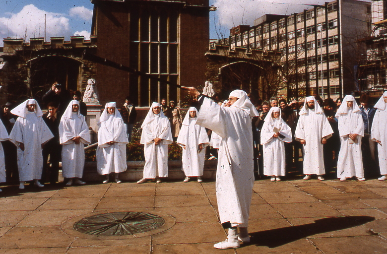
Druids at All Hallows, by the Tower
2.30pm Sat 22nd February 2025 Tower Hill Underground
The walk tells the stories of our changing ideas about the origins of London during the Prehistoric, Roman and Saxon periods.
The walk is led by Kevin Flude, a former archaeologist at the Museum of London, who has an interest both in myths, legends and London’s Archaeology.
The walk will tell the story of the legendary origins of London which record that it was founded in the Bronze Age by an exiled Trojan and was called New Troy, which became corrupted to Trinovantum. This name was recorded in the words of Julius Caesar; and, then, according to Legend, the town was renamed after King Ludd and called Lud’s Dun. Antiquarians and Archaeologists have taken centuries to demolish this idea, and became convinced London was founded by the Romans. Recently, dramatic evidence of a Bronze Age presence in London was found.
When the Roman system broke down in 410 AD, historical records were almost non-existent, until the Venerable Bede recorded the building of St Pauls Cathedral in 604 AD. The two hundred year gap, has another rich selection of legends. which the paucity of archaeological remains struggles to debunk.
The walk will explore these stories and compare the myths and legends with Archaeological discoveries.
The route starts at Tower Hill, then down to the River at Billingsgate, London Bridge, and into the centre of Roman London.
Roman London – Literary & Archaeology Walk 11.30am Sat Mar 8th 25 Jane Austen’s London Anniversary Walk 2.30pm Sat 8th Mar 25
The Decline And Fall Of Roman London Walk 11.30 Sat 22nd March 2025 London. 1066 and All That Walk Sat 2.30pm 22nd March 2025
Jane Austen’s London Anniversary Walk 11.30am Sun 6th Apr 25
Chaucer’s Medieval London Guided Walk 2:30pm Sun 6th Apr 25
and
Chaucer’s London To Canterbury Virtual Pilgrimage 7.30pm Friday 18th April 25 To book
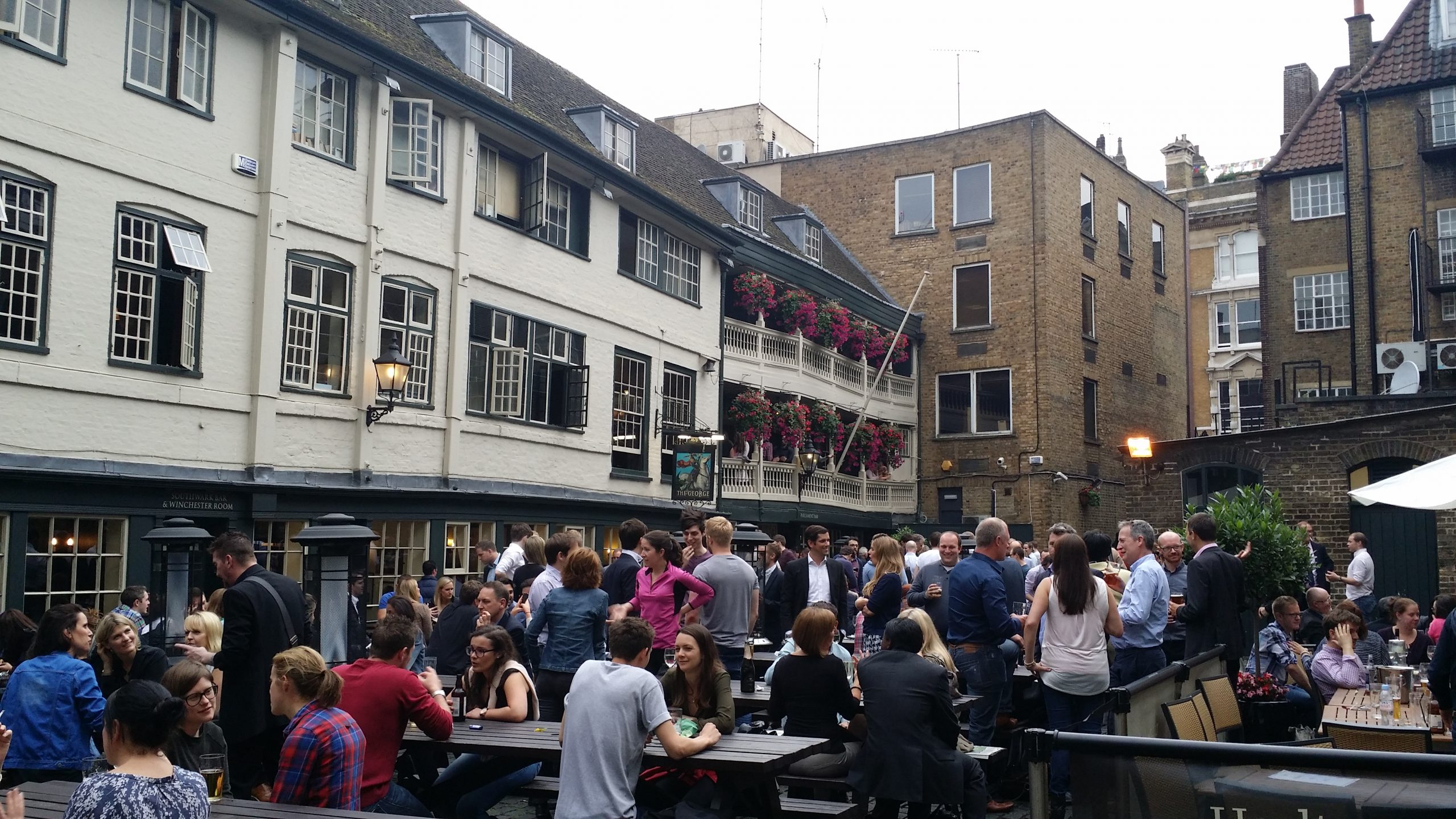
George Inn,Southwark
A Walk around Medieval London following in the footsteps of its resident medieval poet – Geoffrey Chaucer
One of the spectators at the Peasants Revolt was Geoffrey Chaucer, born in the Vintry area of London, who rose to be a diplomat, a Courtier and London’s Customs Officer. He lived with his wife in the Chamber above the Gate in the City Wall at Aldgate. His poetry shows a rugged, joyous medieval England including many scenes reflecting life in London. His stories document the ending of the feudal system, growing dissatisfaction with the corruption in the Church, and shows the robust independence with which the English led their lives.
His work helped change the fashion from poetry in French or Latin to acceptance of the English language as suitable literary language. This was helped by the growth of literacy in London as its Merchants and Guildsmen became increasingly successful. In 1422, for example, the Brewers decided to keep their records in English ‘as there are many of our craft who have the knowledge of reading and writing in the English idiom.’
Chaucer and other poets such as Langland give a vivid portrait of Medieval London which was dynamic, successful but also torn by crisis such as the Lollard challenge to Catholic hegemony, and the Peasants who revolted against oppression as the ruling classes struggled to resist the increased independence of the working people following the Black Death.
A walk which explores London in the Middle Ages, We begin at Aldgate, and follow Chaucer from his home to his place of work at the Customs House, and then to St Thomas Chapel on London Bridge, and across the River to where the Canterbury Tales start – at the Tabard Inn.
This is a London Walks event by Kevin Flude
Roman London – Literary & Archaeology Walk 11.30am Sun 27th Apr 25
Roman layer opus signinum,
Tudor London – The City of Wolf Hall 3:00pm Sun 27th Apr 25
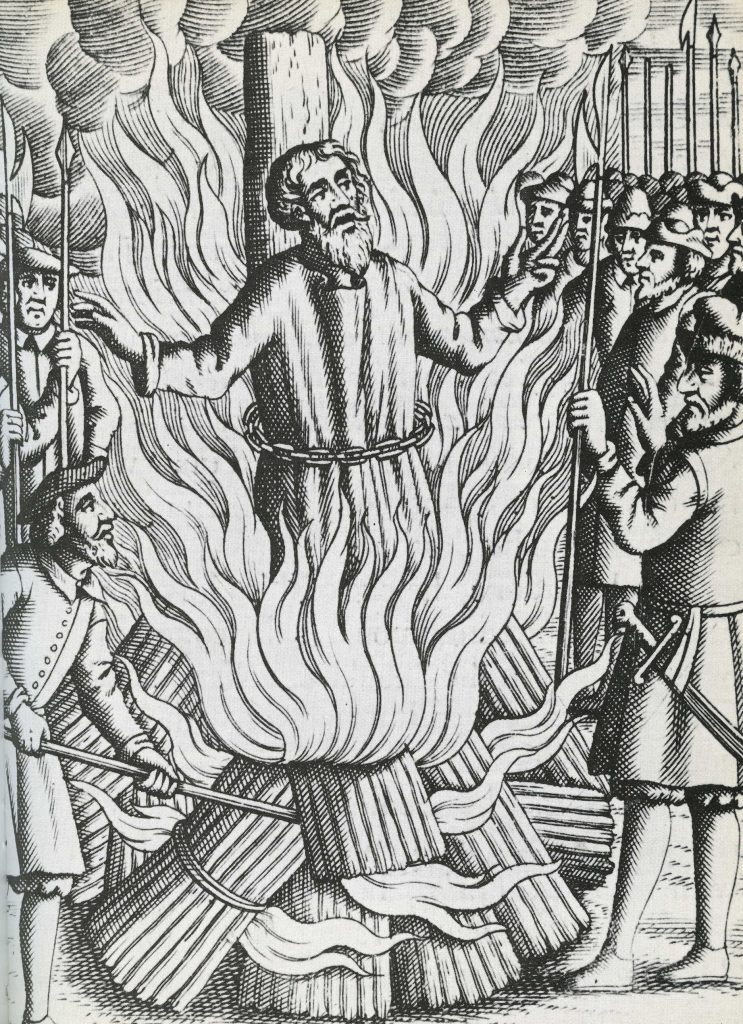
Thomas Bilney martyred in Smithfield.
The Walk creates a portrait of London in the early 16th Century, with particular emphasis on the life and times of Thomas Cromwell and Thomas More during the Anne Boleyn years.
More and Cromwell had much in common, both lawyers, commoners, who rose to be Lord Chancellor to Henry VIII, and ended their careers on the block at Tower Hill.
The walk starts with an exploration of Smithfield – site of the stake where heretics were burnt alive and of St Bartholomew’s Monastery – given to Richard Rich after his decisive role in the downfall of Thomas More. We continue to St Paul where Martin Luther’s books were burnt, and later, where Puritans preached against dancing round the Maypole.
We walk along the main markets streets of London, to Thomas More’s birthplace, and to the site of More’s and Cromwell’s townhouses before, if time allows, finishing at the site of the Scaffold where More and Cromwell met their ends, overlooking where Anne Boleyn was incarcerated in the Tower of London
To Book: https://www.walks.com/our-walks/tudor-london-the-city-of-wolf-hall/
A Boy From Haggerston before the War. 6pm 1st May 2025 Shoreditch Library.
Myths, Legends, Archaeology and the Origins of London 11.30am Sun 25th May 25 To book
The Decline And Fall Of Roman London Walk 3pm Sun May 25 To book
The Peasants Revolt Anniversary Guided Walk
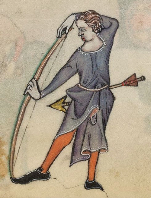
Medieval drawing of an archer
6.30pm Wed 11th June 2025 Aldgate Underground To book
An Anniversary Walk tracking the progress of the Peasants as they take control of London in June of 1381
Short read: The Summer of Blood
Long read: The Peasants’ Revolt. The greatest popular rising in English history. This is the anniversary walk. The London Walk that heads back to 1381, back to the Peasants’ Revolt. You want a metaphor, think stations of the cross. This is the stations of the Peasants’ Revolt walk. We go over the ground, literally and metaphorically. Where it took place. Why it took place. Why it took place at these places. What happened. The walk is guided by the distinguished Museum of London Archaeologist His expertise means you’ll see the invisible. And understand the inscrutable.
On the anniversary of the Peasants Revolt we reconstruct the events that shook the medieval world. In June 1381, following the introduction of the iniquitous Poll Tax, England’s government nearly fell, shaken to the core by a revolt led by working men. This dramatic tour follows the events of the Revolt as the Peasants move through London in June 1381.
We met up with the Peasants at Aldgate, force our way into the City. We march on the Tower of London as the King makes concessions by ending serfdom, at Mile End. But the leaders take the mighty Tower of London and behead the leaders of Richard’s government. Attacks follow on the lawyers in the Temple, the Prior at St. John’s of Jerusalem, Flemish Londoners, and on Lambeth and Savoy Palaces.
The climax of the Revolt comes at Smithfield where a small Royal party confront the 30,000 peasants.
Tudor London – The City of Wolf Hall 11.30am 13th July 2025 To Book Jane Austen’s London Anniversary Walk 3pm Sunday 13th July 25 To book Roman London – Literary & Archaeology Walk 11.30 am Sat 2nd Aug 2025 To Book Chaucer’s Medieval London Guided Walk 2:30pm Sat 2nd Aug 2025 To Book Myths, Legends, Archaeology and the Origins of London 11.00am Sat 16th Aug25 to Book Roman London – Literary & Archaeology Walk 6:30pm Wed 24th Sept 2025 To book The Archaeology of London Walk 6.30pm Fri 3rd October 2025 To Book Chaucer’s Medieval London Guided Walk 11:30pm Sat 4th Oct 25 To book
Previous Years Archives
Here are previous archive of guided walks and events
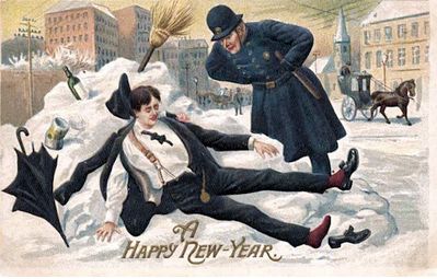
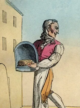
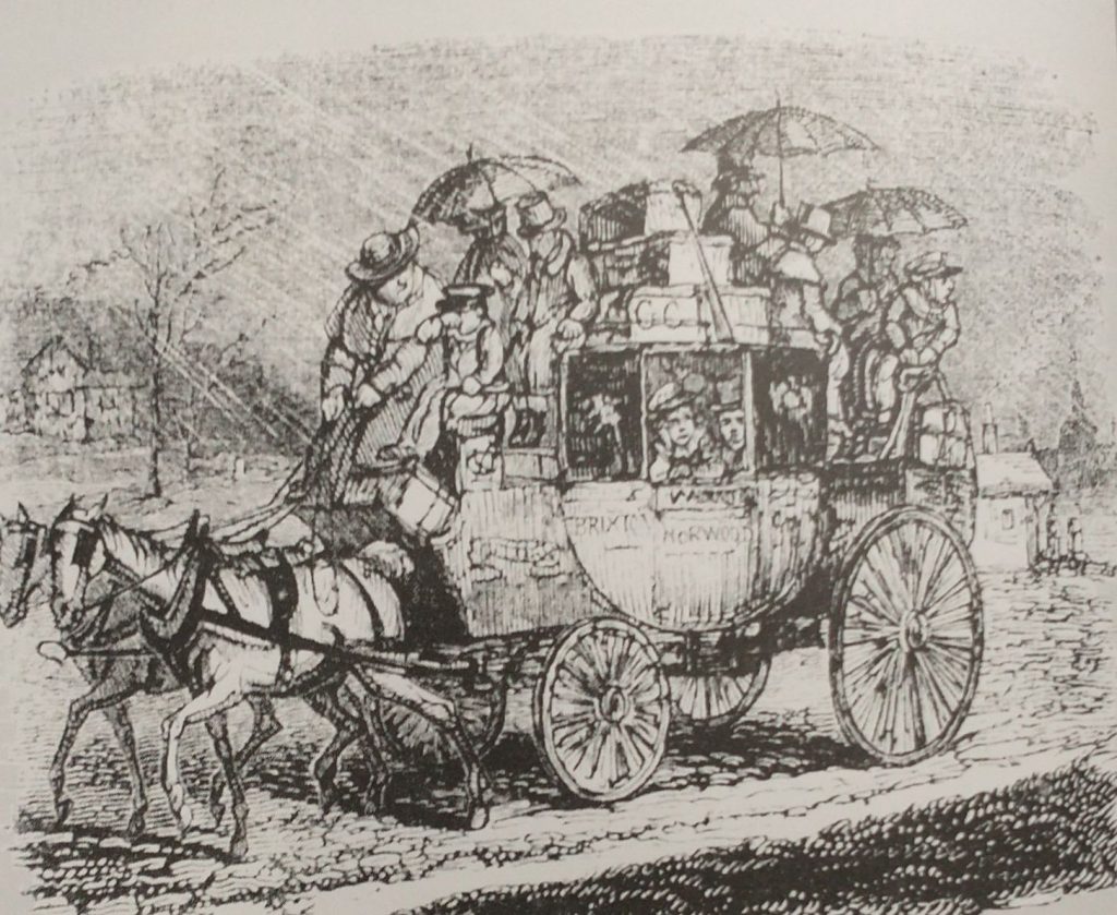
As the Sun enters the House of Capricorn remember the poor Coachman travelling all day everyday in all weathers. Washington Irving in his ‘Old Christmas’ (Originally ‘The Sketch Book of Geoffrey Crayon’ pub. 1819) describes him with a broad red face, a broad body widened by drinking beer; swathed with any numbers of layers of coats trying to keep the cold out. He has many worries on his mind as he has a coach full not only of people who need looking after but also a lot of parcels and commissions that need to be carried out in the many stops along the way. He is delivering parcels, turkeys, geese, presents, children, you name it he is responsible for its safe delivery.
Feel sorry for the people crowded inside the carriage but even sorrier for those sitting on the roof. They have umbrellas in a vain attempt to keep dry, but the umbrella tines will be poking you in your ear, and the run off from the canopy of the umbrella might trickle down your neck. There might be 6 people inside and up to 10 on the roof. 3d for travelling inside and half of that for the roof. voach
Inside, you are next to a large man who is not very salubrious looking, nor too worried about pressing his thighs against you.
John Keats blamed his consumption on his journey on the roof of a stage-coach travelling from London to Hampstead on a cold wet day in February.
Stage coaches became regular sights on the road during the 17th Century and were quite dangerous as the roads were in such a poor condition. It was suggested that passengers made their wills before travelling! From the late 17th and with Parliament increasingly used to set up not-for-profit toll road, the roads got better, and ‘Flyers’ and mail coaches could get up to the tremendous speed of 10 miles an hour, and averaging 7. This happened because improved roads meant improved suspensions, and wheels, and more and faster horses could be harnessed.
This revolutionized travel. It used to take 5 days in around 1700 to get to Manchester from London, by the mid 18th Century the time taken was reduced to 24 hours, and there were many more scheduled coaches, The mail coaches had priority, the coach had a blunderbuss and two pistols to deter highway men, and the guard had a post-horn with which to warn other vehicles to give clear passage, to alert tollgate keepers to open gates, and to announce arrival at a stop. Extra horses would be harnessed to help get up steep hills which, in some cases, like Broadway in the Cotswolds, might mean an additional 10 horses. Passengers might be asked not only to get off the coach to lighten the load but also to push if the going got boggy. On mail coaches, the passengers were not allowed to get off when the horses were changed, and only 4 were allowed inside the coach.
London was ringed by Coaching Inns, which were coach terminals and hotels. The most famous ones, remaining, are in Southwark on the approach road to London Bridge. The Tabard where the Chaucer’s Canterbury Tales started, The White Hart where Dickens’ Sam Wheeler is the Bootboy, and the George, which although not quite so literary is at least still half intact.
Pilgrims leaving the Tabard Inn for the Canterbury PilgrimageGeorge Inn,Southwark (photo Kevin Flude)
Capricorn
‘The man born under Capricorn shall be iracundious and a fornicator; a liar, and always labouring.
....The woman shall be honest and fearful, and have children of three men, she will do many pilgrimages in her youth and after have great wit.’
From Kalendar of Shepheards 1604 quoted in ‘The Perpetual Almanac of Folklore by Charles Kightly’.
iracundious is first mentioned in a work published by Caxton in the 15th Century and pretty much obselete by the 17th Century. It means easily angered or irritable.
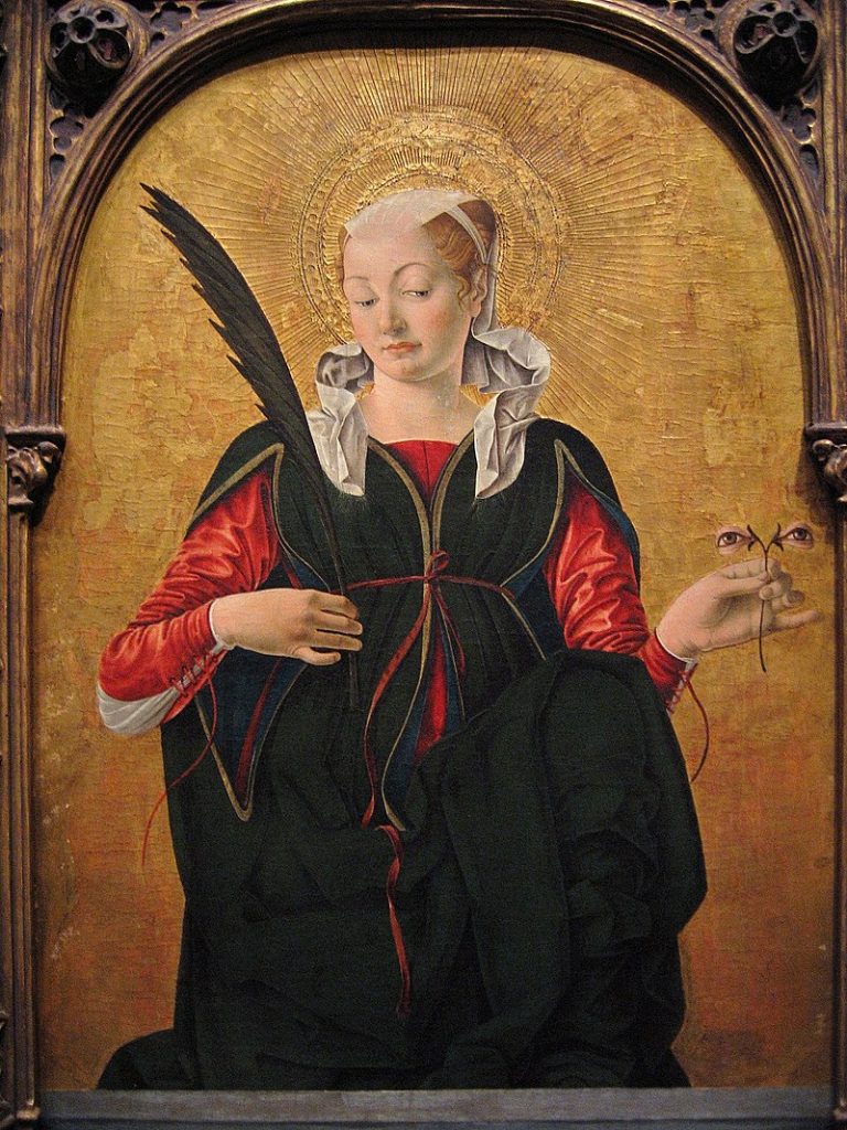
Saint Lucy, by Francesco del Cossa (c. 1430 – c. 1477) (Wikipedia User:Postdlf)
The name Lucy is from the same Latin origin (Lucidus) as lucent, lux, and lucid. It means to be bright, to shine or be clear. It is similar to the Ancient Greek λευκός (leukós, “white, blank, light, bright, clear”. Luke has the same origins (bright one, bringer of light and light of the sacred flame) and is very appropriate for the most literate of the evangelists.
I am just noticing how dim the daylight is even before noon. So, at this time of the year, we are in need of a festival with bright lights to cheer us up! And St Lucy’s Day is the beginning of the winter festival that culminates with the Solstice, where the old sun dies, and the new one is born. December the 13th was the Solstice until Pope Gregory reformed the Calendar in the 16th Century, as nine days were lopped off the year of transition.
The festival of Sankta Lucia is particularly popular in Sweden, where Dec 13th is thought to be the darkest night. In recent years, the Swedish community in the UK has had a service to Lucia in St Pauls. But this year it is in Westminster Cathedral. But as usual, it is sold out by the time I get around to thinking of going!
St Stephens Church by Christopher Wren (Photo K Flude) a rare view during building work.
I found out about Sankta Lucia from a Swedish choir who hired me to do a tour of the City of London some years ago. I took them into Christopher Wren’s marvellous St Stephen’s Church and, under the magnificent Dome, they fancied the acoustics and spontaneously sang. I recorded a snatch of it, which you can hear below
Swedish Choir singing in St Stephen’s London St Stephens Church at night by Christopher Wren (Photo K Flude)
Watch the procession in St Pauls on youtube below.
Sankta Lucia at St Paul’s Cathedral (2011)
Recent medical research has shown the importance of light, not only to our mental health but to our sleep health, and recommends that work places have a decent light level with ‘blue light’ as a component of the lighting. It is also an excellent idea to help your circadian rhymes by going for a morning walk, or morning sun bathing, even on cloudy days.
St Lucy is from Syracuse in Sicily, said to be a victim of the Diocletian Persecution of Christians in the early 4th Century. She is an authentic early martyr, although details of her story cannot be relied upon as true. She was said to be a virgin, who was denounced as a Christian by her rejected suitor, miraculously saved from serving in a brothel, then, destruction by fire, but did not escape having her eyes gouged out. Finally, her throat was cut with a sword. Her connection to light (and the eye gouging) makes her the protectress against eye disease, and she is often shown holding two eyes as you can see above. Other symbols include a palm branch which represents martyrdom and victory over evil She can also be seen with lamp, dagger, sword or two oxen. She appears in Dante’s Divine Comedy, as the messenger to Beatrice whose job is to get Virgil to help Dante explore Heaven, Hell and Heaven. Beatrice takes over as the guide around Paradise because Virgil is a pagan and so cannot enter it.
St. Aldhelm (died in 709) puts St Lucy in the list of the main venerated saints of the early English Church, confirmed by the Venerable Bede (died in 735). Her festival was an important one in England ‘as a holy day of the second rank in which no work but tillage or the like was allowed’.
First Posted on December 13th, 2022, updated on December 13th 2023 and 2024
Worlidge ‘s ‘Systema Agriculturae’ of 1697 says this is the time to destroy snails. He suggests that, at Michaelmas, you create a shelter for snails against a wall using bricks or boards. In Early December the plantsman can get his revenge on the little blighters, all unsuspecting and snuggled up in their cosy den.
The RHS has some more modern advice, but generally takes a negative opinion of snails. The Birmingham and Black Country Wildlife Trust take a much more positive view of snails and slugs and proposes their contribution to nature should be rewarded by learning to love and live with the little critters.
(Thanks to Charles Knightly’s Perpetual Almanac)
Improving the cider before Christmas
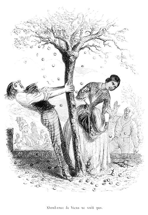
A man shakes an apple tree laden with fruit, which a woman gathers in her apron. The caption reads in the original French: Abondance de biens ne nuit pas (You can never have too much of a good thing)
Britain is by far the largest Cider drinking nation, drinking 32% of the global total. South Africa is second at 15%. One of the reasons is that Britain does not have the climate for mass wine making, while it has an excellent climate for growing apples, particularly in the West Country. But other counties also produce it including: Somerset, Devon, Dorset, Herefordshire, Worcestershire, Gloucester, Kent, Sussex, Suffolk, Norfolk and Cider has expanded into other counties such as Buckinghamshire and Cheshire.
As Cider makes approach Christmas, they will be worrying about their Cider is doing. And old trick if your cider was a bit off was to add half a peck of wheat to restart the fermentation to make it more mild and gentle. Use Mustard or two or three rotten apples to clear the cider.
Although it’s all a little Thomas Hardy, Cider expert Gabe Cook provides instruction here in how to make cider from your own cider tree without investing in a huge fruit press. To buy small cider presses and cider making kits click here.
First Published on December 5th 2022, revised and republished on December 5th 2023 ans 2024
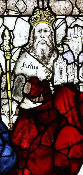
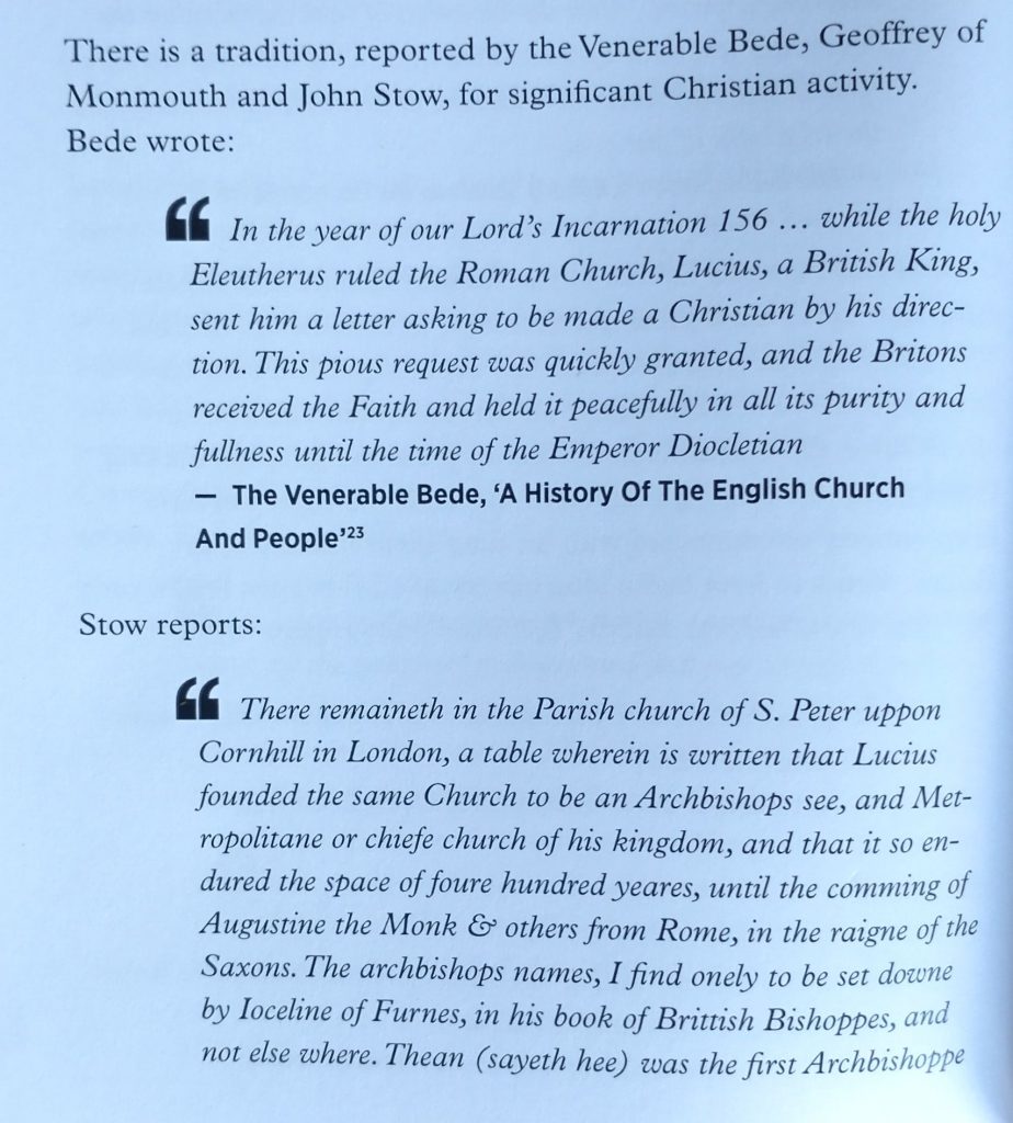
The Venerable Bede tells us that King Lucius converted to Christianity in around 180AD. He says that the King asked Pope Eleutherius to send teachers to instruct him. The Venerable Bede (died 735 AD) got this from the Liber Pontificalis of c 590. There is also a tradition that St Peter’s Cornhill in London was set up by King Lucius, and that St Peter’s is the oldest Church in London.
13th Pope
What to make of this? Bede is considered to be a reliable historian and got his information, in this case, from the Vatican. But the tradition has been written off as a legend. Indeed, there are questions to be answered, but there is, arguably, more to it than a legend but, unfortunately, not enough to make it an established fact.
Not the least of the questions to ask about the veracity of this legend is: ‘What does it mean to be called the King of Britain in the middle of the Roman occupation?’
As to the early origin of St Peters, archaeologists dismissed the tradition as St Peter’s is built over the Roman Forum and so how can it have been the site of a Christian Church?
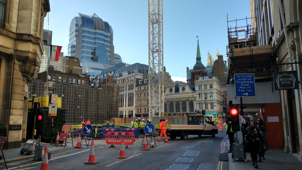
St. Peter’s seen from Cornhill in a rarely seen view as there is normally a building in the way. (Author’s copyright)
But the balance of possibilities, arguably, changed in the 1980s, when archaeologists led by Gustav Milne showed that the Basilica of the Forum was pulled down in about 300AD. So from being practically an impossibility, there is now a possibility that this became the site of a Roman Church. We know London sent at least one Bishop to Constantine the Great’s Council of Arles in 314AD, so a Christian community in London must have predated this time. There must have been Churches. And a site, here, at the prestigious centre of the Capital of Londinium, makes a lot of sense. There are, in fact, three Churches on the site of the Roman Forum: St Peters, St Michael and St Edmund the Martyr.
In AD306, Constantine was acclaimed Emperor on the death of his Father, Constantius Chlorus whose wife was Helena, a Christian. He and his mother were in York when his father died. He was recognised as Caesar, (but not Augustus) by Emperor Galerius and ruled the province for a while before moving to Trier, then Rome, where he accepted the Christian God’s help in becoming the ruler of Rome (after the Battle of Milvian Bridge). This might give a context for the demolition of the Basilica and its replacement by a Church. There is, however, no archaeological evidence for St Peters being Roman in origin other than the demolition of the Basilica and the legends, and nor is there any evidence of the Basilica being turned into a Church as early as the 2nd Century.
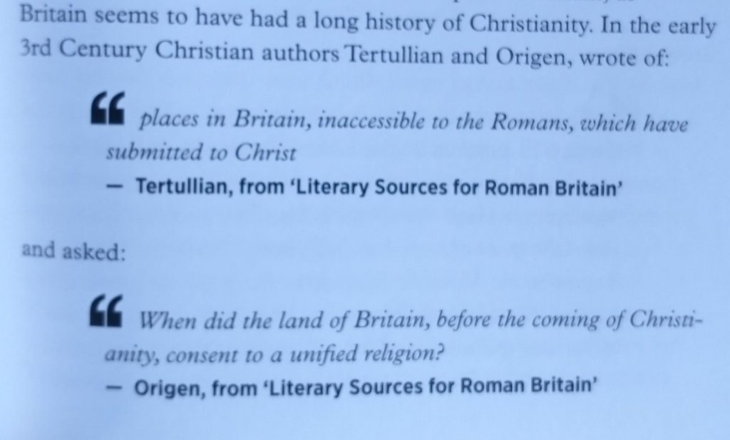
Where does that leave King Lucius? There are well attested Christian traditions that Britain was an early convert to Christianity. (The following quotes are from my book ‘In Their Own Words – A Literary Companion To The Origins Of London‘ D A Horizons, 2009 by Kevin Flude and available here.)
‘In Their Own Words – A Literary Companion To The Origins Of London‘ D A Horizons, 2009
So, an early date for an active Christian community is likely. A Church, replacing the Basilica, is plausible, particularly, after Constantine the Great probably passed through London on his way to seize the Roman Empire. But such an early date as the late 2nd Century? And could anyone, claim to be the ‘King of Britain’ at this date?
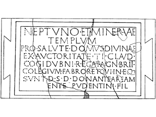
We do know that King Togidubnus was called Great King of Britain in a Roman Temple inscription in Chichester in the First Century.
Altar Dedication, Chichester
To Neptune and Minerva, for the welfare of the Divine House by the authority of Tiberius Claudius Togidubnus, Great King of Britain, the Guild of Smiths and those therein gave this Temple from their resources, Pudens, son of Pudentinus, presenting the site.
Togidubnos seems to have been placed in control of a large part of Southern England, centred around Chichester, after the invasion of 43AD. He is thought to have been the successor to Verica, who was exiled and called on the Romans to restore his throne. Tactitus says that Togidubnos remained loyal down ‘to our own times’ that is to the 70s AD. So he presumably held the line for the Romans against the Boudiccan revolt in 60AD. The Romans had used Verica’s fall as their excuse for invasion, and so an honorific of Great King to him and his successors makes sense. It is assumed that after Togidubnos’s death after 80AD, the title lapsed. But it might have stayed with the family as an empty honour? Furthermore, we know that Britain had a lot of Kings and Queens before the Roman period, and, as the Romans never conquered the whole of Britain, there were British Kings all the way through the period of Roman control, at least beyond Hadrian’s Wall.
So, it is possible there was someone in Britain who had, or made, a claim to be ‘King’ whether ‘a’ or ‘the’ or merely descended from one, we don’t know. And that that someone, perhaps converted to Christianity, possibly in the time of Pope Eleutherius.
It has been suggested that Lucius of Britain was confused with Lucius of Edessa, but this is not very convincing.
The link to London and St Peters, need not be a contemporary one, it might be two traditions that are linked together at a later period. But, of course, there is a faint possibility that the Basilica shrine room, above which St Peter’s is built, was converted for Christian use at the earlier time necessary to make sense of the King Lucius story.
King Lucius may not be a proper saint, but he has a feast day because of his connections to Chur in Switzerland, which saw him enter the Roman Martyrology. David Knight proposes that the tradition of the martyrdom of Lucius in Chur comes from the transplanting of rebellious Brigantes to the Raetia frontier in the 2nd Century AD, bringing with them the story of Lucius and that, possibly, at the end of the King’s life he travelled to join the exiles in Switzerland where he met his unknown end. If true, this would base the story of Lucius in the North rather than London.
For further reading, see ‘King Lucius of Britain’ by David J Knight.
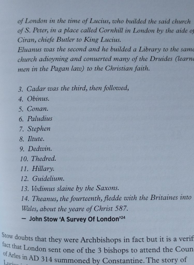
John Stow in the 16th Century records the tradition, which comes with a list of early British Bishops of London, which are recorded in Jocelin of Furness ‘Book of British Bishops’. This book is discussed by Helen Birkett ‘Plausible Fictions: John Stow, Jocelin of Furness and the Book of British Bishops’. In Downham C (ed) /Medieval Furness: Texts and Contexts/, Stamford: Paul Watkins, 2013.
Her analysis concludes that the book is a ’12th-century confection in support of moving the archbishopric from Canterbury ‘back’ to London.’ (This information was included in a comment to the original post by John Clark, Emeritus Curator of the Museum of London.)
To sum up. We can’t bring King Lucius out of legend, nor link him with St Peters Cornhill, but the site of St Peters is a plausible, though unproven, location for a Roman Church from the 4th Century onwards. It also makes sense of the choice of the Saxons, to name their Church St Pauls. St Peter is more common as a dedication for important Churches and perhaps they chose St Paul as they knew of the ruins of St Peters the old Cathedral.
Archaeologists have also tentatively identified a masonry building in Pepys Street on Tower Hill as the Episcopal Church of late Roman London. The foundations suggest a large aisled building. Its identification as a Cathedral springs from multiplying the found foundations symmetrically by a factor of four and comparing the result to Santa Tecla in Milan. The discovery of Marble and window glass doesn’t sit so well with the alternative suggestion that it is a granary. But, to my mind, it’s not very convincing, although Dominic Perring in his recent book ”London in the Roman World’ makes the most of the case for it being a Cathedral.
On This Day
1660 – Margaret Hughes became the first woman (we know about) to act on the English Stage. She played Desdemona in Shakespeare’s Othello. It was staged in a converted tennis court called the Vere Street Theatre, which was in Lincoln’s Inn Fields. In 1660 Charles II was restored to the throne, and had got used to watching female actors perform while he was in exile in France. So when he returned, he licensed two theatre managers, Thomas Killigrew and Sir William Davenant to run theatre. Davenant claimed to be the natural son of William Shakespeare, suggesting that Shakespeare stayed in his parents’ Inn, the Crown, in Cornmarket, Oxford on his way home to Stratford-upon-Avon.
First Published on December 3rd, 2022. Revised in December, 2023, and 2024