In winter, since Covid, I have been giving a series of virtual tours for London walks, and advertised on Eventbrite. Those coming up are listed below. To find more details, just click the ‘to book’ link and this will let you see what they are about without beginning the booking process.
Christmas With Jane Austen Virtual London Tour Mon 9 Dec 24 7.30pm To book Dickens London. Life, Work and Christmas Virtual Tour Mon 16 Dec 24 7.30pm To book The London Winter Solstice Virtual Tour Sat 21 Dec 24 7:30pm To book Ring in the New Year Virtual Walk Wed 1st January 25 7.00pm To book
This post failed to publish on the 7th November, so here it is:
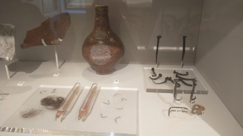
As we are between Halloween, and Halloween Old Style the chances of bewitchment are high what with all those spirits being out and about on this – the most uncanny of all times. So, you might want to look at ‘Doctor Lilly’s Last Legacy’ of 1683 which gives a cure for those who have been bewitched at Halloween.
Take two horseshoes, beat them red-hot and nail one on the threshold of the door, but Quench the other in the Urine of the party bewitched: then set the urine over the fire in a pot or Pipkin and put the horseshoe into it. Make the urine boil with a little salt put onto it, and three horseshoe nails until it is almost all consumed: what is not boiled away cast into the fire. Keep then your horseshoes and nails in a clean paper or cloth and use the same manner three times. It will be the more effectual if is done at the change or full of the Moon.
Doctor Lilly’s Last Legacy, Online at the Wellcome Collection, although you will need a login to view it. I found it first in my favourite source, Perpetual Almanac of the Year by Charles Kightly.
Doctor Lilly’s Last legacy ‘Being the poor man’s physician, the sick man’s friend, and the country-man’s doctor’.
Items like this make me wonder about the gullibility of the human being, but I guess we are surrounded by examples of the lack of sense of a large proportion of our species. Perhaps I should rephrase this, I think most people make sensible decisions about their day-to-day life, but many do not have the critical thinking skills to evaluate the bigger issues.
For more on keeping witches away, witches’ marks etc. have a look at this post of mine.
St Martin was one of the most important in the Medieval Calendar of Saints. We will have a look at him tomorrow on his Saint’s Day.
But it is also Halloween or it would be if the Calendar had not been change in 1752. So for traditionalists this is the actual Halloween. It gives another chance to look into the future and to celebrate Halloween traditions.
If Martinmas ice will bear a duck Then look for a winter of slush and muck.
i.e. it will be a mild winter. From my experience, this will only have any validity if used in the North.
Today is also for Kali, Indian destroyer of Evil, and also for the Fate, the Norns, the Furies, the Morrigan and Persephone.
Tomorrow, I am doing three walks, one Virtual, the rest in the City of London, on the Lord Mayor’s Show day. My walks are:
Roman London – Literary & Archaeology Walk Sat 11.30 am,9th November 2024 To book London: 1066 and All That Walk Sat 2.30pm 9th Nov 24 To book London Before London – Prehistoric London Virtual Walk Sat 7.30pm 9th Nov 24To book
Would be great to see you there?: – here are further details:
Bhai Dooj is the day sisters and brothers celebrate a meal together to eat their favourite disches. often including their favourite dishes/sweets. Last year it was on November 15th. This year 2024 3rd November. October 23rd 2025
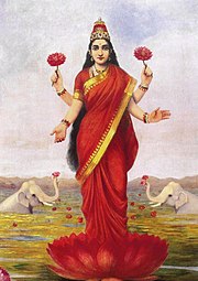
It is part of Diwali which is a 5 day festival of lights, honouring the New Year. It honours Lakshmi, the goddess of wealth and consists of lamps, fireworks and gatherings to exchange gifts and enjoy food together, and honouring community.
First published Nov 6 2021, revised Nov 15th 2023, 2024
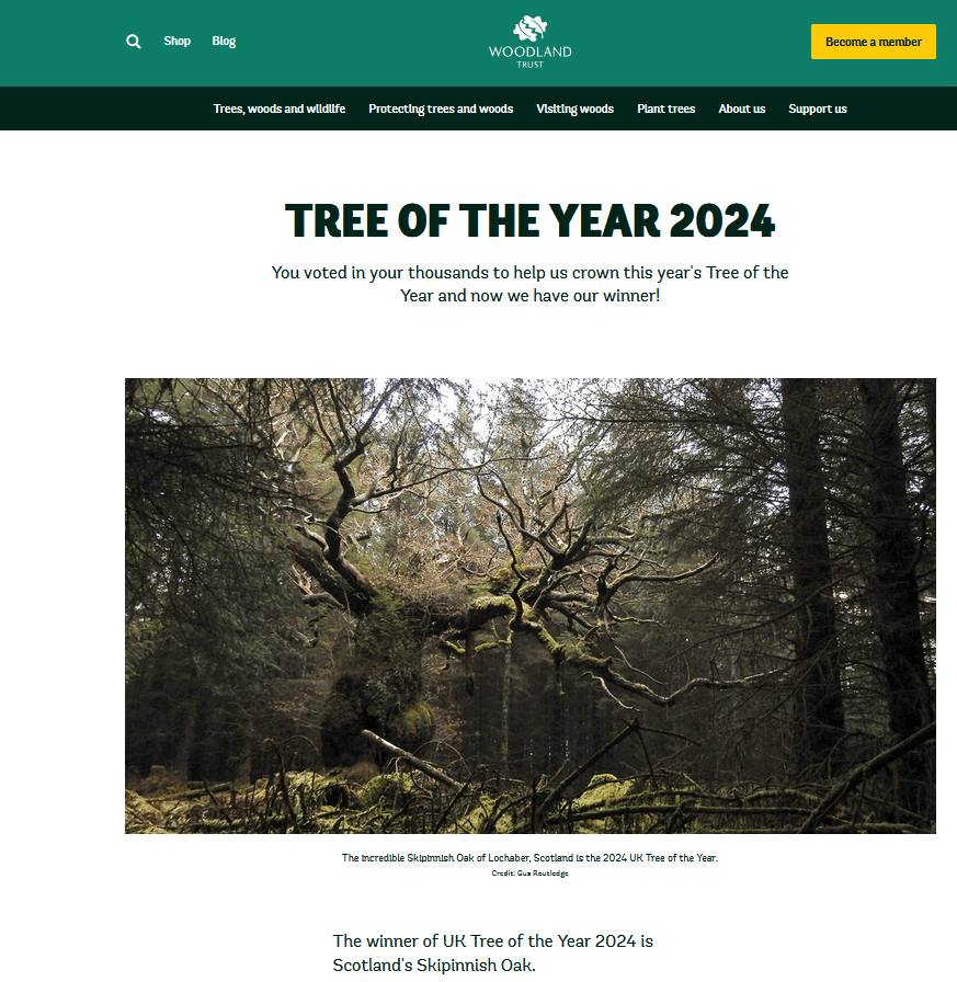
Here is a cautionary tale about AI. On the 29th of October I posted to announce the winner of the ‘The Woodland Trust’s 2024 Tree of the Year. This is what I wrote:
‘I looked at the website at 4.30pm today and no result listed that I can find on the Woodland Trust Site, But google AI says:
The winner ‘is the Capon Oak in Jedburgh, Scottish Borders. The Capon Oak is a remnant of the ancient Jedforest and one of the last surviving trees from the area. Its unusual shape may have saved it from being felled because its wood would have been of little use for shipbuilding.’
Being cautious, I wrote that I assume ‘google AI has information from a press release?’ because I could not find any notice of a winner on the Woodlands Trust website.
I checked a couple of days later and found that AI had indeed got the result wrong! How it did this, I do not know. Did it think there was no announcement so it then, by some means, worked out what it thought was the best guess? But in a question like this there are only two valid answers: 1. we don’t know 2. the correct answer. Anything else is wrong.
Here is the text of the BBC announcement, as seen on my phone:
To look at the woodland trust website, click here.
On Thursday, I am doing my first London Walk Virtual Tour of the winter season.
The walk tells the story of London’s myths and legends and the Celtic origins of Halloween.
The walk will tell the story of London’s Myths and Legends, beginning with the tale of London’s legendary origins in the Bronze Age by an exiled Trojan called Brutus. Stories of Bladud, Belinus, Bran and Arthur will be interspersed with how they fit in with archaeological discoveries.
As we around the City, we also look at the origins of Halloween celebrations and how they may have been celebrated in early London
The virtual route starts at Tower Hill, then down to the River Thames at Billingsgate, to London Bridge and Southwark Cathedral, to the Roman Forum at the top of Cornhill, into the valley of the River Walbrook, passed the Temple of Mithras, along Cheapside to the Roman Amphitheatre, and finishing up in the shadow of St Pauls.
REVIEWS (from London Walks website) “Kevin, I just wanted to drop you a quick email to thank you ever so much for your archaeological tours of London! I am so thrilled to have stumbled upon your tours! I have wanted to be an archaeologist since 1978 at the ripe old age of 8 years,… I was told for years that I could not be an archaeologist [for any number of reasons, which I now realise are completely ridiculous!], so I ended up on a different course of study. And now at the age of 50, it is my one great regret in life. So, I am thoroughly enjoying living vicariously through you, the digs you’ve been on, and the history you bring to life for us! British archaeology would have been my specific area of study had I pursued it. ?? Thank you SO MUCH for these! I look forward to them more than you can imagine, and honestly, I’ll be sad if you get them down to 1.5 hours! They’re the best 2 hours of my week! 🙂 Best, Sue
A day when it is ‘certain to rain heavily’. Well, that wasn’t true last year. On this day you, supposing you want to find who your true lover is, must:
Carefully peel an apple in one piece. Turn round three times with the peel in your right hand Drop the peel over your left shoulder See what shape letter the peel forms on the ground, and this will be the first letter of your true love’s name. And if it breaks into pieces, you are doomed, probably, to never finding your true love. To make this work, you also have to recite:
St Simon and St Jude, on you I intrude By this paring I hold to discover Without any delay, to tell me this day The first letter of my own true love.
Jude is the Saint of:
Lost Causes Desperate causes Hopeless causes And if that is not enough also the Hopeless and the Despairing.
So maybe the apple peel isn’t going to work for you (although Jude is also the Patron Saint of the Impossible!)
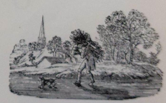
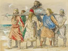
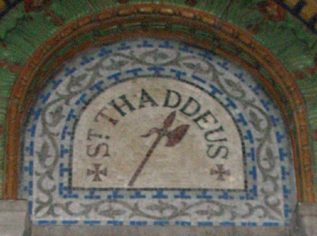
Jude aka Thaddeus was martyred with an axe. Simon the Zealous was martyred by being sawn in half, and is, of course, therefore, the patron saint of woodcutters and lumberjacks. They are linked by the same Saint’s day because they went to Syria together to preach where they were met their fates, and they are also associated with woodworking.
WikipediaBy Bruce Andersen – Own work, CC BY-SA 2.5, https://commons.wikimedia.org/w/index.php?curid=1855844
There are at least four Judes. One of them may have been Jesus’ brother. He or another Jude wrote the Epistle of St. Jude.